Roads and Highways Archives - Page 6 of 17 - Inside GNSS - Global Navigation Satellite Systems Engineering, Policy, and Design

Roads and Highways

November 27, 2017

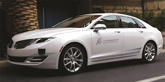
Towards Navigation Safety for Autonomous Cars

Figures 1 – 6, Table 1

There are many good reasons for getting excited about highly automated vehicles, or HAVs, which is the acronym used by the National Highway Traffic Safety Administration (NHTSA). HAVs can make driving more fuel- and time-efficient. They can significantly reduce traffic congestion and emissions by driving a precise speed, minimizing lane changes, and maintaining an exact distance to neighboring cars. They can also increase accessibility and mobility for disabled and elderly persons.

Read More >

By Inside GNSS
November 20, 2017

Fiber Optic Gyro from Tamagawa Designed for ADAS, Mobility Applications and More

The TA7774 iFOG is suitable for autonomous driving and mobility applications, and ADAS. Photo courtesy of AdvanTech International.

Tamagawa Seiki, an advanced inertial sensing technology provider for aerospace, military and automotive applications, is launching a new, low-cost, tactical grade, interferometric Fiber Optic Gyroscope (iFOG) suitable for autonomous driving and mobility applications, and ADAS (Advanced Driver Assistance Systems).

Read More >

By Inside GNSS
October 11, 2017

Connected and Autonomous Vehicles to Play a Major Part in Smart Columbus Projects

Carla Bailo, AVP for mobility research and business development at OSU, spoke at ION GNSS+ on Sept. 26. Photo: Institute of Navigation.

If all goes as planned, Columbus, Ohio will become one of the smarter cities around, using drones to deliver medical supplies, autonomous shuttles for college students, and a smart infrastructure that will help with buses, traffic congestion, collision avoidance for both vehicles and pedestrians, and much more.

Read More >

By Inside GNSS
[uam_ad id="183541"]
September 28, 2017

Honey Shares his Lifetime of Navigation with Boats, Cars and Sports During Keynote Speech

As a child Stan Honey taught himself navigation and he admits he was “always good at math” and “just found navigation interesting.”

When he shared his many tales with the crowd in the Oregon Ballroom Tuesday night at the ION GNSS+ during the Plenary Session, the Yale- and Stanford-trained engineer entertained the audience with a wealth of information on early navigation systems, current navigation technologies, and how he and his colleagues developed many of the systems used to enhance the way millions of fans watch sports on television.

Read More >

By Inside GNSS
September 21, 2017

Broadcom Releases Dual-Frequency GNSS Receiver with Centimeter Accuracy for Consumer LBS Applications

The BCM47755 is designed to enhance LBS applications for mobile phones, tablets and fitness wearables. Photo: Broadcom Ltd.

No longer will a high-end, expensive GNSS receiver be required to achieve centimeter accuracy now that Broadcom Limited has announced the launch of its new dual-frequency receiver with such accuracy designed for consumer location-based services (LBS) applications.

Read More >

By Inside GNSS
September 19, 2017

GSA’s GNSS Opinion Leaders for September 2017

Bernhard Richter, Leica Geosystems GNSS business director
Enrico Salvatori, Qualcomm Europe
Carlo Bagnoli, STMicroelectronics

Multinational semiconductor and telecommunications company Qualcomm is a world leader in the design and marketing of 3G, 4G and next-generation wireless technologies. Headquartered in San Diego, California, Qualcomm has been widening its footprint in the Europe, Middle East and Africa (EMEA) region, with a core focus in Europe.

“We expect to grow Qualcomm’s presence in Europe, becoming a major EU (European Union) player in the digitization of European industries,” said Qualcomm senior vice president and president of Qualcomm Europe, Enrico Salvatori.

Read More >

By Inside GNSS
[uam_ad id="183541"]
September 1, 2017

Location Privacy: GAO Asks More of NHTSA, New State Laws In the Works

Federal watchdogs examining automakers’ privacy practices are urging a key regulatory agency to step up and clarify its role in protecting the location and other personal information of those operating  connected vehicles. The report, posted on August 28, was just one of a number of location-privacy developments including advances in pro-privacy laws in some states and a pullback by Uber on its tracking of its customers.

Read More >

By Inside GNSS
August 1, 2017

STATSports Selects Taoglas to Connect to GPS-based Apex System

Taoglas’ AGGBP.25B two-stage 28 dB Active GPS Patch Antenna Module. Photo: Taoglas.

Taoglas, a Wexford, Ireland-based provider of automotive and Internet of Things (IoT) antenna products, today announced that STATSports has selected Taoglas to provide antenna solutions for its new Apex line of GPS-based sports performance monitors.

Read More >

By Inside GNSS

Polynesian Exploration Launches Integrated Navigation System

The POLYNAV 2000 is one of the company’s integrated navigation systems. Photo: Polynesian Exploration Inc.

Polynesian Exploration Inc., a San Jose, California navigation startup, has launched its high-accuracy navigation solution for demanding applications such as autonomous driving and UAVs.

The POLYNAV 2000 is designed to deliver high accuracy position, velocity and attitude whether the platform is static or moving. The solution features multiple satellite constellations (GPS/GLONASS/BeiDou/Galileo), multiple frequencies real time kinematic (RTK) L1 & L2, multi-antenna signal processing, tactical grade sensors, and high dynamic tolerance.

Read More >

By Inside GNSS
July 21, 2017

Data Collecting Program for Mobile GNSS Field Data Set taking Place in Japan

Mobile GNSS Field Data Set being tested in the winter. Photo: Lighthouse Technology and Consulting

Lighthouse Technology and Consulting Co., Ltd is proceeding with a program to collect precise GNSS data on major highways in Japan. The data is an inevitable “must use” tool for high precision positioning systems used in automated driving vehicles.

While the major part of autonomous driving systems consists of sensors and image recognition technologies, satellite positioning is also a key element used for complementing the precise current position.

Read More >

By Inside GNSS
1 4 5 6 7 8 17
IGM_e-news_subscribe