signal Archives - Page 6 of 22 - Inside GNSS - Global Navigation Satellite Systems Engineering, Policy, and Design

signal

January 16, 2013

NovAtel Announces New BeiDou Capability for Its GNSS Products

NovAtel has announced support for the BeiDou Navigation Satellite System on its OEM6 family and selected OEMStar GNSS receivers.

The long-anticipated BeiDou Interface Control Document (ICD) release is a
significant milestone that facilitates global acceptance of the Chinese
GNSS system into the growing range of satellite-based positioning
applications, the company says.

Read More >

By Inside GNSS
January 8, 2013

Septentrio Tracks BeiDou GNSS Signals Using New ICD

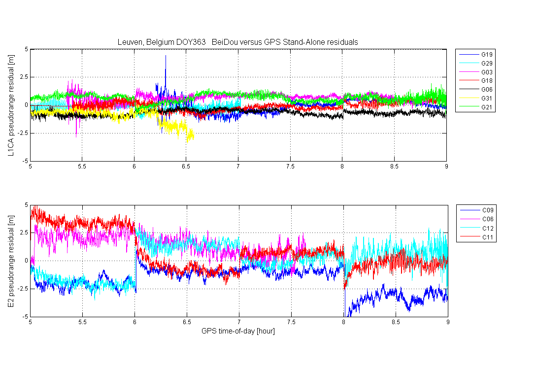
Figure 2. L1 pseudorange residuals (m) for GPS (L1 C/A, top) and COMPASS (B1-I, bottom) vs. time of day (hour).

Septentrio reported today (January 8, 2013) that the Belgium-headquartered GNSS receiver manufacturer has successfully computed a position/velocity/time (PVT) calculation using BeiDou/Compass satellites in a three-constellation (GPS+GLONASS+BeiDou) solution.

"We are positively surprised of the better than expected performance coming out of what we characterize to be ‘a quite mature constellation,’” Laurent Le Thuaut, Septentrio’s business development manager, told Inside GNSS in an e-mail.

Read More >

By Inside GNSS
[uam_ad id="183541"]
December 18, 2012

Civil Galileo System Poses New Options for Secure Services

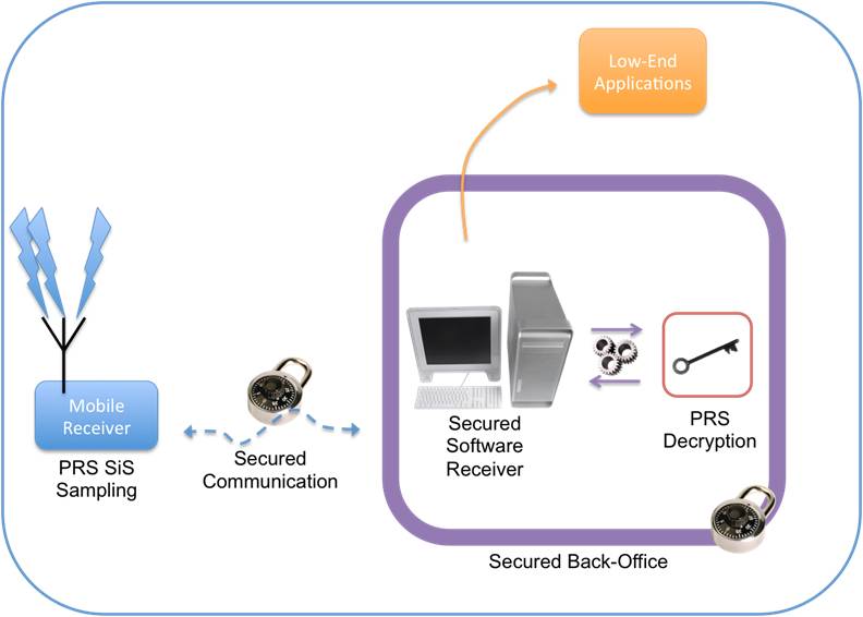
Conceptual design of ULTRA (ultra low-cost PRS receiver)

When European leaders first took up the idea of creating their own GNSS system nearly 20 years ago, they held up the concept of civilian control as a crucial differentiator from existing services operated by national military establishments.

As Galileo nears its operational phase, that principle may manifest itself in a surprising form: the opportunity to offer a range of security-oriented positioning and timing solutions in place of the all-or-nothing alternatives on encrypted services maintained by defense agencies.

Read More >

By Inside GNSS
November 30, 2012

House Panel Suggests Harm Threshold Rather Than Receiver Standards

Members of a key technical advisory group told members of Congress this week that a more creative use of interference limits was preferable to setting receiver standards as the way to expand the use of scarce spectrum.

Although the committee focus was on communication devices in general, the issue of GPS receivers and the recent controversy involving LightSquared’s proposed ground-based wireless broadband service.

Read More >

By Inside GNSS

DoT Gives GPS Spectrum Protection Team Award

The GPS Spectrum Protection Team has received the U.S. Department of Transportation (DoT) Partnering for Excellence Award for outstanding performance in support of the government and industry-wide assessment of potential impacts to GPS operations and safety.

The spectrum protection team played an important role in responding to the proposed LightSquared wireless broadband system’s spectrum plan.

Read More >

By Inside GNSS
November 17, 2012

They’re Back: LightSquared Tries New Route to Wireless Broadband, Later for Nearby GPS Band

With the election finally over, and the chain of decision makers now largely clear, the spectrum war between LightSquared and the GPS community is heating up again with new fronts opening at the Federal Communications Commission (FCC) and Congress.

The focus of the action are changes to rules governing spectrum and receivers that, if enacted, could enable LightSquared to move forward with its plans for a high-powered, terrestrial broadband network.

Read More >

By Inside GNSS
[uam_ad id="183541"]
November 14, 2012

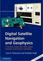
Digital Satellite Navigation and Geophysics: A Practical Guide with GNSS Signal Simulator and Receiver Laboratory

Digital Satellite Navigation and Geophysics: A Practical Guide with GNSS Signal Simulator and Receiver Laboratory
by Ivan G. Petrovski and Toshiaki Tsujii
Cambridge University Press 2012
ISBN-13: 9780521760546

This textbook describes GPS and GLONASS signals, as well as geophysical theory necessary for high accuracy calculation of satellite and user positions. The book is accompanied a free academic version of software for a software receiver and signal simulator.

Read More >

By Inside GNSS

LTE, Positioning, and the Implications for GNSS Over-the-Air Testing

FIGURE 1: (top) Device without case. (bottom) Device with case.

Long Term Evolution (LTE) technology in mobile communications, often called 4G, is making its way into a host of consumer devices. It started with data-only modules for Internet connectivity but quickly made its mark on smartphones, automotive communication, and embedded modules that provide fast and reliable wireless data connectivity to the machine-to-machine (M2M) market.

Read More >

By Inside GNSS
September 28, 2012

The Fallout from GPS vs. LightSquared

With the debacle surrounding LightSquared’s now-stymied proposal still reverberating through Washington, federal agencies are studying ways to repurpose the spectrum adjacent to the satellite navigation frequencies without causing debilitating interference to GPS receivers.

Read More >

By Dee Ann Divis
1 4 5 6 7 8 22
IGM_e-news_subscribe