GNSS Hotspots | September 2017
1. Mangrove Tree-Planting Drones
Myanmar (Southeast Asia)
1. Mangrove Tree-Planting Drones
Myanmar (Southeast Asia)
Working Papers explore the technical and scientific themes that underpin GNSS programs and applications. This regular column is coordinated by Em. Univ.-Prof. Dr.-Ing. habil. Dr. h.c. Guenter W. Hein.
This is the first article in a series. For Part 2: Hybrid- and Non-GNSS Localization, see here.
By Günter W. HeinINTERGEO, the 2017 European geodesy, geoinformation and land management conference and trade fair, will take place at Messe Berlin, South Entrance in Berlin, Germany on September 26, 27 and 28.
By Inside GNSSHighest altitude fix for a GPS signal, GNSS timing signals and hacking the Grid, Eagles act as drone countermeasures and rumors of a GNSS-nano-chip contributes to cash crisis in India
By Inside GNSSThe 10th International Symposium on Mobile Mapping Technology (MMT2017) will take place from May 6 – 8, 2017 at the Conrad Cairo Hotel, on the river Nile in Cairo, Egypt.
Online registration is available. Early bird rates end January 1, 2017.
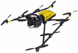
By Inside GNSSTopcon Positioning Group will distribute Intel Corporation’s Falcon 8+ System, a V-shaped, eight-rotor unmanned aerial system (UAS) in North American markets.
Announced at Intergeo 2016 in Hamburg, Germany, the Intel Falcon 8+ features triple-redundant AscTec Trinity autopilot capability and has full electronic system redundancy, the company said. It also includes the Intel Cockpit ground control and Powerpack smart battery system.
By Inside GNSSTerrebonne, Canada-based Eos Positioning Systems has released its Arrow Gold Bluetooth GNSS receiver. Arrow Gold is the first iOS, Android, and Windows Bluetooth GNSS receiver to work with GPS, Glonass, Galileo, BeiDou, Quasi-Zenith Satellite System (QZSS), and the Atlas correction service, the company said.
The palm-sized Arrow Gold receiver provides centimeter-level accuracy on iOS, Android, and Windows devices. Arrow Gold, which costs $4,395, works with such data collection systems as Esri’s Collector/Survey123 and others.
By Inside GNSSApplanix has released its POSPac MMS 8 GNSS-aided inertial post-processing software for georeferencing data collected from cameras, LIDARs, multi-beam sonars, and other sensors on mobile platforms.
The unit, introduced at the InterGEO trade fair in Hamburg, Germany, uses Trimble’s CenterPoint RTX subscription service. The Trimble CenterPoint RTX service allows land, air, marine, and unmanned aerial vehicle (UAV) platforms to achieve centimeter-level accuracy within one hour after data collection with just an internet connection, the company said.
By Inside GNSSThe 2016 IGNSS Conference will take place on December 6-8, 2016 at UNSW Australia’s Sydney campus in Sydney, Australia.
Registration is now open.
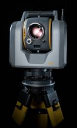
By Inside GNSSTrimble has released the SX10 scanning total station that merges high-speed 3D scanning, imaging technology, and total station measurements for surveyors, the company said.
"This is the top one or two [products] we have launched in the 20 years I’ve been here," said Ron Bisio, Trimble geospatial division vice president, at a media day in Westminster, Colorado, October 5.
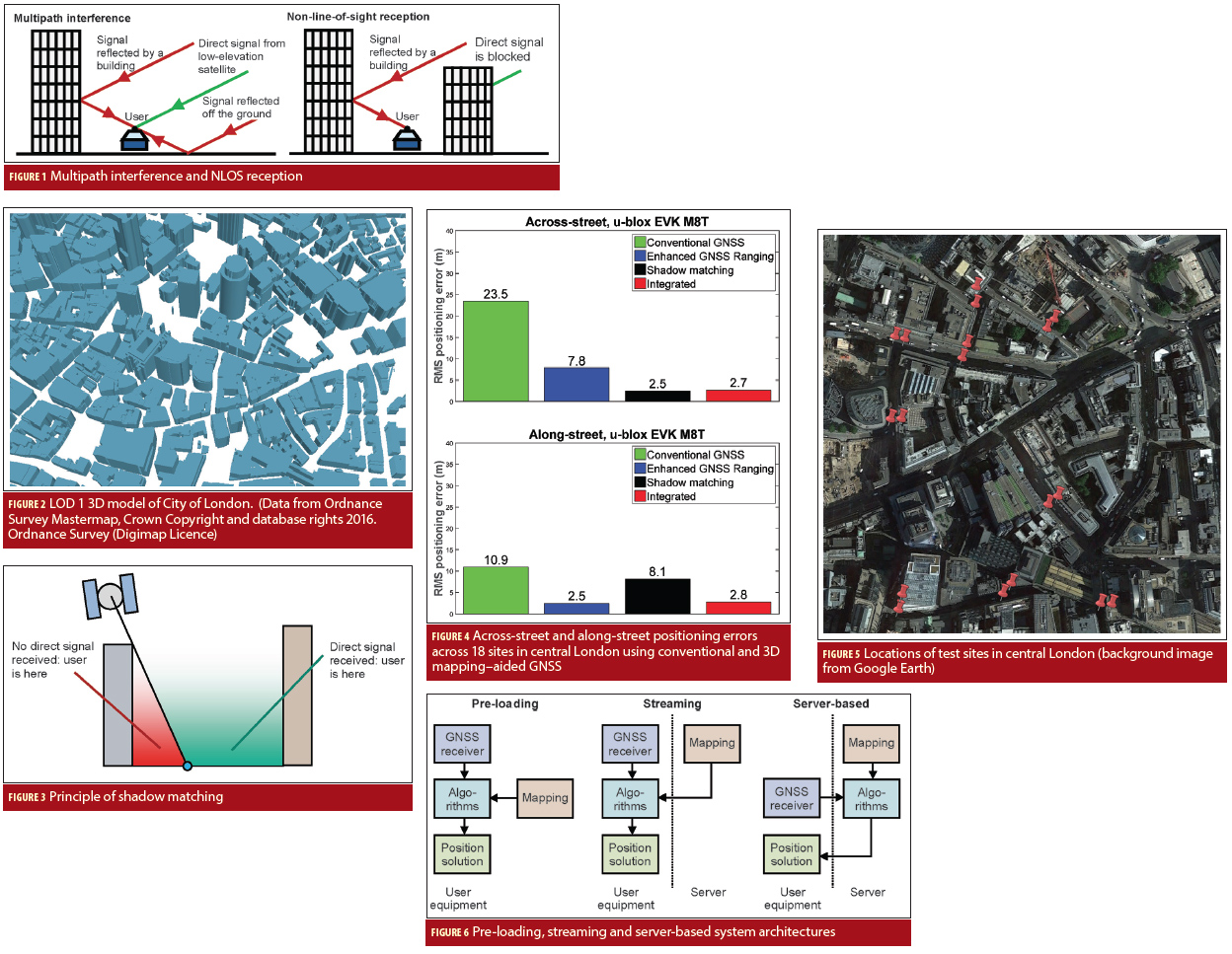
By Inside GNSSReal-time position accuracy, achievable in dense urban areas using low-cost equipment, is currently limited to tens of meters. If this could be improved to five meters or better, a host of potential applications would benefit. These include situation awareness of emergency, security and military personnel and vehicles; emergency caller location, mobile mapping, tracking vulnerable people and valuable assets, intelligent mobility, location-based services and charging, augmented reality; and enforcement of curfews, restraining orders and other court orders.
By Inside GNSSThe 2016 Trimble Dimensions user conference and exhibition will take place at the Venetian Hotel in Las Vegas on November 7, 8 and 9.
The annual event gathers users of Trimble’s products including positioning technology for unmanned systems as well as mapping, GIS, surveying, photgrammetry and remote sensing and other technologies of interest to readers of Inside GNSS.
Four hundred and fifty technical sessions and networking events give attendees an opportunity to network widely within and among industry groups.
By Inside GNSSThe 2016 InterGEO Trade Fair and Conference for Geodesy, Geoinformation and Land Management will take place at the fairgrounds —Hamburg Messe und Congress (HMC)—in Hamburg, Germany on October 11, 12 and 13.
Now 22 years old, the fair attracts 16,000 visitors from 92 countries who process, use or analyze geodata online or in the field.
The conference will cover the latest developments in surveying, geoinformation, remote sensing and photogrammetry and allied technologies. Proceedings are conducted in German and English.
By Inside GNSS