integration/integrated system Archives - Page 4 of 9 - Inside GNSS - Global Navigation Satellite Systems Engineering, Policy, and Design

integration/integrated system

July 2, 2011

Cars on the Road!

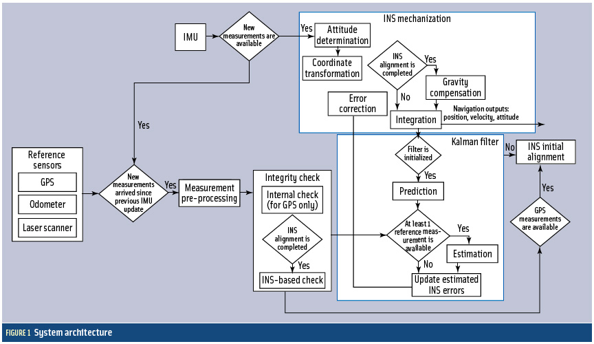
FIGURE 1: System architecture

Cooperative vehicle safety applications should preferably have two-meter horizontal accuracy and six-meter vertical accuracy, all with a 95-percent availability. The solution must be developed to incorporate lower-cost sensor options, specifically, lower-cost inertial measurement units that can be generally characterized by the gyro drift of 100 degrees per hour and an accelerometer bias force of twice its mass times gravity (two milligals).

Read More >

By Inside GNSS
[uam_ad id="183541"]
May 13, 2011

APEC-GIT/15: Asia-Pacific Economic Cooperation-GNSS Implementation Team Meeting

Brisbane City Botanic Gardens facing Alice Street

(See Glen Gibbons’ report from APEC/GIT-14 in Seattle, June 2010)

The fifteenth meeting of APEC’s GNSS Implementation Team will be held June 13-16 at Sofitel Brisbane Central, All Saints Convention Center in Brisbane, Queensland, Australia.

Online pre-registration is required and is limited to 50 delegates. Please contact either of the co-chairs if your password is not accepted on the GIT webpage registration screen.

Read More >

By Inside GNSS
[uam_ad id="183541"]
January 11, 2011

Topcon and DICKEY-john Form Alliance Around Ag System Development

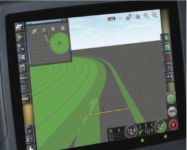
Topcon X30 controller

Topcon Positioning Systems (TPS) and DICKEY-john Corporation, an agricultural systems and machine control manufacturer based in Auburn, Illinois, have formed a strategic relationship in the agriculture industry.

Headquartered in Livermore, California, TPS recently unveiled its System 350 machine control system, which employs the company’s new X30 control console and its AGI-3 receiver for autosteering.

Read More >

By Inside GNSS
October 18, 2010

Topcon Adds Mapping System

Topcon Positioning Systems (TPS), Livermore, California, has announced the addition of the IP-S2 HD Mapping System to its line of mobile mapping solutions.

The IP-S2 HD is a vehicle-mounted surveying and mapping system featuring a high-definition LiDAR scanner from Velodyne Lidar, Inc. The system incorporates high-precision GNSS receivers, an inertial measurement unit, vehicle wheel encoder, 360-degree digital cameras and Velodyne’s HDL-64E S2.2 LiDAR scanner.

Read More >

By Inside GNSS
September 16, 2010

ION 2011 International Technical Meeting

Catamaran Hotel, San Diego

The Institute of Navigation International Technical Meeting (ITM) will take place January 24-26 at the Catamaran Hotel on Mission Bay in San Diego California.

Paul Kline of Honeywell Aerospace is the general chair. Jade Morton of Miami University, Ohio, is the program chair.

"Robotics Navigation" is the plenary session topic. Invited speakers will discuss current trends and future technologies that support navigation for surveillance, search and rescue, undergound and underwater robotics and unmanned air vehicles.

Read More >

By Inside GNSS
IGM_e-news_subscribe