DoT Sets Workshop on GPS Adjacent Band Compatibility
The U.S. Department of Transportation (DoT) will host a workshop on September 18 to discuss implementation of a GPS Adjacent Band Compatibility (ABC) Assessment initiative.
Global Navigation Satellite Systems Engineering, Policy, and Design
The U.S. Department of Transportation (DoT) will host a workshop on September 18 to discuss implementation of a GPS Adjacent Band Compatibility (ABC) Assessment initiative.
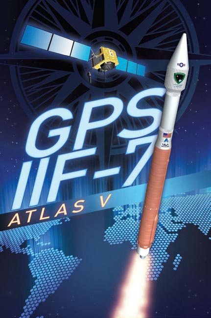
[Updated September 18, 2014] The U.S. Air Force set GPS satellite SVN-68/PRN-09, launched on August 2, to healthy and usable last night (September 17, 2014). This brings the number of satellites transmitting the L2C signal to 14 and those transmitting the L5 signal to 07. The next GPS-IIF satellite, IIF-8/SVN-69, is tentatively scheduled for launch on Oct 29.
By Inside GNSSSeventeen companies have now applied to the Federal Aviation Administration (FAA) for permission to use unmanned aerial vehicles (UAVs) for services that range from filmmaking and photography to oil flare stack monitoring, package delivery and real estate marketing.

A reported White House plan to rely on voluntary adoption of privacy best practices for unmanned aircraft operations appears unlikely to address concerns that the aerial vehicles will be used to spy on people in their homes or abused by law enforcement officials conducting surveillance.
The Global Positioning Systems (GPS) Directorate will host an open public forum on August 22 for the following NAVSTAR GPS public documents: IS-GPS-200 (Navigation User Interfaces), IS-GPS-705 (User Segment L5 Interfaces), IS-GPS-800 (User Segment L1C Interface), and ICD-GPS-870 (Navstar Next Generation GPS Operational Control Segment [OCX] to User Support Community Interfaces).
By Inside GNSS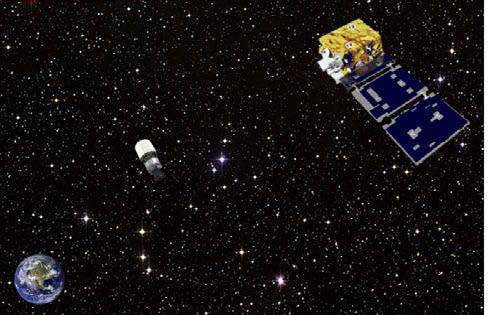 Artist representation of ANGELS observing the AFSPC-4 Delta-4 upper stage several hundred kilometers above GEO. AFRL illustration
While the GNSS community waits for the scheduled launch on Friday (August 1, 2014) of the seventh GPS Block IIF satellite, the United Launch Alliance successfully lifted a three-satellite Air Force Space Command (AFSPC) payload into geosynchronous orbit on Monday (July 28, 2014) from Cape Canaveral Air Force Station, Florida.
By Inside GNSSHere’s the coolest “technology-meets-ingenuity-meets-sustainable-economics” story that I’ve heard in a long time: the International Sun-Earth Explorer-3 (ISEE-3) Reboot Project, a crowd-funded rescue mission to repurpose a 36-year-old NASA spacecraft.
By Dee Ann Divis
 One of 12 magnetograms recorded at Greenwich Observatory during the Great Geomagnetic Storm of 1859
 1996 soccer game in the Midwest, (Rick Dikeman image)
 Nouméa ground station after the flood
 A pencil and a coffee cup show the size of NASA’s teeny tiny PhoneSat
 Bonus Hotspot: Naro Tartaruga AUV
 Pacific lamprey spawning (photo by Jeremy Monroe, Fresh Waters Illustrated)
 “Return of the Bucentaurn to the Molo on Ascension Day”, by (Giovanni Antonio Canal) Canaletto
 The U.S. Naval Observatory Alternate Master Clock at 2nd Space Operations Squadron, Schriever AFB in Colorado. This photo was taken in January, 2006 during the addition of a leap second. The USNO master clocks control GPS timing. They are accurate to within one second every 20 million years (Satellites are so picky! Humans, on the other hand, just want to know if we’re too late for lunch) USAF photo by A1C Jason Ridder.
  Detail of Compass/ BeiDou2 system diagram
 Hotspot 6: Beluga A300 600ST

1. SMART BALL
Portland, Oregon USA
√ Adidas has designed every official World Cup ball since 1970. And that’s not all! The Adidas Innovation Team in Portland, Oregon, spent 4 years on a smart soccer ball with a “six-axis MEMS accelerometer sensor package” that can detect speed, spin, strike and flight path data and whip it on over to the special GPS app on your iPhone. The app interprets the data for you, coaches you, and keeps a video to show your friends. On sale now for only $299.
 Ken Hudnut, U.S. Geological Survey
For at least two decades, GPS experts, geodesists, and public agencies have been working together to develop high-accuracy, large-scale continuously operating GPS reference stations that provide them the capability to monitor and model crustal deformation, tectonic plate movement, and the effects of geohazards such as earthquakes and volcanic eruptions.
Now, GNSS-augmented advance warning systems are going into place that can give us a crucial margin of safety in the event of an earthquake.
And none too soon.
By Inside GNSS
Washington, D.C., has a peculiarity of seasons. While most of the world marks the shifts between winter and spring, summer and autumn, the politicos on the streets of the U.S. capital count the passage of time in two-year increments.
New operatives and appointees flock to the centers of power in the early days of each administration and the opening of each Congress, then migrate to friendlier climes as congressional elections loom and the administration winds down — as it is now.
By Dee Ann Divis
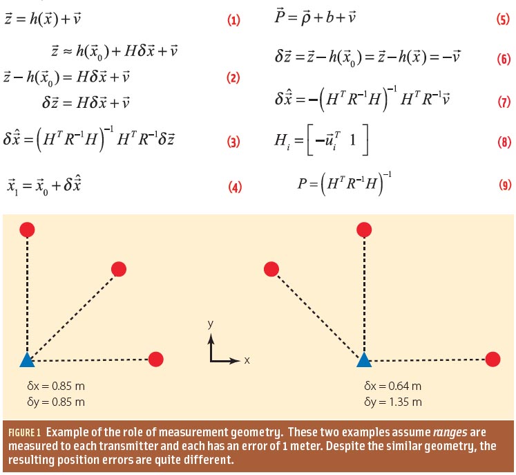
Q: How do measurement errors propagate into GNSS position estimates?
A: Not surprisingly, GNSS positioning accuracy is largely dependent on the level of measurement errors induced by orbital inaccuracies, atmospheric effects, multipath, and noise. This article discusses how, specifically, these errors manifest as position errors.
By Inside GNSS
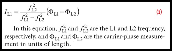 Equation 1
The small satellite “Technologie-Erprobungs-Träger 1” (TET-1) is the first spacecraft developed for the German Aerospace Center (DLR) On-Orbit-Verification (OOV) program, which provides flight opportunities dedicated to testing and qualification of new technologies in space. The satellite was lifted into a low-Earth orbit (LEO) on July 22, 2012, from the launch site in Baikonur, Kazakhstan.
By Inside GNSS
The 12th Conference on Space Weather, sponsored by the American Meteorological Society, and organized by the AMS Committee on Space Weather, will be held 4–8 January 2015, as part of the 95th AMS Annual Meeting in Phoenix, Arizona.
Abstract Submission deadline is August 1, 2014.
By Inside GNSS