Magazine Section

July 19, 2016

GNSS Hotspots | July 2016

One of 12 magnetograms recorded at Greenwich Observatory during the Great Geomagnetic Storm of 1859
1996 soccer game in the Midwest, (Rick Dikeman image)
Nouméa ground station after the flood
A pencil and a coffee cup show the size of NASA’s teeny tiny PhoneSat
Bonus Hotspot: Naro Tartaruga AUV
Pacific lamprey spawning (photo by Jeremy Monroe, Fresh Waters Illustrated)
“Return of the Bucentaurn to the Molo on Ascension Day”, by (Giovanni Antonio Canal) Canaletto
The U.S. Naval Observatory Alternate Master Clock at 2nd Space Operations Squadron, Schriever AFB in Colorado. This photo was taken in January, 2006 during the addition of a leap second. The USNO master clocks control GPS timing. They are accurate to within one second every 20 million years (Satellites are so picky! Humans, on the other hand, just want to know if we’re too late for lunch) USAF photo by A1C Jason Ridder.
Detail of Compass/ BeiDou2 system diagram
Hotspot 6: Beluga A300 600ST

1. CARTOON FRENZY
Absolutely Everywhere, The World

Read More >

By Inside GNSS
July 17, 2016

Air Force Backs GPS OCX as Temporary Shutdown Looms

The Air Force is defending the new GPS ground system, taking a stand against naysayers in Congress and declaring through its actions an intent to stick with the Next Generation Operational Control System program (OCX) — at least for now.

The most public of these actions occurred June 30 when Secretary of the Air Force Deborah Lee James announced OCX would surpass by at least 25 percent the program’s estimated cost. She declared a critical Nunn-McCurdy breach, putting the program on a path to automatic cancellation.

Read More >

By Dee Ann Divis

Jade Morton: The Long and Scintillating Road

Jade Morton, in the front row at the right, with her sisters and grandmother

>>Jade Morton’s Compass Points

Yu — or Jade, in English — Morton is an electrical engineer, a professor at Colorado State University (bound for the University of Colorado Boulder in 2017), and a shining star in the world of GNSS. She left work for eight years to be a full-time mother, then returned to a university professorship and high-level research, where she has been recognized for her work on ionospheric effects on global navigation satellite systems.

Read More >

By Inside GNSS
[uam_ad id="183541"]
July 6, 2016

Interference Mitigation in the E5a Galileo Band Using an Open-Source Simulator

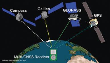
Four global navigation satellite systems are scheduled to be fully operational orbiting Earth in the coming years: the NAVSTAR Global Positioning System (GPS) from the United States, the GLObal NAvigation Satellite System (GLONASS) from Russia, the Compass/BeiDou-2 System (BDS) from China, and Galileo from Europe. A considerably high number of signals, coming from the satellites of those constellations, will share the radio electric spectrum.

Read More >

By Inside GNSS

The Emerging Legal Debate Around Japan’s QZSS

Japan’s regional and augmentation positioning system, the Quasi-Zenith Satellite System (QZSS), is a project yet to be developed. While it will become a constellation of seven satellites covering the western Pacific area, only “Michibiki,” the first satellite launched in 2010 for technological validation , is now in orbit.

Read More >

By Ingo Baumann
July 5, 2016

First Results

In February 2011, Russia launched the first satellite of the GLONASS-K1 series, i.e., SVN (space vehicle number) 801 (R26), which in addition to the legacy frequency division multiple access (FDMA) signals, for the first time was enabled to transmit code division multiple access (CDMA) signals on the GLONASS L3 frequency (1202.025 MHz). Later in 2014, the GLONASS program added SVNs 802 (R17) of series K1 and 755 (R21) of series M, and in 2016, SVN 751 of series M, with the capability of transmitting CDMA L3 signals to the constellation.

Read More >

By Inside GNSS
[uam_ad id="183541"]

The International GNSS Monitoring and Assessment Service

Contemporary times have seen an increase in the number of navigation satellites across various geographical regions. In order to ensure that all these satellite systems work together to optimize the positioning, navigation, and timing (PNT) of users on or near the Earth’s surface there is need for inter-cooperation and inter-operability of the systems.

Read More >

By Inside GNSS
May 29, 2016

GNSS Hotspots | May 2019

One of 12 magnetograms recorded at Greenwich Observatory during the Great Geomagnetic Storm of 1859
1996 soccer game in the Midwest, (Rick Dikeman image)
Nouméa ground station after the flood
A pencil and a coffee cup show the size of NASA’s teeny tiny PhoneSat
Bonus Hotspot: Naro Tartaruga AUV
Pacific lamprey spawning (photo by Jeremy Monroe, Fresh Waters Illustrated)
“Return of the Bucentaurn to the Molo on Ascension Day”, by (Giovanni Antonio Canal) Canaletto
The U.S. Naval Observatory Alternate Master Clock at 2nd Space Operations Squadron, Schriever AFB in Colorado. This photo was taken in January, 2006 during the addition of a leap second. The USNO master clocks control GPS timing. They are accurate to within one second every 20 million years (Satellites are so picky! Humans, on the other hand, just want to know if we’re too late for lunch) USAF photo by A1C Jason Ridder.
Detail of Compass/ BeiDou2 system diagram
Hotspot 6: Beluga A300 600ST

Electronic Throwaways, Space X Wins, Drones at Sea and Shaking It Up

Read More >

By Inside GNSS

GNSS Antennas with Dr. Inder Gupta

Dr. Inder Gupta, The Ohio State University
Chris Bartone, Ohio University

GNSS receivers seem to get all the attention. Go to any technical GNSS conference and the lion’s share of presentations are about receiver design and techniques: better algorithms, signal processing, integration with other sensors, spoofing detection, and on and on.

Read More >

By Inside GNSS

Boubeker Belabbas’ Compass Points

COMPASS POINTS

Engineering specialties

Performance analysis of different GNSS configurations (multi-frequency multi-constellation) with and without augmentation. Integration of receiver subsystems starting with antenna design, receiver processing, interference and multipath mitigation algorithms, PVT including integrity monitoring, and hybridization using MEMS-based inertial sensors.

GNSS Event that most signified to you that GNSS had "arrived"

Read More >

By Inside GNSS
1 9 10 11 12 13 66
IGM_e-news_subscribe