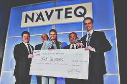
Ventures Archives - Page 8 of 11 - Inside GNSS - Global Navigation Satellite Systems Engineering, Policy, and Design

Ventures

September 16, 2009

Anritsu Selects IFEN GNSS RF Simulator for A-GPS Testing

Anritsu Corporation, a Japanese manufacturer of test and measurement equipment, has selected IFEN’s NavX-NCS Standard GNSS simulator as its assisted-GPS (A-GPS) test system for use in developing mobile terminals.

The NavX-NCS is a GNSS RF navigation constellation simulator capable of simulataneously simulating signals from up to nine L-band frequencies in the GPS, Galileo, GLONASS (including its new G1 frequency), and QZSS systems.

Read More >

By Inside GNSS
[uam_ad id="183541"]
July 14, 2009

GPS Networking, Inc., moves to New Facility

GPS Networking, Inc., a provider of GPS/GNSS signal distribution equipment and accessories since 1999, is moving effective July 15.

The company is remaining in Pueblo, Colorado, and moving into a larger facility at 3915A Outlook Blvd, Pueblo CO 81008.

GPS Networking’s phone number (1-800-463-3063/1-719-595-9880), fax number (719-595-9890) and website address <www.gpsnetworking.com> will also remain the same.

Read More >

By Inside GNSS
June 25, 2009

FAA Awards New WAAS Receiver Contract to NovAtel

FAA graphic

GNSS manufacturer NovAtel Inc., of Calgary, Alberta, Canada, has received a new contract from the Federal Aviation Administration (FAA) to develop the next-generation GPS Wide Area Augmentation System (WAAS) reference receiver (the “GIII” receiver). The three-year contract is worth up to US$9.7million.

Read More >

By Inside GNSS
May 13, 2009

Ready, Set, Go! The 2009 European Satellite Navigation Competition is open for ideas

Galileo Master’s award winners 2008

Submit the best idea for a brand new satellite navigation application or device and you just might win the 2009 Galileo Master’s Award – €20,000 in prize money and lots of support to make your idea a reality.

But that’s not your only chance – you can try for one of the eight special topic prizes or one of the 17 different regional prizes, together worth €500,000 in cash and start-up assistance.

The competition began six years ago in Bavaria, Germany, but it has expanded to include many other regions of Europe as well as Australia, Israel, and Taiwan.

Read More >

By Inside GNSS
[uam_ad id="183541"]
April 9, 2009

earthmine Launches 3D Mapping System Driven by GPS, Inertial

John Ristevski

Privacy rebellions such as recently drove a Google Street View crew from Broughton, England, or security-oriented legislation that would require blurred features or position accuracy in commercial imagery is just part of the market environment for 3-D mapping company earthmine, Inc., which is moving out of beta mode into full-fledged operations.

Read More >

By Inside GNSS

An Expanding CAST Navigation Moves to New Facilities

CAST Navigation LLC is relocating to expanded facilities as a result of increased demand for the company’s GPS simulators, GPS/INS navigation test equipment, and embedded GPS/inertial (EGI) integration tools.

Effective April 20, the new physical location for the CAST Navigation team will be: One Highwood Drive, Suite 100, Tewksbury, MA 01876. Phone contact is 978-858-0130. Faxes may be sent to 978-858-0170; website, <www.castnav.com>.

Read More >

By Inside GNSS
March 30, 2009

Geotagging: u-blox Buys Geotate

Typical implementation of geotagging in camera. Source: Geotate

In a €5.5-million cash deal, u-blox AG, of Thalwil, Switzerland, has acquired Geotate B.V. and its patented technology and products in the area of software GPS and geotagging GPS.

The acquisition will enable u-blox to expand its position in consumer markets with geotagging solutions for digital camera manufacturers and other portable device manufacturers.

Read More >

By Inside GNSS
March 24, 2009

SSTL Leads Team Developing GNSS-Based Remote Sensing of Sea State

Sea State Monitoring

Surrey Satellite Technology Limited (SSTL) will lead a British project to exploit signals from GPS and other GNSS satellites that are reflected from the Earth for remote sensing purposes.

The project will investigate a prototype instrument capable of measuring the roughness of the sea and soil moisture content, providing data for atmospheric science and for operational ocean and weather forecasting.

Read More >

By Inside GNSS
IGM_e-news_subscribe