Industry View category

MMT Launches 20-Channel Module

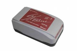
Micro Modular Technologies (MMT), of Irvine, California, has introduced its MN5515HS GPS receiver module, a low-power, 20-channel GPS receiver module based on the SiRFstarIII GPS receiver chipset.

The MN5515HS has a reported cold-start acquisition sensitivity of –145dBm and tracking sensitivity of –159dBm.

Read More >

By Inside GNSS
June 25, 2009

FAA Awards New WAAS Receiver Contract to NovAtel

FAA graphic

GNSS manufacturer NovAtel Inc., of Calgary, Alberta, Canada, has received a new contract from the Federal Aviation Administration (FAA) to develop the next-generation GPS Wide Area Augmentation System (WAAS) reference receiver (the “GIII” receiver). The three-year contract is worth up to US$9.7million.

Read More >

By Inside GNSS
June 4, 2009

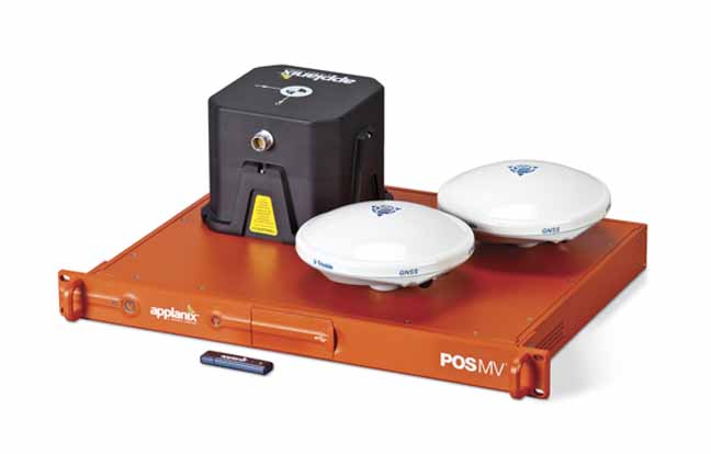
Applanix Introduces New Aerial Digital Photogrammetric System

Applanix
has introduced the POSTrack 410 flight management and direct
georeferencing system designed for use with the latest generation of
medium-format airborne digital photogrammetric camera.

The POSTrack 410 incorporates Applanix’s POS AV GNSS-inertial navigation
system (INS) and POSPac Mobile Mapping Suite (MMS) office software,
featuring the IN-Fusion technology and SmartBase module. This system
can process both GPS and GLONASS signals as well as those from
satellite-based augmentation systems.

Read More >

By Inside GNSS
[uam_ad id="183541"]
June 3, 2009

Pacific Crest Picks GNSS Industry Veteran to Head OEM Effort

Pacific Crest Corporation has  appointed GPS/GNSS industry veteran Don Speedy to head business development and sales for North America. With more than nine years of successful experience in business development and OEM GNSS, geographic information systems (GIS) and survey sales, Speedy will be responsible for driving strategic partnerships in OEM GNSS and data link communications while maintaining regional relationships.

Read More >

By Inside GNSS
May 13, 2009

Ready, Set, Go! The 2009 European Satellite Navigation Competition is open for ideas

Galileo Master’s award winners 2008

Submit the best idea for a brand new satellite navigation application or device and you just might win the 2009 Galileo Master’s Award – €20,000 in prize money and lots of support to make your idea a reality.

But that’s not your only chance – you can try for one of the eight special topic prizes or one of the 17 different regional prizes, together worth €500,000 in cash and start-up assistance.

The competition began six years ago in Bavaria, Germany, but it has expanded to include many other regions of Europe as well as Australia, Israel, and Taiwan.

Read More >

By Inside GNSS
April 27, 2009

Companies Announce GPS/Wi-Fi Collaboration

Ekahau Inc. has announced that its Wi-Fi location tracking software is being integrated into GPS receivers designed by NavSync Ltd. to enable customers to continuously track asset in indoor and outdoor environments.

Wi-Fi–enabled GPS tag combines NavSync’s NavTrac GPS module with Ekahau’s location protocol. The NavTrac module incorporates the CW85 16-channel GPS receiver/802.11b/g transmitter combination.

Read More >

By Inside GNSS
[uam_ad id="183541"]
April 26, 2009

Loctronix Gains Patent for Its Spectral Compression Positioning, Tracks CDMA, GNSS

Loctronix SCP technology

[Updated 4/26/09] On March 31, the U.S. Patent Office granted Loctronix Corporation its first patent, which will provide the foundation for its Spectral Compression Positioning (SCP) technology that enables multi-source positioning capability in a single sensor. Subsequently, the company announced that it had successfully achieved meter-level ranging performance using CDMA cellular signals.

Read More >

By Inside GNSS
April 10, 2009

Air Force Secures ITU Filing with GPS L5 Signal Transmission

Time Series and Power Spectrum of the L5 Demonstration Signal

The GPS IIR-20(M) satellite successfully transmitted for the first time a GPS signal in the L5 frequency band today (April 10), according to the U.S. Air Force operators of the Global Positioning System. L5, the third civil GPS signal, will eventually support safety-of-life applications for aviation and provide improved availability and accuracy to users.

Read More >

By Inside GNSS
April 9, 2009

earthmine Launches 3D Mapping System Driven by GPS, Inertial

John Ristevski

Privacy rebellions such as recently drove a Google Street View crew from Broughton, England, or security-oriented legislation that would require blurred features or position accuracy in commercial imagery is just part of the market environment for 3-D mapping company earthmine, Inc., which is moving out of beta mode into full-fledged operations.

Read More >

By Inside GNSS
1 56 57 58 59 60 66
IGM_e-news_subscribe