August 29, 2019
NovAtel Now Delivering Enhanced Signal Acquisition, Time and Accuracy
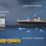
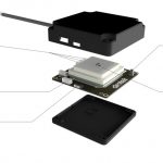
NovAtel, part of Hexagon’s Positioning Intelligence division, now brings users greatly improved processing speed and accuracy as well as significantly reduced signal acquisition time through the latest 7.07.03 firmware release.
By Inside GNSS