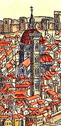
GNSS (all systems)

February 26, 2011

Webinar: Use GNSS Record and Replay to Make Testing More Effective

The makers of LabSat GNSS simulators, in cooperation with NavTech GPS, will host an interactive webinar in March on "How to use GNSS Record and Replay to make your testing faster and more effective." Two sessions will be held.

The US session takes place at 12:30 p.m. EST (9:30 a.m. PST, 17:30 GMT) on Wednesday, March 2 2011.

The UK/European session takes place at 14:00 GMT on Thursday, March 3 2011.

Read More >

By Inside GNSS
January 30, 2011

GPS/ GNSS Community Feels New Telecom Interference Threat from LightSquared

In his State of the Union address on January 25, President Obama held up the Global Positioning System as a prime example of government providing “cutting-edge scientists and inventors with the support that they need” to create world-leading, job-creating innovation.

The following day, the Federal Communications Commission (FCC) International Bureau approved a conditional waiver allowing LightSquared Subsidiary LLC to build tens of thousands of terrestrial transmitters for wireless communications in frequencies on either side of the GPS L1 band.

Read More >

By Inside GNSS
[uam_ad id="183541"]
January 21, 2011

Your Signal Is My Noise

Most people probably don’t associate engineers and linguistic virtuosity.

The attitude is unfair, of course, as with so many stereotypes.

And also untrue.

For example, as the number of existing or planned GNSS systems grew during the past few years, the expression “Your signal is my noise” has recurred in the engineering community with increasing frequency.

I consider that an elegant, if ominous, turn of phrase. A simple declarative sentence, pithy, with an ironic edge, yet almost lyrical.

Read More >

By Inside GNSS

Spectrum-Compact Signals

For the complete story, including figures, graphs, and images, please download the PDF of the article, above.

In the early stages of developing space-based radionavigation, the spectrum compactness of ranging signals was not proclaimed among the material priorities. Conventional bi-phase shift keying (BPSK) modulations, although they consume a rather large amount of spectrum, were adopted as the basis for both GPS and GLONASS signals.

Read More >

By Inside GNSS
January 17, 2011

2011 Space Weather Workshop

The annual Space Weather Workshop will take place on April 26-29 2011 in Boulder, Colorado.

Program organizers call it the "meeting of science, research, applications, operations and users." The program highlights space weather impacts in several areas, including
communications, navigation, spacecraft operations, aviation, and
electric power. 

Recent progress in large-scale modeling efforts will
be featured; while new developments in Sun-to-Earth coupled modeling systems
will also be a highlight.

Read More >

By Inside GNSS

InterGEO 2011

The 2011 InterGeo conference and trade fair for geodesy, geoinformation and land managment will take place at the CNN CongressCenter Nürnberg in Nuremberg, Germany from September 27 to 29, 2011.

It is organized by DVW e.V. – German Society for Geodesy, Geoinformation and Land Management.

The conference language is German.

Read More >

By Inside GNSS
[uam_ad id="183541"]
January 11, 2011

Topcon and DICKEY-john Form Alliance Around Ag System Development

Topcon Positioning Systems (TPS) and DICKEY-john Corporation, an agricultural systems and machine control manufacturer based in Auburn, Illinois, have formed a strategic relationship in the agriculture industry.

Headquartered in Livermore, California, TPS recently unveiled its System 350 machine control system, which employs the company’s new X30 control console and its AGI-3 receiver for autosteering.

Read More >

By Inside GNSS
January 9, 2011

Differences between Signal Acquisition and Tracking

Q: Why is acquisition of GNSS signals generally more difficult than tracking and what are the limiting factors?

A: A fairly good analogy of the difference between GNSS signal acquisition and tracking can be found in the rescue of victims of a sunken ship whose location is not accurately known. The first stage of the rescue attempt typically involves an aircraft flying a search pattern, which hopefully encompasses the location where the ship went down.

Read More >

By Inside GNSS

Wavelets and Notch Filtering

For the complete story, including figures, graphs, and images, please download the PDF of the article, above.

The use of GNSS for safety critical applications is gaining interest, particularly amongst aviation users, who probably have the most demanding requirements. The GNSS frequency band containing the Galileo E5 and GPS L5 signals is designated as an aeronautical radio navigation service (ARNS) band, which enjoys legal protection from other services not allocated to this frequency on a primary basis.

Read More >

By Inside GNSS

A Model-Based Approach

For the complete story, including figures, graphs, and images, please download the PDF of the article, above.

Galileo receiver designers require formal interface specifications for the Galileo signal-in-space (SIS) in order to write unambiguous and accurate specifications for Galileo receivers. To compute their positions, Galileo receivers must be able to retrieve timing and orbital information from the data stream conveyed in Galileo analog signals.

Read More >

By Inside GNSS
IGM_e-news_subscribe