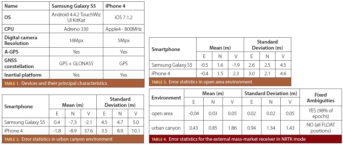
April 8, 2015
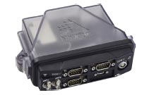
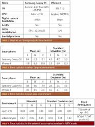
AsteRx4 OEM receiver
Septentrio Introduces New-Generation GNSS OEM Receiver; SBG Selects AsteRx4 for New INS Product Line
AsteRx4 OEM receiverSeptentrio has launched its next-generation dual-antenna GNSS receiver — the AsteRx4 OEM, a multi-frequency receiver that incorporates the latest GNSS tracking and positioning algorithms and operates with all available GNSS signals (GPS, GLONASS, BeiDou, Galileo).
By Inside GNSS