Resilient Timing in Smaller Package for Infrastructure and Mission-Critical Apps
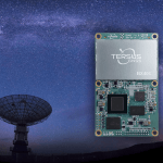
Septentrio has launched mosaic-T, a highly secure and accurate multi-frequency multi-constellation GNSS timing module for critical infrastructure and mission-critical timing applications.
By Inside GNSS