September 8, 2008
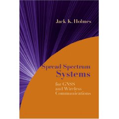
Spread Spectrum Systems for GNSS and Wireless Communications
By Jack K. Holmes
Artech House 2007. Hardcover. 874 pages
ISBN 978-1-59693-083-4
I will tell you up front that if you are a systems or design engineer involved in any field of spread spectrum technology, then you should invest in this new book. And you’ll want to read all 12 chapters with some “post-it” notes on hand to mark the pages containing figures and equations that you most likely will come back to review in more detail.
Most readers will probably not fully absorb this book during the first reading. Nonetheless, it helps to read through the entire presentation before attempting any in-depth understanding, because the author’s writing, equation formulation, and illustration style is conducive to a high level understanding of spread spectrum systems.
Author Jack K. Holmes is a well-known, highly published and long-time spread spectrum systems expert, instructor, and consultant in this field. He is Distinguished Engineer in the Communications and Network Architectures Subdivision of The Aerospace Corporation. One of the key roles of this part of the El Segundo, California–based company is its extensive GPS space segment, control segment, and ground (user equipment) segment systems engineering support for the U.S. Air Force’s GPS Wing.
This is not Dr. Holmes’ first book. I have owned a copy of the second edition of his Coherent Spread Spectrum Systems since 1990 and wish I had been aware of this latest gem sooner.
Like his first book, the new one is based almost entirely on analog (continuous time) theory and equations. It will help bridge the communications gap that inevitably exists between systems analysts and digital designers.
The discussion conveys only a high level of intuition regarding practical design synthesis of the modern hardware and real-time software required to actually build a system, because most spread spectrum systems today are entirely digital at the baseband level. Those skilled in such design will learn excellent trade-offs in their design choices and even how to extend their design skills to other communications systems.
However, readers who are unskilled in digital design probably will not pick up good design skills from this book. Readers skilled in analysis and simulations will be better able to analyze system performance predictions and critique design tradeoffs if the actual architecture is aptly communicated to them by the digital designers.
The author has formulated problems at the end of each chapter; so, he has apparently intended for it to be a graduate course level textbook.
Let’s take a closer look now at the contents of Holmes’ new book itself.
Hot Topic for GNSS Users
The new book encompasses the entire modern world of spread spectrum systems and then some. Chapter 1 provides a brief history of spread spectrum communications, followed by an introduction to narrowband signals (before they are spread), direct sequence with binary phase shift keying (BPSK) and with quadraphase phase shift keying (QPSK), minimum shift keying (MSK).
The discussion then proceeds to noncoherent (slow and fast) frequency hopped spread spectrum signals, and hybrid and time hopping spread spectrum signals. It concludes with a substantial introduction to orthogonal frequency division multiplexing (OFDM) and ultra-wideband (UWB) communications.
Even though OFDM and UWB are not classical spread spectrum systems, they certainly belong to the realm of modern communications signals. I bookmarked the section on Federal Communications Commission restrictions on UWB operations and the Part 15 emission limits. This is a hot topic to GNSS users worldwide because UWB has the potential of significantly raising the noise floor on these navigation signals.
Codes and Jamming
Chapter 2 deals rigorously with the math, formulation, and limitations of binary shift register codes. You will be able to design and analyze a large variety of pseudorandom noise (PRN) codes of various lengths and code sequences that are synthesized by this method.
Chapter 3 develops the effects of various types of jamming on the bit error rate (BER) performance for various types of spread spectrum modulations where no coding is provided to enhance the BER performance. Jammer types considered are wideband (barrage) noise jammers including pulse jammers and narrowband (partial band) noise jammers, plus continuous wave (tone), multi-tone, and matched spectral jammers.
Numerous chip modulation and data modulation combinations are analyzed for all types of jammers that effect BER. For most of the analysis cases, there is a BER plot provided with running parameters. For example, for pulsed jammer analysis, the running parameter is ρ (Rho), which represents the normalized time that the jammer is “on.” For examples, ρ = 1 is 100% and ρ = 0.4 is 40%.
Chapter 4 includes the beneficial effects of coding and interleaving to improve the BER and word error rate (WER) performance in the presence of jamming (or other effects such as attenuation that reduce the signal to noise ratio of the detected spread spectrum signal). First the various types of interleaving and coding techniques are defined and described mathematically as well as the decoding process.
In particular, the popular convolutional codes along with the Viterbi algorithm to decode the convolutional codes are presented and analyzed in depth. Both are now used in the data modulation and demodulation process of modernized GNSS signals. Here you will be dealing with some new terminology such as code rate, constraint length, maximum-likelihood processes, soft-decisions, zero filling, and tail-biting. These designs, especially the Viterbi decoder designs, are not only complicated but also memory- and throughput-intensive processes.
But this is the age where such marvelous innovations can be supported by modern digital technology. These analyses are not closed form, so they require computer simulations to determine the BER and WER performance. Some specific design examples have been simulated and plotted for the reader. Numerous other coding and decoding examples are also presented.
Carrier Tracking and Pseudonoise Code
Numerous carrier tracking loops for residual carrier signal tracking and suppressed carrier signal tracking are described and analyzed in Chapter 5. Several models of the phase locked loop (PLL) are analyzed (for dataless carrier applications). First, second and third order (analog) PLLs are then analyzed. Three types of frequency synthesis are described: digital, direct and indirect.
Various tracking techniques of BPSK signals are shown, including several Costas loops. Also described are Costas loop false lock protection levels and decision-directed Costas feedback loops. Very precise delta pseudorange measurements are obtained from PLLs in GNSS receivers operating with modernized dataless carriers.
Those containing data modulation (such as the present GPS signals) require the use of Costas (or Costas-like) PLLs. Costas PLLs lose some accuracy due to squaring loss caused by the presence of data modulation and about 6 dB of threshold performance in comparison to a pure PLL.
Multiphase carrier tracking loops, which are generalizations of the usual bi-phase Costas loops, are described in the context of quadraphase Costas loops. This chapter concludes with a brief treatment of (analog) frequency locked loops.
The acquisition of pseudonoise (PN) code in direct sequence receivers is covered in Chapter 6. PN acquisition is the initial alignment of the receiver’s replica PN code generator phase with that of the incoming PN code sequence. Numerous sequential code acquisition detector types are presented and analyzed, initially without the effects of Doppler and later with Doppler present.
In GNSS receivers, Doppler must always be considered, so the search process is simultaneously two-dimensional (code range dimension and carrier Doppler dimension). Section 6.4 provides a nice treatment of parallel code searching utilizing multiple correlators to speed up the code range search process. Section 6.5 is an extensive and thorough presentation of parallel frequency searching using fast Fourier transform (FFT) techniques to speed up the carrier Doppler search process.
Detection probabilities for BPSK and QPSK code modulation are analyzed assuming arbitrary Gaussian noise interference. BPSK detection probabilities are also derived assuming matched spectral and narrowband jamming interference (another place I bookmarked).
Section 6.6 is devoted to an optimum single correlator channel serial sweep search scheme pioneered by Holmes for the case where the time uncertainty is not uniformly distributed. Section 6.7 is devoted to sequential search detectors with variable integration times. Section 6.8 describes frequency domain search techniques using Fourier transform techniques. Section 6.9 provides an extensive treatment of matched filter search techniques.
Section 6.10 is a fairly comprehensive treatment of acquisition techniques for fast and slow frequency hopped signals with multiple frequency shift keying (MFSK) data modulation. Appendix 6A is devoted to signal flow graphs and discrete time invariant Markov processes.
Code Tracking
Direct sequence code tracking loops from which the pseudorange measurements are derived for a GNSS receiver are presented in Chapter 7. Numerous versions of non-coherent (in-phase) I and (quadraphase) Q, early-minus-late and dot product code tracking loops are described and analyzed for non-return-to-zero (NRZ) code modulation, including the effects of various types of interference.
The error performance is derived for a coherent code tracking loop (requiring the carrier tracking loop to be in phase lock) and three non-coherent code tracking loops (that will operate equally well with the carrier tracking loop in phase or frequency lock provided that both the I and Q signals are used in the code tracking loop).
Section 7.8 provides a fairly comprehensive description of multipath effects on both coherent and non-coherent code tracking loops. Other code tracking loop effects such as loss of lock and receiver blanking are presented.
Chapter 8 presents the performance of frequency hopped signals first without, then with data modulation. Chapter 9 describes multiple access methods for digital wireless cellular communications beginning with a brief history of cellular systems. First, second and third generation cellular communications systems multiple access techniques are presented and analyzed.
Chapter 10 is an introduction to fading channels. This chapter describes and analyzes numerous models for the various causes of loss of signal strength, including both outdoor and indoor models. Noteworthy is Section 10.12 that describes smart antennas, in particular adaptive array antennas.
Covert Communications
An introduction to the detection of covert communications systems is the focus of Chapter 11. Radiometers are the main focus for such covert signal detection, but three classes of detectors are described: those based on transform techniques (spectrum analyzer, compressive receiver, Bragg cell and FFT), energy detectors, (radiometers and channelized receivers), and rate line detectors (chip rate detectors and carrier frequency detectors). Both covert communications and interceptor techniques using these three classes of detectors are described and analyzed.
The performance of lock detectors that are used with all synchronization devices is covered in Chapter 12. The analytical approach used is to treat the lock detectors as absorbing Markov chains.
The theorems pertinent to lock detector theory are defined and proven up front. Some block diagram models for both suppressed and residual carrier tracking, PN tracking and frequency hopping are presented and discussed.
Overall, this book provides both a brief historical and a comprehensive theoretical plus analytical reference for spread spectrum and other modern communications systems. For those only interested in the GNSS applications, you will discover concepts and innovations presented in the wireless communications systems areas that should be in your GNSS conceptual and analytical tool kit (and vice versa). I rate it “5 Stars” as a comprehensive theoretical and analytical resource for all spread spectrum systems applications
By
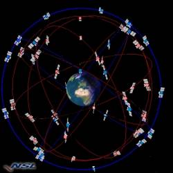 Combined GPS + Galileo constellation. Image source: Nottingham Scientific Ltd., UK