B: Applications

Digital Nav Payload Emerges as Factor in GPS III Re-Bid

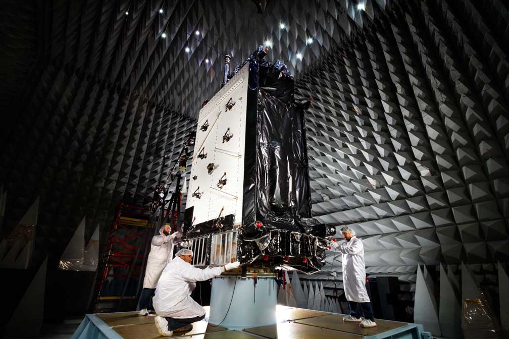
The advantages of a digital navigation payload, a technology singled out by both the House and Senate for $20 million worth of research support, appears to be a key factor in the Air Force’s search for a new GPS III contractor.

The digital payload “is a direct complement to the Production Readiness Alternate Sources Sought released in June,” Air Force officials said in an emailed response to questions about the technology and how it fits into the ongoing search for new GPS III suppliers.

Read More >

By Inside GNSS
August 15, 2014

As Galileo FOCs Near Launch, EC Holds Public Consultation on Open Service ICD

Installation of Galileo FOC satellite “Doresa” on the payload dispenser system. The first of two Galileo navigation satellites has been integrated on its payload dispenser system at Europe’s Spaceport in Kourou, French Guiana. The second satellite “Milena” was then installed in a side-by-side arrangement and will be mated atop a Soyuz Fregat upper stage. ESA/CNES/Arianespace/Optique Vidéo du CSG photo by P. Baudon

The European Commission (EC) has opened a public consultation on a newly revised version of the Galileo Open Service Signal in Space Interface Control Document (OS SIS ICD).
 
The consultation will take place through September 22, overlapping the scheduled first launch of fully operational capability (FOC) Galileo satellites on August 21. Details of the consultation process can be found on the EC Directorate-General for Enterprise website.
 

Read More >

By Inside GNSS
[uam_ad id="183541"]
August 8, 2014

Test Sites: The Select Six

ALASKA
Remote Sensing

1. The Team
The Pan-Pacific UAS Test Range complex is likely the largest of the FAA test ranges both in terms of its number of participants and its geographic coverage. The University of Alaska Fairbanks manages the team, which comprises some 59 contributors including Oregon and Hawaii as well as the countries of Norway, Ireland and Canada.

Read More >

By Inside GNSS

Special Report: UAS in the NAS

Clockwise from top left: A small drone rests on the ground during a demonstration in Florida, The Golden Eagle, a UAV developed at Clarkson University, takes wing, Nick Roy smiles at a drone in a lab at MIT, The Qube unmanned aerial vehicle by AeroVironment.

BY THE NUMBERS

Read More >

By Inside GNSS

Europe’s UAV Experience

Clockwise from top left: Belgium’s Trimble UX5; MAVinci unmanned autonomous microplane is ready to take off for a land survey mission; MAVinci autonomous micro air-vehicle surveys an open mining site; A Delair-Tech UAV sits poised on its stand

To say that the European unmanned aerial vehicle (UAV) industry has drawn a crowd may be understating things. According to Paris-based UAV International, the non-profit association representing European UAV manufacturers, the European Union (EU) counts more than 1,000 “approved and authorized” civil UAV operators within its borders. Others put that number at closer to 1,400.

Read More >

By Inside GNSS

Driverless Cars

Stanley, an autonomous car developed by the Stanford University Racing Team, won the 2005 DARPA Grand Challenge after successfully traversing a 132-mile course.

Interest in automated vehicles is surging, fueled by visions of computer-directed cars able to independently thread their way through a traffic jam before safely dropping off their otherwise-occupied passengers and finding their own parking place.

Read More >

By Inside GNSS
[uam_ad id="183541"]

Publisher’s Letter

Transformative.

My first encounter with an unmanned aerial vehicle, or UAV, was at the German Aerospace Center (DLR) in Oberpfaffenhofen Germany. Here, I watched in awe as a small quadrotor operated in an indoor flight testing “holodeck,” complete with an array of high-frequency strobe/camera units designed to log, stream and visualize precise position and attitude for rapid 3D mapping.

Read More >

By Inside GNSS
July 31, 2014

GPS Directorate to Hold Public Forum for Feedback on GPS Technical Specifications

The Global Positioning Systems (GPS) Directorate will host an open public forum on August 22 for the following NAVSTAR GPS public documents: IS-GPS-200 (Navigation User Interfaces), IS-GPS-705 (User Segment L5 Interfaces), IS-GPS-800 (User Segment L1C Interface), and ICD-GPS-870 (Navstar Next Generation GPS Operational Control Segment [OCX] to User Support Community Interfaces).

Read More >

By Inside GNSS
July 24, 2014

GNSS Hotspots | July 2014

One of 12 magnetograms recorded at Greenwich Observatory during the Great Geomagnetic Storm of 1859
1996 soccer game in the Midwest, (Rick Dikeman image)
Nouméa ground station after the flood
A pencil and a coffee cup show the size of NASA’s teeny tiny PhoneSat
Bonus Hotspot: Naro Tartaruga AUV
Pacific lamprey spawning (photo by Jeremy Monroe, Fresh Waters Illustrated)
“Return of the Bucentaurn to the Molo on Ascension Day”, by (Giovanni Antonio Canal) Canaletto
The U.S. Naval Observatory Alternate Master Clock at 2nd Space Operations Squadron, Schriever AFB in Colorado. This photo was taken in January, 2006 during the addition of a leap second. The USNO master clocks control GPS timing. They are accurate to within one second every 20 million years (Satellites are so picky! Humans, on the other hand, just want to know if we’re too late for lunch) USAF photo by A1C Jason Ridder.
Detail of Compass/ BeiDou2 system diagram
Hotspot 6: Beluga A300 600ST

1. SMART BALL
Portland, Oregon USA

√ Adidas has designed every official World Cup ball since 1970. And that’s not all! The Adidas Innovation Team in Portland, Oregon, spent 4 years on a smart soccer ball with a “six-axis MEMS accelerometer sensor package” that can detect speed, spin, strike and flight path data and whip it on over to the special GPS app on your iPhone. The app interprets the data for you, coaches you, and keeps a video to show your friends. On sale now for only $299.

Read More >

By Inside GNSS
July 21, 2014

GNSS & Geohazards

Ken Hudnut, U.S. Geological Survey

For at least two decades, GPS experts, geodesists, and public agencies have been working together to develop high-accuracy, large-scale continuously operating GPS reference stations that provide them the capability to monitor and model crustal deformation, tectonic plate movement, and the effects of geohazards such as earthquakes and volcanic eruptions.

Now, GNSS-augmented advance warning systems are going into place that can give us a crucial margin of safety in the event of an earthquake.

And none too soon.

Read More >

By Inside GNSS

New Leaders at the GPS Helm

Washington, D.C., has a peculiarity of seasons. While most of the world marks the shifts between winter and spring, summer and autumn, the politicos on the streets of the U.S. capital count the passage of time in two-year increments.

New operatives and appointees flock to the centers of power in the early days of each administration and the opening of each Congress, then migrate to friendlier climes as congressional elections loom and the administration winds down — as it is now.

Read More >

By Dee Ann Divis

GNSS Position Estimates

Q: How do measurement errors propagate into GNSS position estimates?

A: Not surprisingly, GNSS positioning accuracy is largely dependent on the level of measurement errors induced by orbital inaccuracies, atmospheric effects, multipath, and noise. This article discusses how, specifically, these errors manifest as position errors.

Read More >

By Inside GNSS
IGM_e-news_subscribe