New Book, Basic GIS Coordinates, Third Edition, Now Available
CRC Press has released a new book Basic GIS Coordinates, Third Edition by Jan Van Sickle.
By Inside GNSSCRC Press has released a new book Basic GIS Coordinates, Third Edition by Jan Van Sickle.
By Inside GNSS1. RESCUE DRONE
Noordwijk, Netherlands
√ Inspired by the refugee crisis, Dutch start-up Avy has been working on robust, long-duration drones capable of detecting people in distress and, if necessary, dropping life jackets, life buoys, food and medicine. The rescue drone can take off from a boat or the shore, carrying among other items, a cylinder that contains a large deployable rescue buoy, which not only can keep refugees afloat but indicates its location to boats in the vicinity.
The Virginia firm that had been hoping to use satellite frequencies near the GPS band to support a terrestrial broadband network has changed its pitch to regulators. Ligado, previously named LightSquared, is working to convince the Federal Communications Commission (FCC) that its frequencies are the way to provide connectivity to the broad internet of things (IoT) including unmanned aircraft, driverless cars and other unmanned systems.
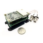
By Dee Ann DivisSwift Navigation and Carnegie Robotics (CRL) rolled out their first joint product, a real-time kinematic (RTK) GNSS receiver called Duro, at the AUVSI XPONENTIAL trade show in Dallas, Texas, May 8-11.
The companies say Duro is targeted to robotics, precision agriculture, mapping, military, outdoor industrial and maritime markets.
By Inside GNSSHemisphere GNSS announces the Vector Eclipse H328, the next offering in a line of new and refreshed, low-power, high-precision, positioning and heading OEM (original equipment manufacturer) boards. The multi-frequency, multi-GNSS H328 is an all signals receiver board that includes Hemisphere’s new hardware platform and integrates Atlas GNSS Global Correction Service.
By Inside GNSSA partnership between Swift Navigation and Carnegie Robotics announced this week is expected to yield a line of navigation products for autonomous vehicles, outdoor robotics and machine control.
San Francisco-based Swift Navigation is a startup building centimeter-accurate GPS technology designed to power a world of autonomous vehicles, while Carnegie Robotics, located in Pittsburgh, Pennsylvania, provides advanced robotics sensors and platforms for defense, agriculture, mining, infrastructure and energy applications.
By Inside GNSSSpirent Communications plc’s annual security forecast warns of the increased likelihood of disruptions this year to a wide variety of civil and military applications relying on global navigation satellite systems — GPS, GLONASS, Galileo, and BeiDou.
By Inside GNSSSwift Navigation co-founders Fergus Noble (29) and Colin Beighley (28) have been honored in the 2017 Forbes 30 Under 30 Consumer Technology list.
Swift Navigation is a San Francisco-based startup that provides centimeter-accurate real-time kinematics (RTK) GPS and GNSS positioning technology for autonomous vehicles, unmanned aerial vehicles (UAVs), precision agriculture, robotics, surveying, space applications and more.
By Inside GNSSAutoliv, Inc., a manufacturer of automotive safety systems with headquarters in Stockholm, Sweden, released its sixth-generation, aftermarket location and positioning module at the 2017 Consumer Electronics Show (CES) in Las Vegas, Nevada.
Accurate and reliable positioning and localization are critical for today’s vehicles containing advanced driver assistance (ADAS) and active safety systems, and even more essential in future autonomous vehicle systems.
By Inside GNSSA new reports says that the GNSS market landscape is growing because of rapid growth of satellite technology-enabled wearables, unmanned aerial vehicles (UAVs), new innovation opportunities, and low-cost precision receivers.
ABI Research’s new GNSS integrated circuit (IC) vendor competitive analysis says that Broadcom and Qualcomm remain the two top companies for the fourth straight year.
By Inside GNSSNovAtel Inc. announced today (November 15, 2016) that it has entered into an agreement with two educational institutions to fund leading-edge research to determine how GNSS technology can deliver a positioning solution that meets both the safety and accuracy requirements of unmanned automotive vehicles.
By Inside GNSSThe Geospatial World Forum 2017 and industry exhibition will be held at the Hyderabad International Convention Centre, Hyderabad, India on January 23 – 25, 2017.
Online registration is available.
By Inside GNSSNovAtel has signed a contract with Stanford University for a study to determine how GNSS technology can deliver a positioning system that meets safety and accuracy requirements for autonomous land vehicles, the company said.
NovAtel said the study, to be conducted at Stanford’s GPS Research Laboratory, will build on similar aircraft research. In addition, the research will include concepts for high integrity carrier-phase algorithms, threat models, and safety monitors for improving autonomous vehicle transportation, the company said.
By Inside GNSS