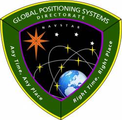
SBAS and RNSS

June 30, 2017

Applanix, University of Waterloo Collaborate on Advanced Technologies for Autonomous Vehicles

Applanix will provide WatCAR with its POS for testing autonomous guidance and control systems in real-world conditions. Photo source: Applanix.

Applanix, a Trimble Company, announced this week that it is collaborating on advanced research for autonomous vehicle guidance and control systems with the University of Waterloo Centre in Ontario, Canada for Automotive Research (WatCAR). Applanix will provide WatCAR with its Positioning and Orientation System (POS) for testing autonomous guidance and control systems in real-world conditions. Applanix will also provide the Trimble GNSS-Inertial board set for integration with car systems and sensors to enable precise positioning.

Read More >

By Inside GNSS
June 29, 2017

Air Force, Congress Face Off over Space Program Management

The U.S. Air Force is in a tug of war with congressional lawmakers over how military space programs will be managed going forward.

The House Armed Services Subcommittee (HASC) Chairman Mac Thornberry, R-Texas, this week threw his support behind a measure to move Space Command out from under the Air Force, placing it instead within U.S. Strategic Command (USSTRATCOM), one of the Department of Defense’s (DoD) nine unified commands.

Read More >

By Inside GNSS
[uam_ad id="183541"]
June 19, 2017

38th Asian Conference on Remote Sensing (ACRS-2017)

The event’s venue is Hotel The Ashok, Nitti Marg, New Delhi (http://www.theashok.com).

The 38th Asian Conference on Remote Sensing (ACRS-2017) will take place in October at New Delhi, India. The main theme of the conference is Space Applications: Touching Human Lives. The venue is Hotel The Ashok, Nitti Marg, New Delhi. Delhi is connected to all major cities, and the venue place is at the heart of the Delhi City.

Read More >

By Inside GNSS
June 15, 2017

White House Boosts GPS Budget, GPS III Procurement Decision Still Pending

Maj. Gen. Roger Teague, the director of space programs in the Office of the Assistant Secretary for Acquisition. Photo courtesy of Air Force.

The White House is asking Congress to boost overall funding for the GPS program back over $1 billion, with the largest infusion of new money earmarked to cover the cost growth of the Next Generation Operational Control System (OCX).

If approved, overall spending on the GPS program would reach $1.09 billion in fiscal year 2018 (FY18) with funding for OCX surging to $510.94 million from the $393.27 million allocated by Congress for FY17.

Read More >

By Dee Ann Divis
June 14, 2017

White House Pushes to Privatize Air Traffic Control

The White House has thrown its support behind a proposal to privatize the nation’s air traffic control (ATC) system as part of its plan to improve the country’s infrastructure.

The administration is seeking to create a nonprofit organization empowered to take over the ATC system from the Federal Aviation Administration (FAA) and finance its operations by charging fees to flyers. The new group would also be expected to reach out to the financial markets and borrow against that income stream to support, and hopefully accelerate, ATC modernization.

Read More >

By Inside GNSS
June 13, 2017

ESA, Thales Alenia Space Sign Contract to Upgrade EGNOS

The European Space Agency (ESA) has signed a contract with Thales Alenia Space for an upgrade of EGNOS, Europe’s satellite-based augmentation system (SBAS).

Designed by ESA and being exploited by Europe’s GNSS Agency (GSA) the European Geostationary Navigation Overlay Service (EGNOS) improves the precision of U.S. GPS signals over most of the European territory, while also providing continuous and reliable updates on the “integrity” of these GPS signals.

Read More >

By Inside GNSS
[uam_ad id="183541"]
June 12, 2017

Earth Networks Demos How Weather Data Can Optimize Drone Operations

Sferic Maps empowers emergency management and business continuity professionals with real-time collaboration capabilities to make intelligent weather-related decisions. Photo source: Earth Networks.

Advanced weather data is crucial to safeguarding business assets from severe weather. For example, energy companies build outage models utilizing their real-time hourly forecasting for every point in the country. These companies can then plan field teams accordingly, and plan drone operations to be conducted after the weather event to assess infrastructure damage that may have occurred.

Read More >

By Inside GNSS
June 1, 2017

MEMSIC Announces Compact, Accurate VG380 Inertial Modules

The VG380 vertical gyros modules. Photo source: MEMSIC Inc.

MEMSIC Inc., with headquarters in Andover, Massachusetts, recently announced the addition of the VG380 to its portfolio of inertial modules. These new vertical gyros are designed to provide highly accurate pitch and roll (with respect to gravity), in both static and dynamic conditions. The static and dynamic accuracy is specified at +/-0.2 and +/-1.0 degrees (respectively) over the -40C to +85C temperature range.

Read More >

By Inside GNSS
May 31, 2017

Ligado Focuses on Unmanned Sector in Push for Terrestrial Network

The Virginia firm that had been hoping to use satellite frequencies near the GPS band to support a terrestrial broadband network has changed its pitch to regulators. Ligado, previously named LightSquared, is working to convince the Federal Communications Commission (FCC) that its frequencies are the way to provide connectivity to the broad internet of things (IoT) including unmanned aircraft, driverless cars and other unmanned systems.

Read More >

By Dee Ann Divis
May 30, 2017

Spirent Interference Detector Helps Civil Aviation Battle GNSS Interference Threats

The new GSS200D Interference Detector was developed as part of Spirent’s partnership with Nottingham Scientific Limited. Photo source: Sprirent.

Spirent Communications has announced a solution that enables the civil aviation industry to evaluate the growing threat of GNSS interference, jamming and spoofing. The new GSS200D Interference Detector was developed as part of Spirent’s partnership with Nottingham Scientific Limited.

Read More >

By Inside GNSS
May 25, 2017

Raytheon Launches GEO 6 Payload to Improve GPS Accuracy for Safer, More Efficient Air Travel

With designs on providing a boost to navigation safety and efficiency for commercial and general aviation, Raytheon Company on May 18 launched its GEO 6 satellite payload into orbit for its 12-year mission. It is the latest payload to support the Federal Aviation Administration’s Wide Area Augmentation System (WAAS) which enhances the reliability and accuracy of GPS signals for directing air travel.

Read More >

By Inside GNSS
1 7 8 9 10 11 41
IGM_e-news_subscribe