GNSS Hotspots | November 2016
Highest altitude fix for a GPS signal, GNSS timing signals and hacking the Grid, Eagles act as drone countermeasures and rumors of a GNSS-nano-chip contributes to cash crisis in India
By Inside GNSSHighest altitude fix for a GPS signal, GNSS timing signals and hacking the Grid, Eagles act as drone countermeasures and rumors of a GNSS-nano-chip contributes to cash crisis in India
By Inside GNSSAmerican Election 2016 — now that was something, wasn’t it?
A national unpopularity contest. Sort of Commedia dell’arte meets Monty Python, directed by Todd Phillips, with a cameo appearance by Berlusconi.
Did we find it risible? Oh, yes, but were those tears of laughter, sorrow, or disbelief?
So, while we are collectively unpacking the meaning and nonsense from two years of political theater and telling each other our fortunes for the next four, what does it portend for GNSS?
Well, the tea leaves are a little unclear.
By Dee Ann DivisWith the Republican Party now entirely in charge of Washington’s prime policy real estate the neighborhood is going to change. The current residents are warily watching the newcomers take measurements for a major remodel of agencies, lobbying rules, national priorities, and international relationships, and everyone is assessing the implications of the new landscape.
By Dee Ann DivisTrimble has announced that the Hitachi Construction Machinery’s ZX200X-5B semi-automatic excavator is now available in Japan with the GCS900 Grade Control System.
The system uses GNSS, laser, sonic, or total station technology, to position the heavy machinery’s blade or bucket in real-time, for significant reduction in material overages and improving the contractor’s productivity, the company said. The unit makes design surfaces, grades, and alignments accessible to the operator inside a cab, Trimble said.
By Inside GNSS
GPS seems to have come out of nowhere. There was no progression like eight-track tape to cassette to CD to MP3 player. One day we were driving around clueless of where we were, struggling with roadmaps bought as gas stations that couldn’t be folded back neatly once opened and — suddenly — there was an amiable female voice coming out of the dashboard offering directions to our destination and showing no signs of impatience when we made wrong turns.
From the author’s introduction to GPS for Everyone
A United Launch Alliance (ULA) Atlas V rocket carrying the Geostationary Operational Environmental Satellite R-series (GOES-R) for National Aeronautics and Space Administration (NASA) and National Oceanic Atmospheric Administration (NOAA) lifted off from Cape Canaveral Air Force Station, Florida, yesterday (November 19, 2016) headed for geosynchronous orbit.
By Inside GNSSCalgary, Canada-based NovAtel Inc. announced that the Canadian Army has successfully tested its GPS Anti-Jam Technology (GAJT) in live-fire conditions on the M777C1 howitzer.
GAJT protects GPS-based navigation and precise timing receivers from intentional jamming and accidental interference, Novatel said. The unit features a null-forming antenna system, which ensure satellite signals necessary to compute position and time are always available, the company said.
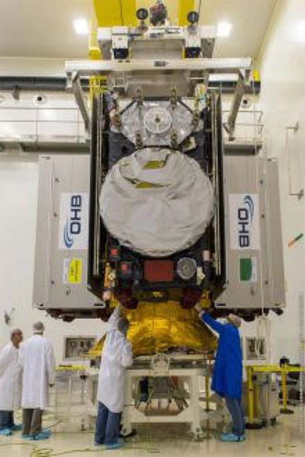
By Inside GNSSA modified Ariane 5 rocket lifted four Galileo satellites into orbit today (November 17, 2016) following an 8:06 a.m. (EST) launch from the European Space Center in Kourou, French Guiana.
The Galileo satellites reached their target altitude, after a "flawless release" from the new dispenser designed to handle four satellites, according to the European Space Agency (ESA). The dispenser released the first pair three hours and 25 minutes after liftoff, while the second separated 20 minutes later.
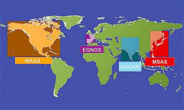
By Inside GNSSThe European Commission (EC) has opened the third round of competition for €33 million (US$35.15 million) in Horizon 2020 (H2020) contracts for development of European GNSS (EGNSS) applications exploiting use of Galileo and the European Geostationary Navigation Overlay Service (EGNOS).
By Inside GNSSCongress is back in Washington with a December 9 deadline to pass the 2017 Fiscal Year (FY17) federal budget and avoid a government shutdown.
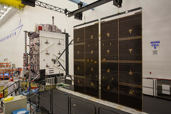
Lawmakers are widely expected to pass another continuing resolution, or CR, leaving the final decisions on the FY17 budget until after President-elect Donald Trump takes office in January — an approach that could both help and hurt the Pentagon’s GPS modernization effort.
By Dee Ann DivisNASA plans to launch the Cyclone GNSS (CYGNSS) hurricane mission aboard a Pegasus XL rocket on December 12 from Cape Canaveral Air Force Station in Florida. CYGNSS, which is NASA’s first Earth science small-satellite constellation, will help improve hurricane intensity, tracking, and storm surge forecasts, the agency said.
By Inside GNSSNASA’s Magnetospheric Multiscale (MMS) mission broke the Guinness World Record for highest altitude fix of a GPS signal, the agency announced this week. The MMS satellites, operating in a highly elliptical orbit, set the record at 43,500 miles above the Earth.
The four MMS satellites incorporate GPS measurements into their tracking systems for position and orbit calculations to guide tight formations, NASA said.
By Inside GNSSAbstracts for the ION GNSS+ 2017 conference will be accepted online through March 10, 2017. The conference and industry exhibition covering all aspects of satellite navigation technology will take place September 25-29 at the Oregon Convention Center in Portland, Oregon USA.
By Inside GNSS