November 1, 2012
Explore Hurricane Sandy Impact Maps on ESRI website
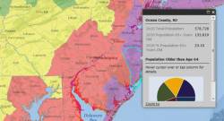
ESRI, major supplier of geographical information system (GIS) software, features a number of maps and apps on Hurricane Sandy on its website.
These include FEMA, Red Cross, various municipal and state maps and social networking apps on many aspects of the storm and its effects, from power outages to demographic information.