A: System Categories

State Officials Argue at AUVSI for Ban on Warrantless UAV Surveillance

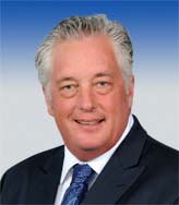
Alaska Lieutenant Governor Mead Treadwell

Three key associations of state officials are recommending that states pass legislation banning the use of unmanned aerial vehicles (UAVs) for surveillance unless the person being tracked has given permission or a warrant has been issued.

The associations also recommended banning UAVs from carrying weapons and emphasizing in state laws that both UAVs and their smaller cousins, model aircraft, be operated in ways that do not “present a nuisance to people or property.”

Read More >

By Inside GNSS
August 10, 2013

LightSquared Investors Sue GPS Industry

[Updated August 15, 2013] Investors led by Harbinger Capital Partners have filed a $1.9 billion lawsuit against a trio of GPS receiver manufacturers  over LightSquared, a now bankrupt firm that still hopes to build a wireless broadband network across the United States.

Read More >

By Inside GNSS
[uam_ad id="183541"]
August 2, 2013

QinetiQ, Nottingham Scientific Demonstrate Cloud-Based Galileo PRS Technology

Two British companies, QinetiQ and Nottingham Scientific Ltd (NSL), have partnered to demonstrate an Internet “cloud”-based technology that enables a wide range of high-volume, low-cost satellite navigation applications using Galileo’s Public Regulated Service (PRS).

The NSL-QinetiQ application allows a service provider to host secure navigation on one server in a back office, capture data from multiple locations and units, and subsequently verify the location of a remote user.

Read More >

By Inside GNSS
July 31, 2013

Exit Interview: GPS Directorate’s Col. Bernie Gruber

USAF Col. Bernie Gruber, GPS Directorate. Air Force photo

Last month, USAF Col. Bernard Gruber stepped down after three years of running the Global Positioning Systems Directorate at Los Angeles Air Force Base.

The GPS Directorate, originally established in 1974 as the NAVSTAR GPS Joint Program Office, is responsible for development, acquisition, fielding and sustainment of all GPS space segments: the modernized operational control segment (OCX), the next-generation GPS III satellites, and modernized GPS user equipment (MGUE).

Read More >

By Inside GNSS

FAA Approves Two UAS Type Certificates

The Federal Aviation Administration (FAA) has issued restricted category type certificates to a pair of unmanned aircraft systems (UAS), a milestone that will lead to the first approved commercial UAS operations later this summer.

Issuing the type certificates is an important step toward the FAA’s goal of integrating UAS into the nation’s airspace.  FAA officials announced the action last Friday (July 26, 2013).

Read More >

By Inside GNSS
July 28, 2013

Encouraging Galileo GNSS and EGNOS Use in the Mediterranean Basin

Tunis, where the new Galileo Euro-Med Cooperation Office (GEMCO) will open in October.

A European-Union funded consortium invites companies and public agencies from Mediterranean countries in North Africa and the Middle East to submit ideas for extending Galileo GNSS and EGNOS use in the region.

Eligible ideas could be for a small pilot project or research study, a technical training plan, and/or a publication or article. The submission deadline is August 25, 2013.

The countries in the target area are Algeria, Egypt, Israel, Jordan, Lebanon, Libya, Morocco, Palestine, Syria, and Tunisia.

Read More >

By Inside GNSS
[uam_ad id="183541"]
July 27, 2013

Boeing Names New Director of GPS Programs

Dudley Barnfield, director, Boeing GPS Programs

Dudley Barnfield has joined the Boeing Government Space Systems (GSS) leadership team as director of the GPS programs.  He will have oversight for the entire GPS portfolio, which includes the GPS IIF program and alternate architecture initiatives.

Read More >

By Inside GNSS
July 25, 2013

Safety Board Says Connected Vehicle Technology Should Be Required to Prevent Collisions

In a Tuesday (July 23, 2013) hearing on two fatal school bus/truck collisions, the National Transportation Safety Board (NTSB) recommended adoption of “connected vehicle technology” on all newly manufactured highway vehicles as a way to reduce such accidents.

Such collision-avoidance systems — similar to those used in civil aviation — would typically depend on real-time transmissions of the GNSS-derived locations of nearby vehicles to provide enhanced “situational awareness” to drivers.

Read More >

By Inside GNSS
July 22, 2013

GPS III Prototype Arrives at Cape Canaveral

The GPS III Non-Flight Satellite Testbed (GNST) completed pathfinding activities at Lockheed Martin’s GPS III Processing Facility outside of Denver prior to it shipping to Cape Canaveral Air Force Station. Lockheed Martin photo

Lockheed Martin has delivered a full-sized, functional prototype of the next generation GPS satellite to Cape Canaveral Air Force Station.

The GPS III Non-Flight Satellite Testbed (GNST) arrived at the Cape on July 19 where it will be used to test facilities and pre-launch processes in advance of the arrival of the first GPS III flight satellites, which will undergo similar testing. The first flight GPS III satellite is expected to arrive at Cape Canaveral in 2014, ready for launch by the U.S. Air Force in 2015.

Read More >

By Inside GNSS
July 18, 2013

Spoofing

Logan Scott, LS Consulting

Sometimes GNSS spoofing seems a bit like UFOs: much speculation, occasional alarms at suspected instances, but little real-world evidence of its existence.

As far back as 2001, a U.S. Department of Transportation Volpe Center report suggested that as GPS further penetrates into the civil infrastructure, “it becomes a tempting target that could be exploited by individuals, groups or countries”.

Read More >

By Inside GNSS

Location, Location, Location

In a part of the world where frustrated drivers will park anywhere, including squarely on a sidewalk, a local newspaper is using location data to shame car owners into shaping up.

The Village, a Russian online publication serving Moscow, St. Petersburg and Kiev; created a free app that notes a badly parked vehicle’s make, color, and license plate information when users snap its picture.

Read More >

By Dee Ann Divis

European Space Solutions

Old Congress Hall, Munich

European Space Solutions will take place at the Alte Kongresshalle in Munich, Germany on November 5, 6 and 7.

It is a 3-day conference for public agencies and industry to meet with users and developers of products and applications that could benefit from Galileo, EGNOS and Copernicus services and capabilities.

Breakout sessions for specific groups include:

Read More >

By Inside GNSS
IGM_e-news_subscribe