January 19, 2016
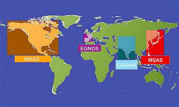
SBAS
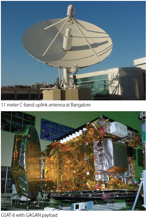
ISRO’s GSAT-15 satellite before launch, with GAGAN navigation payload
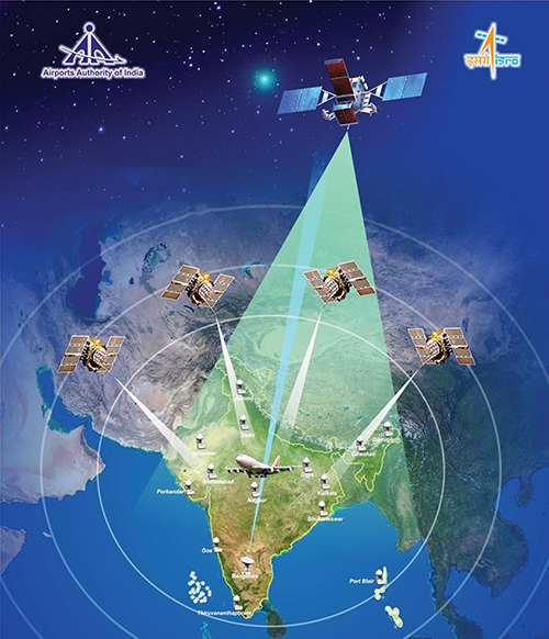
GAGAN — India’s SBAS
Redefining Navigation over the Indian Region
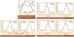
Recognizing the potential benefits of satellite-based augmentation systems, India took the early initiative to create its own SBAS called GAGAN — GPS Aided Geo Augmented Navigation.