July 26, 2019
Racelogic’s SatGen GNSS Simulation Software Now Includes Galileo
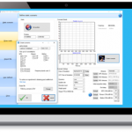
The latest update to Racelogic’s SatGen GNSS simulation software for PC now incorporates Galileo RF simulation.
Designed to create a GNSS RF I&Q or IF data file based on a user-generated trajectory file, the updated software can now accurately simulate the European Galileo GNSS satellite constellation alongside existing GPS, GLONASS and BeiDou RF signal generation.
By Inside GNSS