GLONASS

January 24, 2011

GLONASS: Bumpy Road

After technical and political setbacks, Russia gets ready to launch its first CDMA-equipped satellite in February.

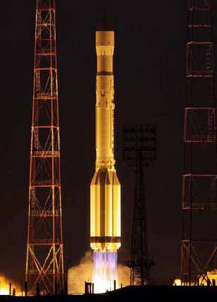
Russia’s GNSS program started off the year recovering from a series of setbacks that resulted in the dismissal of two space officials in the wake of the December 5 launch failure of three GLONASS-M satellites.

The postponed launch of the next-generation GLONASS-K demonstration spacecraft in 2010 meant that the program ended up the year with four fewer satellites in orbit than expected.

Read More >

By Inside GNSS
[uam_ad id="183541"]
December 6, 2010

GLONASS Triple Satellite Launch Suffers Rare Failure

A Proton rocket carrying three modernized GLONASS (GLONASS-M) satellites failed to reach orbit following its launch Sunday (December 5, 2010), falling into the Pacific Ocean.

The Russian Federal Space Agency (Roscosmos) said that a special board had been established to investigate the event — rare for the GLONASS program — and "define next steps."

Read More >

By Inside GNSS
December 1, 2010

Tracking Santa and Father Frost: GPS or GLONASS

GLONASS Tracks Father Frost

As GLONASS approaches completion, it’s no surprise that the Russian counterpart to GPS has gotten into more popular applications of GNSS technology — even Santa-tracking.

For more than 50 years, the North American Air Defense Command (NORAD) has followed the travels of the Christmas gift-bearer from his North Pole headquarters. The Santa-tracking operation can be viewed online.

Read More >

By Inside GNSS
November 14, 2010

GeoForm+ 2011

The 8th GeoForm+  trade fair will take place at EcoCentre Sokoniki in Moscow, Russia from March 15 through March 18, 2011.

It includes these specialized exhibitions of interest to Inside GNSS readers:

GeoMap covers geodesy, cartography and geographic information management systems.

GeoWAY covers GLONASS and GPS, intelligent transporation systems on land and sea, AUTOSPUTNIK and navigation using the GPS system.

Read More >

By Inside GNSS
[uam_ad id="183541"]
November 7, 2010

Munich Satellite Navigation Summit 2011

Residenz entrance, familiar to Munich Satellite Navigation Summit attendees.

The 2011 Munich Satellite Navigation Summit will take place from March 1 through 3 in Der Residenz, the palace of the old Bavarian royal family and now home to four museums. 

The event features high-level discussions about all of the world’s navigation satellite systems. It is organized by the Institute of Geodesy and Navigation at University FAF Munich.

The technical program begines with a plenary presentation on "GNSS in Balance," followed by a Bavarian State Reception.

Read More >

By Inside GNSS
November 2, 2010

Asia Oceania Regional Workshop on GNSS

Thailand’s largest island and a popular tourist destination

The 2nd Asia Oceania Regional Workshop on GNSS will be held in Melbourne, Australia, on November  21–22, in the two days before the Asia-Pacific Regional Space Agency Form (APRSAF) annual meeting in the city.

The free event will take place at the Royal Melbourne Institute of Technology (RMIT) University in Storey Hall at 342 Swanston Street. Registration is required on the event website.

Read More >

By Inside GNSS
August 27, 2010

GLONASS-M Satellite Launch Highlights Ambitious Promotion of Russia’s Revitalized GNSS

GLONASS-M satellite. Figure/photo, JSC “Academician M.F. Reshetnev “Information Satellite Systems”

A Proton-M carrier rocket successfully launched three GLONASS-M satellites into orbit early this morning (September 2, 2010, Moscow time) from the Baiknour space center in Kazakhstan. Another launch on November 30 will send three more M-type satellites into orbit, and the first GLONASS-K is scheduled to go up on December 25.

The imminent completion of a full constellation by the end of the year is accompanied by a vigorous policy initiative to promote Russia’s revitalized GNSS.

Read More >

By Inside GNSS
August 26, 2010

Applanix Releases Updated POS for Land Vehicles

Applanix recently released Version 5 of its Position and Orientation System for Land Vehicles (POS LV).

According to the company, the system uses integrated inertial technology and is designed to generate stable, reliable and repeatable positioning solutions for land-based vehicle applications such as road geometry, pavement inspection, GIS database and asset management, road surveying and vehicle dynamics. The company says the unit is designed to operate under the most difficult GPS conditions in urban and suburban environments.

Read More >

By Inside GNSS
1 23 24 25 26 27 31
IGM_e-news_subscribe