On 13 January 2026, Europe’s Copernicus Earth-observation program carried out a planned reconfiguration of the GNSS receiver aboard the Sentinel-3B satellite, a low-profile engineering activity that nevertheless illustrates how deeply Galileo-based positioning and timing now underpin European Earth-observation services.
Copernicus is the European Union’s flagship Earth-observation program, jointly implemented by the European Commission, ESA and EUMETSAT. Its family of Sentinel satellites provides continuous, free and open data on the oceans, land surface and atmosphere, supporting applications ranging from climate science and disaster response to commercial maritime services and precision agriculture.
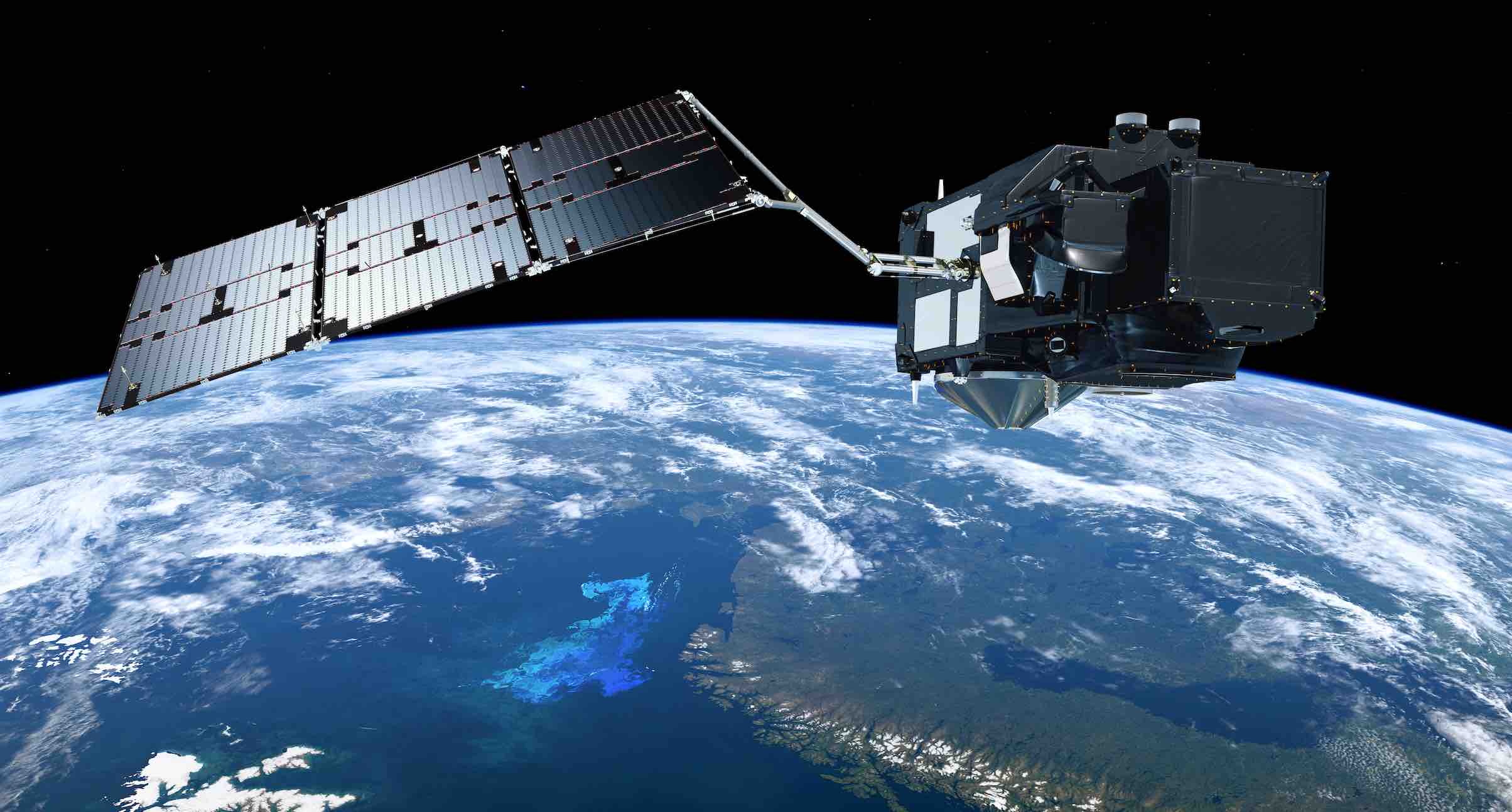
Among these missions, Sentinel-3 plays a central role, delivering high-accuracy ocean altimetry, sea-surface temperature, land and atmospheric measurements. Crucially, nearly all of those measurements depend on precise orbit and time knowledge derived from GNSS.
Sentinel-3B carries an onboard GNSS receiver that tracks Galileo and GPS signals to determine the spacecraft’s position with centimeter-level accuracy. That information is fundamental for processing everything from sea-level rise data to land deformation products.
Linked infrastructures
The reconfiguration carried out on 13 January, during a multi-hour operations window announced in advance to Copernicus users, involved changes to the spacecraft’s GNSS tracking and processing chain. While such updates are a normal part of satellite operations, Copernicus operators cautioned that GNSS-derived products could be temporarily degraded during the procedure, an acknowledgement of how tightly Earth-observation quality is now coupled to PNT performance.
This growing interdependence reflects a broader evolution of the EU Space Program. Galileo is no longer simply a positioning system for receivers on the ground; it is increasingly an internal infrastructure layer for Europe’s own satellites. Orbit determination, instrument calibration, and even inter-satellite data alignment all rely on stable, high-quality GNSS signals.
European Commission officials have explicitly recognized this convergence. “Galileo is a strategic enabler for all European space services, including Copernicus,” said Commission Vice-President Margrethe Vestager during recent EU space policy discussions, highlighting the need for stronger coordination across EU-funded space systems.
From an operational standpoint, the Sentinel-3B GNSS reconfiguration is likely to reinforce that message. As Galileo rolls out new capabilities such as authenticated signals and higher-accuracy services, Earth-observation missions will increasingly need to synchronize their GNSS configurations with evolving PNT policies. What was once a background subsystem is rapidly becoming a mission-critical interface between navigation and science, and a point of strategic attention for Europe’s space infrastructure.


