The team at UK based OxTS recently completed a survey with its developmental LiDAR mounted backpack at an unexpected location: Minster Lovell Hall, an English Heritage site in Oxfordshire.
OxTS is known for its reliable, accurate georeferencing solution, which is made up of an OxTS INS and the company’s LiDAR georeferencing software OxTS Georeferencer. The solution, which combines INS navigation data with raw LiDAR data, is typically used in surveying and mapping, though other industries are starting to show an interest.
“Predominantly used on the road, we enable centimeter-level accurate point cloud creation with our LiDAR and INS integrations, alongside our OxTS Georeferencer software,” according to an article on the company website. “However, we are now seeing a greater need for localization and georeferencing technology in both GNSS denied areas and those that cannot be reached by car.”
This interest spans across various industries, including construction, environmental, conservation and heritage, with each having different requirements for accuracy and point cloud quality. It’s also the reason the team decided do “some mapping off the beaten track” to see what they could achieve.
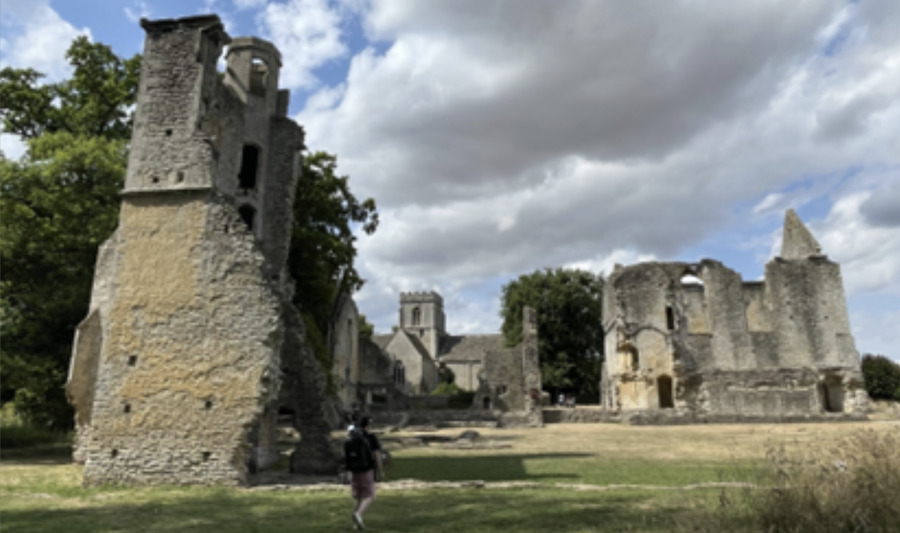
The survey site
Minister Lowell Hall was built in the 1430s. The hall, after having several owners, was abandoned and eventually demolished in the 18th century. The ruins are what remain today.
“The buildings are grouped around a central courtyard in a form characteristic of a late medieval manor house,” according to the article, “and it proved to be a great place to test our prototype backpack.”
The site has dense tree canopies on one side, tight doorways and narrow views of the sky. It also offers plenty of height, allowing the team to test the angled mounting of the survey-focused LiDAR. The open sky areas made it possible to get back to RTK before surveying other sections of the hall.
The backpack
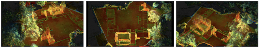
The prototype backpack tested was designed to allow for quicker data collection without a car. It features two Hesai LiDAR sensors, one of the company’s prototype INS devices and a single antenna. Connecting to a laptop makes it possible to configure, warm-up, optimize lever arms and boresight the system.
Data collected from the backpack, combined with the company’s ability to boresight and post process the data, allowed the team to create a high-quality point cloud.
More details on the Minister Lowell Hall survey here.


