Viasat, a global communications company (NASDAQ: VSAT), led a successful demonstration of the UK Satellite Based Augmentation System (UK SBAS) during a recent test flight. This demonstration, conducted as part of an ongoing trial funded by the Department for Transport through the European Space Agency (ESA), showcased the potential of UK SBAS to provide highly accurate GPS data, promising improved safety and operational efficiency.
“The trial on a sovereign UK SBAS is all about delivering trust. Trust for pilots in their tracking systems so they can stay safe in challenging conditions. Trust for the aviation industry more broadly so it can rely on data to operate more efficiently,” said Todd McDonnell, President, International Government, Viasat.
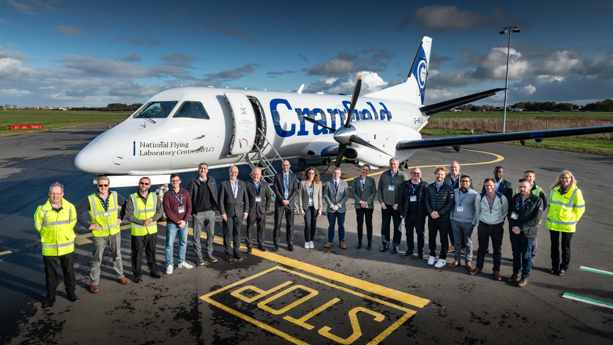
The test flight, carried out from Cranfield Airport using the National Flying Laboratory Centre’s Saab 340B aircraft, focused on highlighting the capabilities of a UK-based SBAS to deliver more precise and reliable navigation data. With the UK no longer part of the EU’s European Geostationary Navigation Overlay Service (EGNOS), the trial aims to pave the way for a complementary UK SBAS, specifically designed for critical safety-of-life navigation services across air, land, and sea.
“UK SBAS generates trust for pilots in their tracking systems so they can stay safe in challenging conditions. It is a vital project in helping the Government understand the potential benefits of a UK SBAS,” said Dean Thomas, Position, Navigation and Timing Lead at the UK Space Agency.
UK SBAS operates by merging ground monitoring data with satellite connectivity, offering positioning accuracy down to a few centimeters. This level of precision far surpasses the few meters provided by standard GPS. The system is anticipated to significantly enhance safety in aviation by providing pilots with increased confidence in their onboard instruments, particularly during challenging weather conditions where visibility may be limited.
“The project is directly supporting our work on future provision of high-accuracy, high-integrity positioning services, which could increase efficiency and enable new innovations across the transport network,” commented Anthony Browne, Technology Minister at the Department for Transport.
The successful aviation test marks a crucial step in further trials across various transport applications, including rail, unmanned aerial vehicles, and autonomous road vehicles. Fully funded by the government through the ESA NAVISP program, the trial aligns with broader efforts to deliver high-accuracy, high-integrity positioning services to boost efficiency and innovation across the transport network.


