At the ESA/JRC International Summer School on GNSS in Austria last month, one of the participants asked us during the evening panel — where they can address any kind of question to the lecturers and experts — What does satellite navigation look like in 50 and in 100 years from now?
We were all quiet at first, as nobody dared to answer. Then I responded: Tax authorities are currently writing-off a GNSS receiver in three years. The knowledge of mankind is doubling presently in two years (compared to 100 years between 1800 and 1900). Thus, how can we predict how satellite navigation looks in 50 years, or only in 20 years from now?
After a while, I tried to find a better answer for myself, just looking at what is going on with respect to our global and regional satellite navigation systems and augmentations.
With respect to (Satellite-Based Augmentation System) SBAS we recognize that Advanced Receiver Autonomous Integrity (ARAIM) has great potential. Horizontal ARAIM may be ready around 2023 and vertical ARAIM certainly a few years later. SBAS systems are guaranteed until 2035, especially for aviation. And after 2035: Are the SBAS systems becoming obsolete?

• Constellation: > 4000 sats
• Worldwide broadband internet
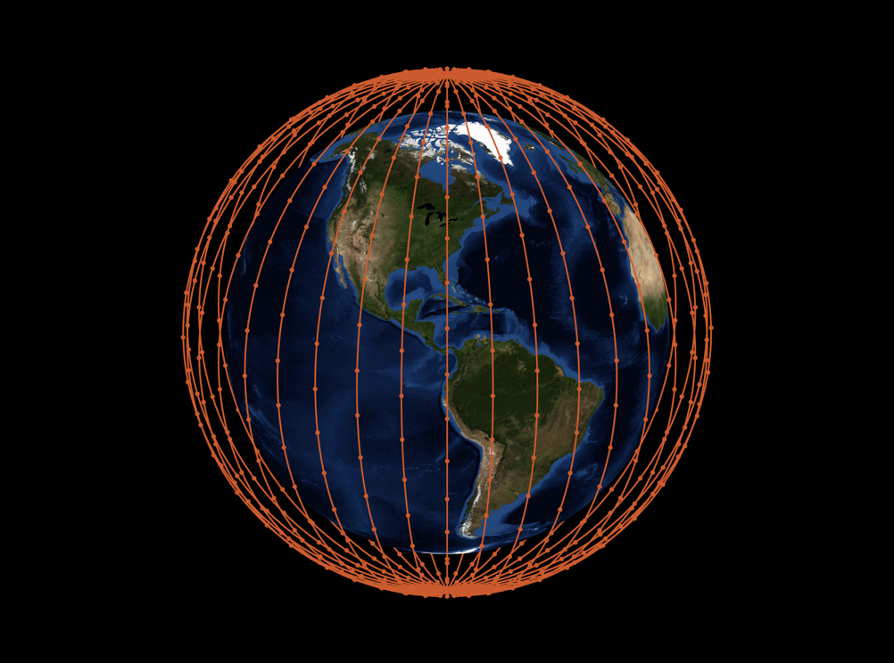
• 2 experimental sats (Tintin A & B) launched 22 February 2018 by SpaceX
Let’s look around more. 5G wireless networks are coming in the coming years. The standardization process for the first release incorporating 5G capabilities has been completed in June 2018 with the 3GPP Release 15. 5G technology might represent a new mobile revolution in the wireless landscape, with many new mission-critical services and positioning applications. Among the main targets you’ll find the Internet of Things (IoT) and ultrafast enhanced mobile broadband using millimeter waves and small cells. Will this produce a competitor to our GNSS? Or might the number of GNSS applications decrease? Or, more likely, we’ll see a hybridization GNSS/5G to develop.
And what about New Space, formerly known as alt/alternate space? Although there is no unique definition, it is certainly a movement and new philosophy, encompassing a globally emerging, private spaceflight and aerospace industry which is more socio-economically-oriented. In other words, working commercially and independent of governmental-funded (political) space programs with a faster, cheaper and better access to space.
Examples for such systems in the near future might be the low-earth orbit (LEO) systems with many hundreds or even thousands of mini-satellites mainly dedicated for communication and internet. OneWebb and SpaceX Starlink/Samsung are presently being built-up (see Figures 1 and 2). On the aerospace industry side, the company SpaceX is an example for New Space. But, can those LEO systems be used for satellite positioning and navigation?
Some Quick Considerations
GPS signals broadcast at 27 Watts which are received at 158 x 10-18 Watts on earth. Signals of OneWebb and SpaceX Starlink are 1000x (30dB) stronger compared to LEO vs. MEO (GNSS). But, it takes seven LEOs to match the coverage of 1 MEO.
200+ LEOs are needed for similar coverage – but no problem, as both mentioned LEO systems have significantly more than 200 satellites. Thus, the geometry (Dilution of Precision – DOP values) is consequently 3x better than that of present GNSS.
When you consider further, that a positioning error is approximately SIS URE (signal-in-space (SIS) user range error (URE)) x geometry, then we can recognize that the 3x better geometry of a LEO system relaxes the URE. A constellation like OneWeb/SpaceX Starlink could have a URE 3x worse and give comparable positioning performance to GPS (about 3 meters horizontally, 4-5 meters vertically).
The chip-scale atomic clocks (low power < 120mW, small size 17 cc volume, low-cost < 1000 USD … 300 USD) in the LEO satellites are approximately 100x worse at one day compared to GPS atomic clocks. However, we may get comparable performance if they are updated once per LEO orbit (approx. 100min) instead of once every 12 hours (GPS).
Simple computations of the LEO orbits by ground stations indicate that it is possible to achieve 3m RMS, using in addition cross-links approximately 1.5 meters.
And the costs? No taxpayer’s money has to be provided by governments…?
Also, a new feature of satellite positioning in the near future might come up. If the high doppler of the LEO satellites can be used for fast carrier phase ambiguity resolution in conjunction with the GNSS MEO signals – an old proposal by Brad Parkinson and Stanford University (more than 20 years old) – then centimeter positioning from our GNSS in real time can be achieved. A hybrid LEO/MEO solution!
In conclusion: 5G wireless networks and New Space LEO systems for communication and the internet are being built up in the next 10-15 years. Advanced RAIM may make SBAS after 2035 obsolete. So, how does the future of satellite navigation look? No more RNSS and GNSS? Or only military operations with RNSS and GNSS in future?
I follow the customs of the tax authorities (writing-off a GNSS receiver within three years), as it is hard or even impossible to predict the future of satellite navigation over more than 3-5 years. Don’t we live in an exciting (satellite navigation) time and future?
For more details about LEO constellations for navigation, read the following article:
Reid, Tyler G.R., Neish, Andrew M., Walter, Todd, Enge, Per K., “Broadband LEO Constellations for Navigation”, NAVIGATION, Journal of The Institute of Navigation, Vol. 65, No. 2, Summer 2018, pp. 205-220.


