A new data source to help scientists better understand the ionosphere and its potential impact on communications and PNT is now publicly available. The data was collected by sensors on GPS satellites in 2018, and released through a collaborative effort by Los Alamos National Laboratory (LANL)and the National Oceanic and Atmospheric Administration (NOAA).
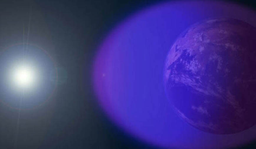
[Image above: A layer of charged particles, called the ionosphere, surrounds Earth, extending from about 50 to 360 miles above the surface of the planet – shown in purple and not-to-scale in this image. Because the ionosphere swells in response to incoming radiation from the sun, the exact size and shape of the ionosphere can change throughout the day, and the daytime ionosphere is always larger than the nighttime ionosphere. Image credit: NASA’s Goddard Space Flight Center/Duberstein]
“Radio signals from satellite or ground-based transmitters can travel through the ionosphere or bounce off of it, so ionospheric conditions have the potential to disrupt communications depending on the density of electrons,” said Erin Lay, a remote-sensing scientist at Los Alamos who was a technical lead on the project. “This new set of data will help us better model and predict the behavior of the ionosphere and possibly improve the reliability of our communications and positioning, navigation, and timing services, which are critical for both everyday life and national security.”
Research on the Markov Chain
In a separate but related development, earlier this year researchers published an article in the open access Space Weather journal of the American Geophysical Union on “Markov Chain-Based Stochastic Modeling of Deep Signal Fading: Availability Assessment of Dual-Frequency GNSS-Based Aviation Under Ionospheric Scintillation,” describing how they developed a new mathematical model to more accurately capture how irregularities in Earth’s atmosphere interrupt GNSS signals.
The mathematical model accurately emulates interruptions of GNSS signals caused by space weather, specifically some irregular low-density patches in the ionosphere.
The patches, known as equatorial plasma bubbles, usually form above Equator around twilight and cause the signal distortion called ionospheric scintillation.
The researchers, Andrew K. Sun, Hyeyeon Chang, Sam Pullen, Hyosub Kil,J iwon Seo, Y. Jade Morton and Jiyun Lee, write that: “GNSS navigation may be lost when multiple satellites are briefly unusable for GNSS receiver calculations due to the signal fades caused by scintillation. The use of dual-frequency signals can diminish the impact of scintillation by providing a backup ranging source on one frequency. However, frequency diversity is only partially helpful because the effect of scintillation is correlated across frequencies, meaning that a receiver may still lose satellites when their signals on both frequencies are simultaneously plagued by deep fading. Here we propose a new stochastic model to represent a more accurate description of correlated fading processes observed in actual scintillation data. We incorporate scintillation effects into a simulation of aviation availability. The simulation results provide estimates of the impact of scintillation on L1 single and L1/L5 dual-frequency aviation availability and quantify the benefit from the use of dual-frequency signals during strong scintillation. Further development of this model will enable the assessment of effects from other scintillation conditions and scenarios on availability for aviation and other applications of GNSS.”
This approach could improve understanding of other effects of ionospheric scintillation on GNSS signals and eventually help make GNSS satellites more resilient to scintillation and other forms of space weather.
Los Alamos and NOAA Files
The files mentioned at the top of this article, published collaboratively by LANL and NOAA, contain data products derived from LANL broadband radio-frequency (RF) sensors on GPS satellites that measure transient events in the very-high frequency (VHF, 30-300 MHz) range. As a RF signal from transient broadband lightning events travels through the ionosphere, it is dispersed, so lower frequencies arrive later in time than higher frequencies. This dispersion can be used to determine the slant total electron content (STEC, or the integrated electron density along the line of sight between the lightning location and the GPS satellite in medium Earth orbit (MEO)).
A mapping factor is used to project the slant TEC (along the line of sight) to a vertical TEC (VTEC), which is the integrated electron density vertically above a given location. The VTEC measurements from lightning events are combined in latitude, longitude, and time bins, and the median VTEC in a given bin is provided in these data files. This binning creates a time and spatial averaged sparse global TEC product from lightning events that can be used to compare to other TEC measurement products such as from GPS ground-based receivers.
The ionosphere is the boundary between Earth’s atmosphere and space, stretching approximately 40 to over 250 miles above Earth’s surface. It is composed of tenuous atmosphere and charged particles (ions and electrons) that interact with traversing radio waves. The behavior of the ionosphere reacts to weather on Earth, such as thunderstorms, wind, and hurricanes, as well as space weather created by solar winds impacting Earth’s magnetic field.
“NOAA’s Space Weather Prediction Center (SWPC) serves a huge customer base interested in space weather effects on communications and GPS-reliant technologies,” said Bill Murtagh, program coordinator at SWPC. “We expect access to these Los Alamos data sets to improve the development, validation, and testing of models used at SWPC for characterizing and forecasting ionospheric disturbances.”
The new data comes from unique measurements of lightning events, each of which produces a flash of radio waves that gets dispersed through the ionosphere before it is detected on satellite receivers. Each measured flash provides a snapshot of the ionospheric conditions at that instant, and many lightning measurements accumulated over time provide a unique view of ionospheric weather. This is the first-ever global set of ionospheric electron density data to use a naturally occurring source phenomena.
Prior to this release, the data available to feed ionosphere models was primarily from arrays of ground-based receivers, which are limited because they only monitor fixed locations. According to Lay, “the new data is gathered from lightning that happens all over the world and will give scientists the opportunity to study the ionosphere in ways previously not possible.”
The release of underutilized data sets was a priority established in the 2019 National Space Weather Strategy and Action Plan. Los Alamos processed the data from its radio-frequency sensors that are onboard GPS satellites and used for nuclear treaty monitoring, and then worked with a government interagency group, called the Space Weather Operations, Research, and Mitigation (SWORM), to facilitate public release. NOAA’s National Centers for Environmental Information will host the data on existing sites that serve terrestrial weather and space weather resources.
Link to data: https://www.ncei.noaa.gov/archive/accession/0241206


