
April 12, 2019
Harris Awarded $243 Million GPS IIIF Contract
Harris Corporation has inked a $243 million contract with GPS IIIF prime contractor Lockheed Martin to build all-digital payloads for the first two IIIF satellites.
By Inside GNSSGlobal Navigation Satellite Systems Engineering, Policy, and Design
Harris Corporation has inked a $243 million contract with GPS IIIF prime contractor Lockheed Martin to build all-digital payloads for the first two IIIF satellites.
By Inside GNSS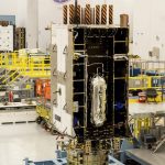
Harris Corporation has provided Lockheed Martin with its sixth of 10 advanced navigation payloads contracted for the U.S. Air Force’s GPS III satellite program, the company announced today.
The GPS III navigation payload features a Mission Data Unit (MDU) with a unique 70-percent digital design that links atomic clocks, radiation-hardened processors and powerful transmitters – enabling signals three times more accurate than those on current GPS satellites. The payload also boosts signal power, which increases jamming resistance by eight times and helps extend the satellite’s lifespan.
By Inside GNSS
Harris Corporation and L3 Technologies, Inc., have agreed this week to combine in an all stock merger of equals to create a global defense technology leader, focused on developing differentiated and mission critical solutions for customers around the world.
By Inside GNSS
Harris Corporation has been awarded three multi-award IDIQ contracts with ceilings totaling $1.5 billion to provide the National Geospatial-Intelligence Agency (NGA) with geospatial data services for up to 10 years.
Harris will create, manage and disseminate high-quality geospatial-intelligence (GEOINT) information for use by the U.S. intelligence community and military worldwide under contracts that cover all three areas of NGA’s JANUS program – geography, imagery and elevation.
By Inside GNSS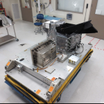
Harris Corporation has delivered an environmental monitoring sensor for the Greenhouse Gases Observing Satellite-2 (GOSAT-2), which will significantly enhance Japan’s ability to monitor greenhouse gases from space.
The Harris-built TANSO-FTS-2 (Thermal and Near Infrared Sensor for Carbon Observation-Fourier Transform Spectrometer-2) will measure greenhouse gases in the atmosphere. The newly built instrument will collect high-spectral resolution data of the Earth in five bands, which enables measurement during daylight and darkness. The instrument’s unique intelligent pointing system identifies, in real time, cloud-free areas of the atmosphere – greatly increasing the amount of useable data, according to the company.
By Inside GNSS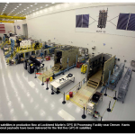
Harris Corporation has provided Lockheed Martin with its fifth of 10 advanced navigation payloads contracted for the U.S. Air Force GPS III satellite program.
By Inside GNSS