Spoofing detection and mitigation through multi-sensor integration.
MIGUEL ÁNGEL DE FRUTOS CARRO, LAURA TRAIN GARCIA, SEBASTIÁN C. MÉNDEZ VELÁSQUEZ, JOSÉ MARIA PULIDO FERNANDEZ, JOSÉ ANTONIO GUTIÉRREZ, DAVID PINTA SIERRA, UAV NAVIGATION-GRUPO OESÍA
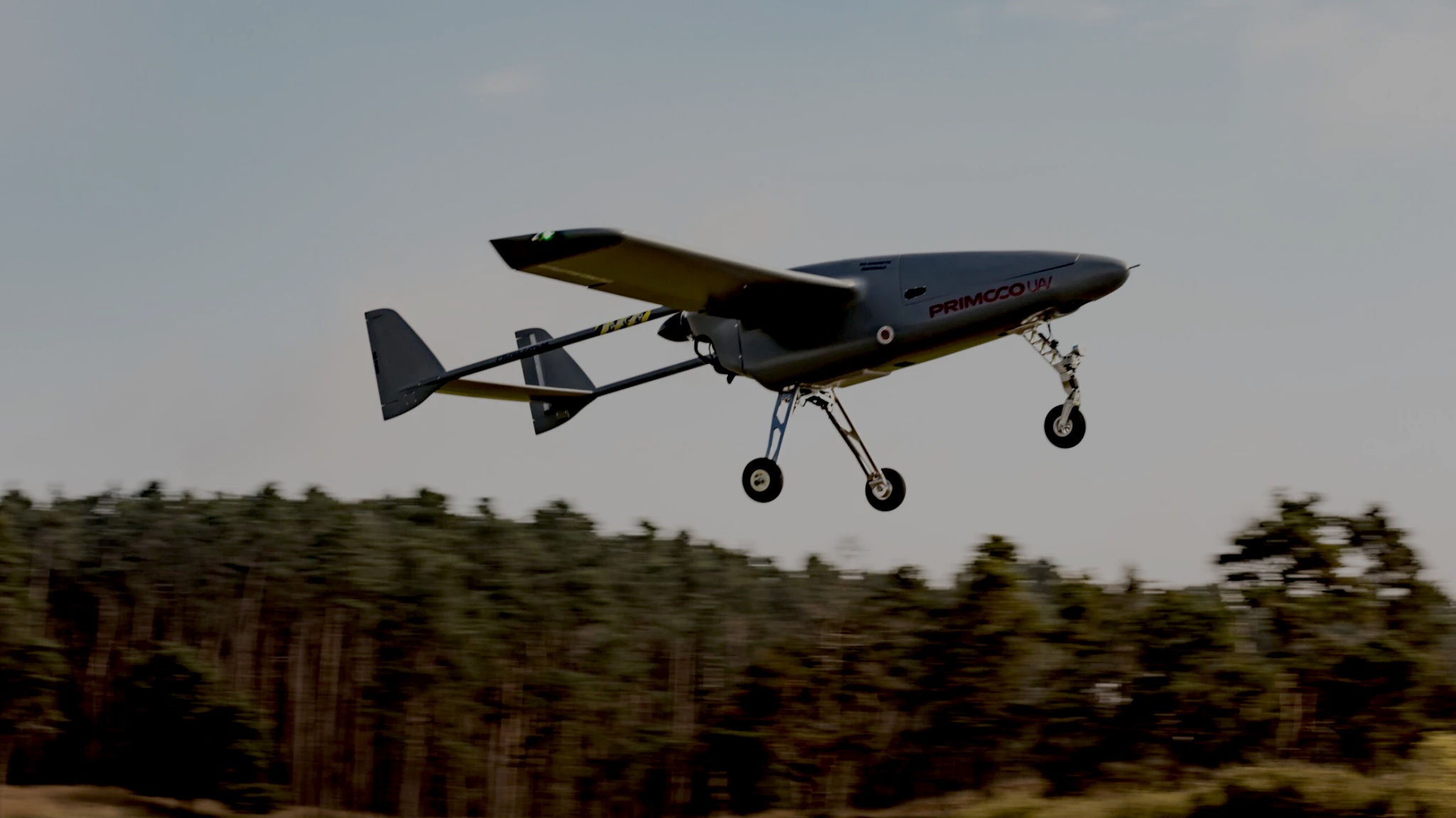
The use of GNSS for unmanned navigation has become ubiquitous in modern UAS operations. However, the low power of GNSS signals makes them susceptible to interference and spoofing. Spoofing attacks can mislead a GNSS receiver into calculating incorrect positions, velocities and times, potentially leading to mission failure or loss of the UAS. As the geopolitical landscape becomes more complex, the need for robust navigation systems that can withstand spoofing attacks is critical.
This article presents advancements in spoofing detection and mitigation technologies developed by UAV Navigation-Grupo Oesía. By integrating multiple navigation systems and employing advanced detection algorithms, UAV Navigation-Grupo Oesía provides a comprehensive solution to ensure the reliability and accuracy of UAS operations in GNSS-denied environments.
The Growing Threats to GNSS
GNSS spoofing and jamming are two major threats to the reliability of satellite-based navigation. GNSS spoofing involves the transmission of false GNSS signals that imitate legitimate ones, deceiving the receiver into calculating incorrect positions. Spoofing attacks can be categorized as simplistic or sophisticated. Simplistic spoofing transmits a single false signal, while sophisticated spoofing generates multiple false signals that closely mimic the timing and structure of authentic ones. The latter is significantly more difficult to detect and can lead to severe navigational errors.
In contrast, GNSS jamming involves the deliberate transmission of radio frequency signals that overwhelm or disrupt GNSS receivers by raising the noise floor, effectively denying access to satellite signals. Unlike spoofing, which aims to manipulate the receiver’s position estimate, jamming prevents it from acquiring or maintaining a satellite lock altogether. This loss of signal results in degraded or failed navigation capability, especially in systems that rely solely on GNSS.
Traditional methods for detecting spoofing include signal strength monitoring, time-of-arrival analysis, and consistency checks with onboard sensors. Signal strength monitoring looks for abrupt fluctuations that may signal spoofing activity. Time-of-arrival techniques compare the arrival timing of GNSS signals to detect anomalies, while consistency checks cross-reference GNSS data with inputs from inertial measurement units (IMUs), barometers, or other sensors to identify discrepancies.
Emerging technologies for spoofing and jamming mitigation include machine learning algorithms, multi-antenna systems and cryptographic protections. Machine learning can classify signal anomalies indicative of spoofing or jamming. Multi-antenna systems exploit spatial characteristics to detect direction-of-arrival inconsistencies. Meanwhile, cryptographic techniques, such as encrypted GNSS signals (e.g., Galileo Public Regulated Service), provide authentication to prevent spoofing. When combined with robust sensor fusion architectures, these methods significantly improve the system’s resilience in contested navigation environments.


Technologies for Spoofing Detection and Mitigation
As threats such as GNSS spoofing increasingly jeopardize the integrity of navigation systems, UAV Navigation-Grupo Oesía has developed a suite of advanced technologies designed to enhance the resilience and reliability of its navigation solutions.
By integrating inertial systems, visual navigation, and alternative methods such as solar-based heading determination, the company offers a robust, redundant architecture that ensures operational continuity even in GNSS-denied environments. These technologies not only detect interference or spoofing attempts but also actively mitigate their impact through independent sources of positioning, significantly improving the safety and autonomy of unmanned platforms during critical missions.

Robust and Precise Inertial Navigation Systems
The autopilots developed by UAV Navigation-Grupo Oesía integrate a sophisticated, in-house designed Attitude and Heading Reference System (AHRS), forming the core of their precise inertial navigation solution. This AHRS employs a combination of accelerometers, gyroscopes and magnetometers to estimate the aircraft’s attitude and heading, enabling the calculation of its position based on the last known coordinates. When GNSS data becomes unavailable or unreliable, the system seamlessly continues navigating using these inertial estimates, ensuring short-term positional continuity.
To address increasingly common threats such as GNSS spoofing, jamming and electronic interference, the AHRS has undergone rigorous validation. It has been tested extensively by specialized military units under high-intensity electronic warfare scenarios, including exposure to spoofing attacks and counter-UAS (C-UAS) systems. These demanding tests confirmed the system’s ability to maintain mission continuity, even when confronted with intentional disruptions.
In one notable operational deployment, UAV Navigation-Grupo Oesía’s autopilot successfully completed a highly sophisticated mission through an area protected by a “jamming curtain.” Despite the intentional GNSS denial, the system maintained control, completed its objectives, and even executed coordinated flight maneuvers as part of a swarming operation, underscoring its capabilities in autonomous navigation under contested conditions.
A key system feature is its ability to detect and assess navigational threats, dynamically identifying potentially compromised data sources and prioritizing alternative, trusted sources. This allows the autopilot to preserve navigational integrity and continue the mission effectively and autonomously.
This resilient behavior is supported by a robust architectural design based on multi-sensor data fusion, advanced algorithms, and internal logic that intelligently weighs and combines inputs from various subsystems. This includes data from the integrated Air Data System (ADS), which supplies critical variables such as airspeed and barometric altitude, further refining inertial navigation calculations.
UAV Navigation-Grupo Oesía’s autopilots have been tested under MIL-STD-810F (environmental conditions) and MIL-STD-461F (electromagnetic compatibility) standards, certifying both the hardware robustness and system reliability. In field trials and real-world missions, the AHRS/INS system has demonstrated performance comparable to fiber optic gyroscope (FOG) based systems, despite being built on MEMS technology. This represents a significant achievement in size, weight and cost optimization.
Even in fully GNSS-denied and dynamic flight conditions, the AHRS has proven capable of maintaining stable and accurate attitude and heading estimation, ensuring the continuity and safety of autonomous UAV operations in the most challenging and hostile environments.

Visual Navigation Systems
The VNS01 system is an advanced visual navigation solution designed to enhance the accuracy and reliability of UAV operations, particularly in GNSS-denied environments. Leveraging artificial intelligence (AI) and advanced computer vision techniques, the VNS01 significantly reduces inertial drift, thereby improving overall navigation performance when satellite signals are unavailable or unreliable.
The system operates by capturing real-time images of the terrain using an onboard camera. These images are processed to extract environmental features, which are then used to estimate the aircraft’s position and velocity. VNS01 supports three operational modes depending on mission requirements and signal availability: GNSS-aided mode, enhancing accuracy during normal operation; GNSS-denied navigation over known terrain using terrain recognition; and navigation over unknown areas through visual odometry (VO).
One of the core challenges in GNSS-denied navigation is the drift generated by inertial dead reckoning. This drift results from the continuous integration of accelerometer and gyroscope data, which accumulates errors over time. The VNS01 mitigates this problem by creating a visual map of the environment during flight. By recognizing patterns and comparing successive images, the system can continuously adjust the estimated position and orientation of the UAV, significantly reducing navigational drift.
The VNS01 was launched by UAV Navigation-Grupo Oesía more than four years ago and has since undergone extensive testing in real-world operational scenarios. These tests have consistently validated its effectiveness, especially in GPS-contested or denied environments. Under optimal conditions, the system achieves a final positional error of less than 1% of the total distance traveled, making it a highly reliable tool for precision navigation in complex missions.
This year, UAV Navigation-Grupo Oesía plans to release a new version of the VNS capable of operating in low-light and nighttime conditions, significantly extending mission windows and operational flexibility. Additionally, the upcoming version will incorporate digital cartography and public map sources using deep neural networks to enhance navigation over known areas, even in degraded visual conditions.
In parallel, the company is actively exploring complementary technologies such as Terrain Contour Matching (TERCOM), a technique based on correlating onboard altimeter data with digital elevation maps to estimate position through terrain profiling—offering another GNSS-independent alternative for robust navigation.
Fully integrated with the VECTOR autopilot, the VNS01 enhances autonomous flight capabilities and ensures mission stability and continuity, even in challenging conditions.


New Alternatives: Solar Navigation
As part of its ongoing commitment to innovation, UAV Navigation–Grupo Oesía is actively developing new navigation alternatives to further enhance the accuracy, robustness and autonomy of its systems. This includes research into novel sensors and advanced algorithms designed to improve navigation performance, particularly in contested or degraded environments where conventional GNSS-based systems may be unreliable or unavailable.
One such innovation is solar navigation, which determines the aircraft’s heading using the position of the sun. This method offers a highly robust alternative to traditional magnetometer-based heading systems. By precisely measuring the solar incidence vector and referencing the known position of the sun at any given time and location, the system can accurately calculate the aircraft’s heading relative to true north—independent of magnetic fields.
Solar navigation systems offer several operational advantages: they require no onboard calibration, are immune to magnetic interference, and are unaffected by ferrous materials or electromagnetic fields. These attributes make them particularly well-suited for missions in urban environments, near metal structures, or in military scenarios where electronic countermeasures may degrade magnetometer performance. As a result, solar navigation represents a promising and complementary solution within a multi-sensor architecture aimed at ensuring reliable and resilient navigation in any situation.


Methodology
The integration of INS, VNS and solar navigation creates a powerful, multi-layered navigation solution that significantly improves accuracy and reliability against interferences and attacks. By combining data from a diverse range of sources—each with its unique strengths—the system compensates for the limitations and vulnerabilities of individual technologies.
For instance, while INS can provide continuous data in the absence of GNSS signals, VNS and solar navigation offer supplementary positioning capabilities that further enhance performance in challenging environments. This integration not only optimizes navigation accuracy across various conditions but also strengthens resilience, ensuring the system remains operational and precise even when one or more sources of data are compromised. Ultimately, this holistic approach offers a more robust, adaptable and fault-tolerant navigation solution, suitable for a wide range of missions and environments.

Performance Analysis, Results and Discussion
UAV Navigation-Grupo Oesía has carried out rigorous testing of its navigation systems. These flight logs have provided invaluable data, enabling the company to refine and enhance the systems,
creating a solution rooted in a philosophy of continuous improvement.
The systems have undergone extensive testing in real-world operational scenarios and have received significant validation through military-grade assessments. Specialized military units have subjected the systems to rigorous scenarios, including deliberate jamming and spoofing attacks. Despite these intense conditions, the systems consistently demonstrated their ability to maintain mission continuity and successfully complete objectives even under hostile interference. These results underline the systems’ ability to withstand and operate effectively in contested environments, offering critical performance when reliability is paramount.
A critical part of the system’s evaluation is its performance under jamming and spoofing attacks. Rigorous testing in environments with active electronic interference has shown these systems can effectively detect, reject and mitigate false signals. The systems are equipped with advanced algorithms designed to identify interference and prioritize trustworthy data sources, ensuring mission success despite active attempts to disrupt navigation. These results demonstrate the systems are highly resilient and capable of functioning even when GNSS signals are unreliable or compromised.
The solar navigation system has been successfully tested in trial flights, demonstrating its potential for precise navigation even in the absence of traditional GNSS signals. The testing was conducted on UAV platforms with a maximum take-off weight (MTOW) of 10 kg, equipped with the solar navigation system. These tests have proven the effectiveness of the system in real-world conditions, further validating its reliability as an alternative solution in contested environments.
An essential aspect of the development process for these systems is the continuous improvement cycle, which is driven by ongoing feedback from operators and end users in the field. The company regularly updates its systems based on this feedback, ensuring they evolve to meet the challenges of increasingly complex operational conditions. This user-driven approach ensures the systems remain reliable and effective, particularly in environments where GNSS signals are compromised or subjected to interference. The integration of real-time performance data allows for the identification of potential system improvements and the implementation of these enhancements in future iterations.
Inertial and Visual Navigation System Performance Analysis
The performance of UAV Navigation’s INS and VNS has been rigorously evaluated through both real-world operational feedback and structured testing procedures. The extensive hours of flight accumulated in actual missions have provided invaluable insights into the performance in contested environments. This operational feedback has been crucial in the continuous improvement and refinement of the navigation technologies, ensuring their robustness and adaptability to evolving mission requirements. The accumulated data from real-world flights has been systematically incorporated into the system’s development cycle, facilitating the ongoing enhancement of the system’s capabilities.
The company has also conducted non-destructive operational tests designed to simulate realistic mission scenarios. These tests included the use of mission configuration, control, guidance and navigation systems, with auxiliary systems integrated to simulate GNSS jamming or spoofing attacks. The ability to detect and reject such interference in a timely manner is key to maintaining reliable navigation during compromised GNSS conditions. This capacity allows the system to continue using the available GNSS signal for as long as possible, but to reject it before it compromises the system’s integrity.
The system demonstrated its capability during flights in GNSS-denied conditions, flying over previously unexplored areas to assess its performance when GNSS signals were unavailable. In these tests, the system’s performance was evaluated based on three key indicators as shown in Figures 2a and 2b:
• The raw GNSS position (circle), representing the last known GNSS location.
• The estimated position from the VNS (arrow), derived from visual odometry and terrain pattern recognition.
• The final combined estimation from both the INS and VNS systems (blue aircraft).
Figure 2b shows the system successfully navigated over several kilometers in GNSS-denied conditions. The final combined position (blue aircraft) remained highly accurate, demonstrating the effectiveness of the INS and VNS systems working together to provide continuous, precise navigation even in the absence of GNSS signals.
Solar Navigation Performance Analysis
Solar navigation has emerged as a promising technology to further improve the robustness and safety of unmanned platform operations. While current systems deliver excellent results in contested environments, solar navigation provides a complementary method to enhance system resilience, especially when other sensors face limitations due to environmental interference or operational constraints.
Typically, an aircraft’s heading is derived by fusing data from gyroscopes and magnetometers, or through solutions like dual GNSS, which calculates the phase difference between signals from two receivers. However, magnetic sensors are sensitive to ferrous materials and electromagnetic fields, limiting their use on naval platforms, electrically driven engines, or in areas with strong interference. Magnetometers also require calibration for each aircraft configuration, complicating operations, particularly for larger platforms. Though techniques exist to calibrate magnetometers in-flight, they often focus on visual navigation systems. Dual GNSS provides precise solutions but fails in GNSS-denied conditions.
In contrast, solar navigation eliminates the need for onboard calibration, simplifying operations and installation, with the only requirement being that the sensor has visibility to the sun. However, it has limitations, such as only being usable during daylight hours and facing challenges during sunrise, sunset or in high-latitude regions during winter. Additionally, the sensor operates in the visible and infrared spectrum, meaning cloud cover can obstruct the solar signal. To address this, UAV Navigation-Grupo Oesía is exploring sensors that detect the ultraviolet (UV) spectrum, which could allow for continuous operation even under adverse atmospheric conditions.
The proposed system is summarized in Figure 4, which includes all elements involved in the navigation system. The section marked in red highlights the components that are active during a GNSS-denied operation. The Air Data, Attitude, Heading Reference System (ADAHRS) architecture provides a complete, GNSS-independent solution based on a robust attitude estimator and advanced visual navigation techniques. Incorporating the solar sensor adds a precise and reliable observable for the aircraft’s yaw angle, further enhancing the system’s performance in GNSS-denied environments.
Figures 4a and 4b outline both the ADAHRS architecture and the solar peripheral architecture. Position and UTC time inputs are used as external sources to the predictive model. No high precision is required for these inputs, as the sun appears stationary to the observer on the ground during short periods, and the angular perspective from the sun relative to two separate points on the platform remains relatively constant. At this point, we must say factory calibration of the sensors plays a fundamental role, as it guarantees optimum performance within the sensor’s field of view and minimizes assembly errors.
Figure 5 illustrates the comparison between the heading estimated by the solar device, which is subjected to radiation changes on a day alternating between sunny and cloudy conditions, and the Dual GNSS Compass. The average difference between the two sources is less than 2 degrees. Additionally, Figure 6
compares the three heading sources during level flight, where the magnetometer signal exhibits the highest noise density, while both the solar peripheral and the Dual GNSS Compass provide much more stable signals.
The results obtained from the tests indicate the solar navigation technology shows promising potential as an alternative solution for heading stability in UAS platforms. The system, through preliminary validation on the ground and in flight, demonstrated low size, weight and power consumption (SWaP-C), good precision and ease of integration, with the added benefit of not requiring in-flight calibration.
This study provides proof of concept for integrating astronavigation techniques into UAS guidance, navigation and control systems. The results highlight the viability of solar navigation systems as independent alternatives to GNSS, with significant potential for the defense sector, where GNSS-denied operations are increasingly common.
Conclusion and Future Work
The integration of INS, VNS and solar navigation provides a comprehensive solution that ensures mission success even without the availability of GNSS signals. These advancements address the critical need for precise navigation in contested environments where GNSS signals are subject to jamming, spoofing or complete denial.
The company’s ongoing research focuses on further enhancing the accuracy and reliability of its navigation systems. This includes developing new sensors and algorithms aimed at improving overall performance. In addition, UAV Navigation-Grupo Oesía is actively working on enhancing AI-based navigation systems, which will enable more efficient data processing and even more accurate positioning, particularly in complex operational conditions.
UAV Navigation-Grupo Oesía is also expanding its technologies to cater to other UAS classes and operational environments. This expansion includes adapting systems for use in larger platforms and environments with varying interference types, further increasing the versatility and resilience of the systems.
The company continues to invest in research and development to refine its technologies, ensuring the best possible solutions for unmanned aerial systems navigating in challenging and GNSS-denied environments. These efforts will significantly impact the UAS industry, providing reliable, precise and robust navigation solutions for critical missions.
Authors
Miguel Ángel de Frutos Carro is an Aeronautical Engineer from the Universidad Politécnica de Madrid, holds a Master΄s in Artificial Intelligence from the Universidad Internacional de La Rioja, and a Master΄s in Project Management and Organization from Universidad Nebrija. His main areas of interest are guidance, navigation and control systems in unmanned systems, with special attention to AI applications for enhancing autonomy and decision-making. He is conducting doctoral research in this field, affiliated with the Center for Automation and Robotics (UPM-CSIC). He is the Technical Director at UAV Navigation-Grupo Oesía, a leading Spanish company in designing control solutions for UAS.
Laura Train García holds a degree in Aerospace Engineering and a Master’s in Space Engineering from the Universidad Carlos III de Madrid, where she was also the president of the STAR rocket team. She carried out a one-year academic stay at Purdue University. She works at UAV Navigation-Grupo Oesía as an engineer in the state estimation and sensor fusion area, developing advanced navigation algorithms and exploring disruptive technologies to improve navigation in GNSS-denied environments through the integration of inertial, visual, and alternative sensors. She also participates in the design and support of flight tests with unmanned systems, with particular interest in navigation solutions applied to the space and defense sectors.
Sebastián Camilo Méndez Velásquez holds a degree in Aerospace Engineering from the Universidad Politécnica de Madrid and a Master’s in Aerospace Engineering from the Universidad Europea. He is the team leader in the flight control department at UAV Navigation-Grupo Oesía, where he manages projects focused on control solutions for high-reliability products. His role requires strong project management skills to coordinate multidisciplinary teams, ensure technical excellence, and deliver results under tight operational constraints. With extensive operational experience in advanced and highly complex technical missions, he has worked in demanding environments within the unmanned systems sector.
Jose Maria Pulido Fernandez is an Aeronautical Engineer from the Universidad Politécnica de Madrid and has been deeply committed to the field of unmanned vehicles since the beginning of his career. Currently, as a team leader at UAV Navigation-Grupo Oesía in the state estimation and sensor fusion area, he explores innovative solutions to improve navigation in contested or GNSS-denied environments. His strong passion for research, combined with solid technical knowledge, drives him to continuously investigate advanced techniques and develop new approaches to enhance the performance, autonomy and reliability of navigation systems.
José Antonio Gutiérrez Rivilla is an Industrial Engineer from the Universidad Politécnica de Madrid and has more than 20 years of experience in the electronics sector, with over 17 years in the unmanned vehicle field. He is currently responsible for the hardware and production department at UAV Navigation-Grupo Oesía, where he leads the design, miniaturization and integration of electronic systems onboard light aircraft. He has developed over 40 products, coordinating all phases—from conceptual design to production and delivery to the client—following strict quality and validation procedures.
David Pinta Sierra is an Aeronautical Engineer from the Universidad Politécnica de Madrid with a postgraduate degree in Marketing and Business Management from CEPADE (Graduate School of Business Administration)–Universidad Politécnica de Madrid. Specializing in business intelligence, data analysis, and strategy, he focuses on identifying trends, analyzing competitors, defining key market messages, assessing opportunities, and aligning strategies with business goals to drive growth. Passionate about connecting data, strategy and execution, he supports sales teams in optimizing business development. He excels at bridging technical insights and market needs and currently leads marketing and technical communication in the B2B aerospace sector, with a strong interest in innovation and disruptive technologies.


