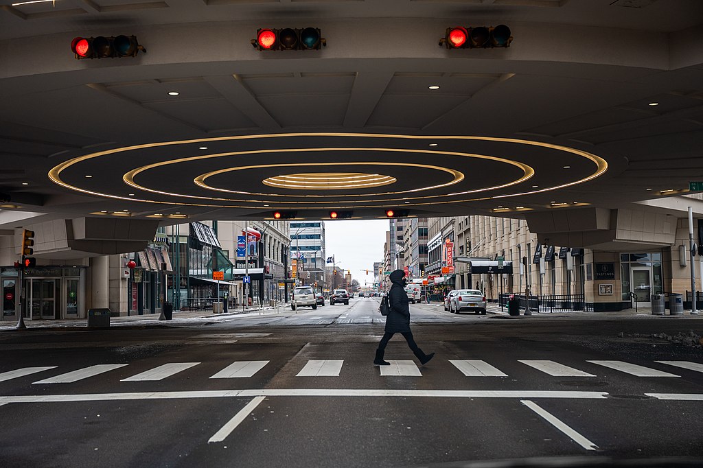
Intelligent Material Solutions (IMS) is taking a new approach to helping the blind and visually impaired (BVI) navigate in cities and other environments, using a technology that dovetails on GPS to provide more precise geo-location.
The cooperative guidance system is based on custom, optically-active rare-earth crystals called Intelligent Material. The crystals are embedded in critical infrastructure elements such as standard road paint and thermoplastics, IMS President Howard Bell said. The resulting I-Paint is paired with a detection device that can be mounted to a cane.
The device identifies the unique optical signatures in the paint for precise location, providing enhanced situational awareness with more accuracy than the GPS based BVI navigation features found in smartphones, he said.
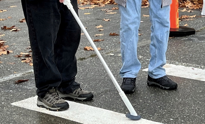
“I-Paint may be painted on sidewalks and roadways to indicate crosswalks, public transit and other key areas,” Bell said. “The accompanying sensor can then read the paint and enhance/calibrate GPS to allow for exact and accurate location services. The paint may also supply specific message content in key markings that may be provided to the user’s smartphone. For example, if temporary lines are painted on a sidewalk when there is construction, the lines may supply the user with the information that there is a blockage on the sidewalk X blocks or feet away.”
Recent Testing
The Federal Highway Administration (FHWA) recently tested the platform at the Turner-Fairbank Highway Research Center (TFHRC) to see how the intelligent paint technology might be used on roadways, Bell said. They wanted to assess how reliably and timely it identified a vehicle passing at a marked location, if it could differentiate between locations marked with different compounds, and if it could identify roadway paint markings by their purpose and location.
“This study showed the averaged GPS reading of 8 measurements was about 6-8 meters (a fifth decimal place of a degree) away from the actual points of measurement,” Bell said. “A low-end GPS has a resolution of ~10 meters so the measurement is well within the error range of the GPS used in the test. The test confirmed that a calibration of the GPS to a reference point is necessary. The label with IMS crystal can be readily used to identify the reference point on roadways.”
Possible FHWA applications include identifying stop lines at intersections as well as specific geo-location marks on roadways so the vehicle systems’ own location data, obtained through GPS or other means, could be confirmed or corrected as needed.
IMS is working with various partners to develop and test the technology, such as the City of Tampa, Tampa Lighthouse for the Blind, Ohio State University, Ohio State School for the Blind, Portland State University (PSU) and the University of British Columbia (UBC). The company continues to seek out partners, collaborators and investors to help get the technology commercialized.
Demonstrations were recently held at PSU and UBC to test the current state of the paint and cane as well as to receive feedback from BVI volunteers. I-Paint also has had multiple trials in Tampa.
“Our BVI volunteers who participated in trials in Portland and Vancouver BC were quite excited about the potential assistance that the I-Paint and cane system could provide them,” said Jonathan Fink, director of Portland State University’s Digital City Testbed Center. “We’re just at the early stages of exploring all of the ways this technology might be used to help people navigate through complex urban environments.”
A Long Road
The idea to put crystals on roads has been around since the 1990s, Bell said, with it really gaining momentum in recent years. The team at IMS was working on an anti-counterfeit application, using a small device that reacted to the rare-earth crystals, when someone suggested putting a line down on the ground so pedestrians with visual impairments could follow it. That suggestion led to the cane system.
Because the detection platforms can be miniaturized, Bell said, they can be used in a variety of applications for GPS calibration such as canes, of course, and vehicles. When I-Paint is part of the infrastructure, vehicles can calibrate their position, even in instances, say in urban canopies, where there’s limited or no access to GPS.
“A shift toward autonomous cities is ever present,” Bell said, “and it is vital to make sure the environment adapts in an inclusive manner to address the needs of the entire pedestrian population.”
The Future
For now, the company is focusing on incorporating the technology into locations such as indoor markets and construction areas in large cities, but Bell sees a place for the platform in hospitals and airports, with BVI visitors receiving a cane much like a handicapped guest might receive a wheelchair. Canes also can be offered at construction sites where walkways are altered.
Bell also sees eventually adding infrared emissions to the Intelligent Paint.
“Vehicle sensors are advancing exponentially,” he said. “Intelligent Paint can be seen by LiDAR and vision systems more readily than just regular white/yellow paint. The concept of having infrared emission from paint in addition to the yellow and white pigment so vehicles can process the information for benefit is reachable.”


