
A look back at a remarkable career as Van Dyke retires from federal service. Karen Van Dyke’s remarkable trajectory as a GNSS engineer took her from helping design tools that notify pilots of GPS outages to spearheading America’s national strategy on the future of positioning, navigation and timing (PNT).
Her personal rise reflects the equally impressive evolution of GPS, from a brilliant but obscure military system to a pillar of modern infrastructure.
When Inside GNSS profiled Van Dyke in 2007, she was already an influential voice in the satellite navigation universe, even as she joked about being “geographically challenged.” Back then, it was easy to think of her work, focused on tools like Receiver Autonomous Integrity Monitoring (RAIM) and systems to predict GPS outages, as a niche, highly technical corner of the transportation world. But, with the passage of time and the proliferation of technologies dependent on PNT, that niche has been transformed into an arena of enormous global consequence, and Van Dyke has remained at its center every step of the way.
From RAIM to Resilience
Van Dyke first stepped into the world of navigation technologies in 1988 as a newly graduated electrical engineer from the University of Lowell (now UMass Lowell). She quickly discovered a keen interest in PNT, working at a summer research job under Dr. James Rome on a Volpe Center project. She started by helping to assess whether the nascent GPS system could help manage aircraft separation over the North Atlantic.
It was early projects like the one at the Volpe Center that set the tone for a career defined by technical excellence and service-oriented vision. Among her most cited early achievements were developing RAIM outage reporting tools for both civilian and military aviation, and creating the GPS Specifications Traceability and Analysis of Requirements (STARWEB), an online traceability tool for tracking GPS requirements and their fulfillment.
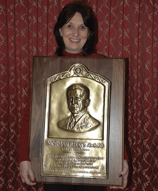
By 2007, Van Dyke had already earned accolades like the Institute of Navigation (ION) Early Achievement and Distinguished Service Award and The Department of Transportation (DOT) Silver and Bronze medals for Meritorious and Superior Achievement, respectively. Indeed, for all her technical achievements, Van Dyke remains equally proud of her volunteer contributions to ION, where she served as president from 2000 to 2001, and as long-time air navigation technical representative.
Meanwhile, as the PNT landscape grew more complex, her role shifted from engineer to strategist. “The transition wasn’t something I initially set out to do,” Van Dyke said. “But the need for a more unified, strategic view of PNT became increasingly apparent.”
In 2007, the Secretary of Transportation realigned the DOT’s Radionavigation and Spectrum Management program under the Research and Innovative Technology Administration (RITA), and Van Dyke’s trajectory took a significant turn. She was chosen to serve as the Acting Director for PNT and Spectrum Management, a position that allowed her to expand her influence beyond GPS algorithms and into national policy.
By 2015, she was designated as Director of PNT and Spectrum Management under the Office of the Assistant Secretary for Research and Technology (OST-R), overseeing coordination of civil PNT efforts across federal agencies and liaising with international and private-sector partners.
The DOT PNT Strategic Plan
A cornerstone of Van Dyke’s career was the development of the National PNT Architecture, a sweeping interagency initiative launched in 2007 in partnership with the Department of Defense (DOD). The effort brought together more than 200 individuals from 31 U.S. government departments and agencies and was completed in 2008.
“The goal was to provide a vision for future investment decisions, and a roadmap to more resilient and effective PNT capabilities,” she said. “The National Architecture recognizes GPS as the cornerstone of the nation’s PNT framework, but not the sole solution. It’s about resilience, redundancy and ensuring our national capabilities can withstand both intentional and unintentional disruptions.”
Building on this foundational work, Van Dyke oversaw the development of the DOT PNT Strategic Plan, issued in January. Based upon the original 19 National PNT Architecture recommendations, the Strategic Plan emphasizes a system-of-systems approach that combined GPS with a diversity of complementary PNT sources, including terrestrial, autonomous and space-based systems. It also advocated for establishing standards, and ensuring the availability of spectrum required for PNT services and protecting PNT services against harmful interference.
Other key goals for civil PNT under the Strategic Plan include:
• Advancing technologies and systems to support national PNT services
• Addressing cybersecurity challenges
• Leading civil and international PNT coordination
“The Strategic Plan is our playbook for the next phase,” Van Dyke said. “PNT is much more than a transportation issue—it’s a national infrastructure imperative.”

Spectrum Wars: The GPS Adjacent Band Compatibility Assessment
One of the most technically ambitious projects under Van Dyke’s leadership was the GPS Adjacent Band Compatibility (ABC) Assessment, a multiyear effort to understand how commercial RF transmissions near GPS frequencies might interfere with receiver performance. “Pressure for commercial access to spectrum has only increased over time,” she said. “We had to ensure that GPS services, especially those used in safety-of-life applications, wouldn’t be compromised.”
DOT’s study, released in 2018, evaluated close to 100 GPS/GNSS receivers used across sectors from aviation and rail to agriculture and emergency response. The findings were interesting, to say the least. For instance, it was shown the transmitter power level that can be tolerated by certified GPS avionics (9.8 dBW) may cause interference with, or degradation to, most other categories of GPS/GNSS receivers, including those used for general aviation and drones. “The results directly informed the NTIA [National Telecommunications and Information Administration] petition to reconsider the FCC’s Ligado decision in 2020,” Van Dyke said. The Ligado decision essentially approved a 5G network using spectrum near GPS frequencies, sparking backlash from federal agencies who warned it could interfere with critical GPS services.

Backing Up The Backbone
Perhaps no topic better illustrates the maturing of GPS than the drive to develop complementary PNT technologies. Van Dyke led DOT’s 2020 field demonstrations of 11 such technologies, including low Earth orbit (LEO) satellites, terrestrial radio frequency (RF), fiber-optic timing, and inertial measurement units (IMUs). “These weren’t theoretical exercises,” she said. “We were looking at high readiness-level systems that could be deployed quickly.”
Key outcomes included the 2023 Complementary PNT Action Plan, updated in 2024, and a $7.2 million investment in rapid-phase projects with nine commercial vendors with plans underway for a second rapid phase with up to an additional $7.5 million to be awarded to increase the diversity of technologies. DOT’s goal is to instrument field-tested test ranges to evaluate backup and complementary PNT solutions across critical infrastructure within six months of contracting. “Facilitating adoption of complementary PNT technologies ensures our trains run safely, our emergency responders stay coordinated, and our power grids stay synchronized, even in the face of interference,” Van Dyke said.
In characteristic style, Van Dyke credits others for her attainment: “All of the success for these projects,” she said, “and many more in fulfilling DOT’s role to represent the civil departments and agencies in GPS development, acquisition, management, and operations in conjunction with DoD under Space Policy Directive 7 and ensure responsible use of PNT in conjunction with DHS under Executive Order 13905 have only been possible due to the phenomenally talented people I have had the opportunity to work with across the government, industry and academia, both in the U.S. and around the world. My sincere thanks and appreciation to everyone who I have had the pleasure of working with and who has contributed to the success of our DOT PNT and Spectrum Management mission!”

Timing is Everything
As for what she sees on the PNT horizon, Van Dyke said, “Atomic clocks. The future of navigation is in timing,” referencing the Smithsonian’s Time and Navigation exhibit tagline: “If you want to know where you are, you need a good clock.”
She envisions miniaturized chip-scale atomic clocks becoming standard in mobile and distributed systems. “And as systems get smaller and smarter, we’ll see greater sensor fusion—GPS combined with onboard inertial, visual and other sensors.”
As PNT applications deepen in complexity, spanning autonomous vehicles, smart infrastructure, and national security, Van Dyke said the next big step is net-centric distribution, that is reliable, real-time delivery of PNT information across networks.
“It’s not just about where you are” she said. “It’s about what you can safely do because you know precisely where you are.”
The Other Side
Behind Van Dyke’s formidable professional persona is a story of personal balance. Raised in the Boston area, she stayed close to home for college, earning both her bachelor’s and master’s degrees from the University of Lowell. She credits early mentors like Dr. Richard John and Dr. Frank Tung (Director and Deputy Director of the DOT Volpe Center), as well as Mike Moroney, head of the Volpe Center for Navigation, for opening her eyes to the joy of applied engineering.
Van Dyke’s husband, Ken Kepchar, an engineer with a “built-in navigation sensor,” as she affectionately put it, was a lucky match, both personally and professionally. They met at the GPS Joint Program Office in Los Angeles, and their careers in PNT have often paralleled each other. “I always say he was born knowing where north is,” Van Dyke laughed. “I had to work at it.”
With her recent retirement, Van Dyke is looking forward to enjoying long-deferred pursuits. “My near-term goals are to enjoy some of the aspects of life that I haven’t had enough time for,” she said, “including projects around our home in Virginia, such as gardening, spending more time with friends and family, traveling, hiking, reading non-work-related material, and far fewer emails, and becoming more involved in our local community.”
She expects to divide her time between two very different but equally meaningful places. “My husband and I plan to keep our house in northern Virginia, as well as our townhouse in eastern Massachusetts,” she said. “They are both unique locations. In northern Virginia, we live on a peninsula on the Potomac River and enjoy a wide variety of wildlife around the property. To me, though, the bald eagles are the most special part of our Virginia locale. We are fortunate enough to have an active bald eagle’s nest adjacent to our property.”
Massachusetts, where she was raised and where much of her family still lives, remains close to her heart. “We always enjoy our time in eastern Mass during all seasons of the year, but especially in the summer when we can take long walks along the ocean, go sailing and whale watching, and enjoy lobster fresh off the boat.”
Future Bound
Van Dyke can still recall having to explain what GPS even stood for, back in her early days at Volpe. Now, it’s embedded in everything from smartphones to global finance. “That shift is the clearest sign to me that GPS, and by extension, PNT, is no longer niche,” she said. “It’s essential.”
Reflecting on her career, Van Dyke sees not just how far the field has come, but how quickly the world around it has changed. “As was described during the National PNT Architecture effort, the PNT landscape is continually changing and evolving,” she said. “However, PNT technology hasn’t changed as quickly as the world has changed—certainly what were hypothetical disturbances to GPS/GNSS are now real-world events being experienced, especially in and around conflict zones.”
The need for PNT resiliency, cybersecurity, situational awareness, and spectrum protection from harmful interference are all critical challenges. With increasing interest in complementary PNT solutions, Van Dyke cited the importance of ensuring these technologies meet stringent safety-of-life performance requirements: “There is a need to facilitate adoption of these technologies and ensure that these performance requirements for safety-of-life applications can continue to be achieved.”
“I am also interested in seeing how PNT evolves to meet other emerging requirements,” she said, “including the fully operational delivery of much needed capabilities such as the GPS modernized civil signals (L2C, L5 and L1C), signal authentication, utilization of CRPA antennae for civil applications, and operationalizing an automated GPS interference detection and geolocation capability.”
Not Really
Few believe, and no one hopes, that Van Dyke is really leaving the PNT stage for good. Despite her retirement from federal service, her connection to the community she helped build remains strong, and her compass remains fixed on the future of navigation. “I started my career in PNT and have been deeply involved for the past 36.5 years, so in a way it is now in my blood,” she said.
Van Dyke is particularly proud of the new generation of engineers taking up the mantle. “I am delighted that the DOT Volpe Center in Cambridge, Mass, where I started my career, has hired a number of younger engineers over the past several years to work on complementary PNT,” she said. “I am very interested in hearing about the results from their efforts to implement the DOT PNT Strategic Plan and DOT Complementary PNT Action Plan. I will be cheering them on and all who serve in the PNT community for their continued successes and accomplishments.”
So, over the course of a few very kind and memorable years, Van Dyke went from a young engineer curious about satellites to a national strategist who helped lay the foundation for America’s navigation future. We will hope to see her and follow her progress for many more years in whatever role she chooses to play. Her own contributions are sure to be as enduring as the systems she helped build, quietly reliable, globally significant, and always pointing the way forward.


