 Dr. John Fulton, Ohio State University
Nowhere has the fact that GNSS can guide things besides military weapons and transport manifested itself more profoundly than in agriculture.
While Google and automotive manufacturers struggle to figure out how to put autonomous vehicles on the highway, farmers have been using GNSS for well over a decade to guide equipment through their fields — along with a host of other ag-related, site-specific applications.
Indeed, GNSS — along with an array of other high-tech resources — is transforming agriculture at an accelerating rate.
To help us get our arms around the state of the arts and sciences in precision farming, we turned to Dr. John Fulton, associate professor in the Department of Food, Agricultural, and Biological Engineering at Ohio State University. Previously the assistant manager of a 2,000-acre, family owned fruit and vegetable farm in Ohio for 24 years, Fulton has conducted research and written extensively on the use of advanced technologies on U.S. farms of which he estimates around 70 percent are using some level of GPS/GNSS.
IGM: What level of positioning accuracy is most widely sought for these applications? Has there been a trend toward obtaining greater GNSS precision/accuracy in the agricultural community?
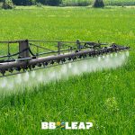
FULTON: The level of positioning accuracy depends on the field operation and technology being used. Typical application equipment such as sprayers and fertilizer applicators will use Wide Area Augmentation System (WAAS) or sub-meter correction since high accuracy is not required. These operations occur generally at higher ground speeds versus other field operations in the range of 10 to 20 mph. Therefore, adjacent passes occur in less than 15 minutes; so, precision of the positioning system is sufficient for both guidance and rate control technology on these machines.
However, the trend during the past 10 years in agriculture has been towards decimeter- to centimeter-level accuracy due primarily to reduced pricing but also as a result of the availability of higher accuracy correction services, in particular state-provided continuously operating reference stations (CORS) and private network solutions. These have enabled the number-one precision ag application using GNSS technology: guidance systems, including both lightbar guidance and autoguidance systems for agricultural equipment. Field operations such planting, tillage, and harvesting are using GNSS technologies. Real-time kinematic (RTK) adoption continues to increase in agriculture and has become one of the leading correction services used by farmers.
IGM: What are the leading farming applications of high-precision (i.e., centimeter-level) GNSS technology?
FULTON: High-precision or real-time kinematic (RTK) has become well adopted into autoguidance technology for tractors and harvesters to improve machine control and to accurately maintain spacing for adjacent passes. More specifically, RTK provides the necessary accuracy where machine and/or implement alignment is critical for subsequent field operations.
A typical example would be conducting a strip-till operation, then planting to ensure seeds are placed at the center of the tilled strip. Operation near the edge or even off of the tilled strip can negatively impact crop yield. Therefore, RTK level accuracy is required to maintain accurate alignment of passes over time. This requirement also exists for situations where the harvester needs to be aligned accurately with crop rows to minimize harvesting loss. We are also seeing RTK used to more accurately place fertilizers in relation to a row of plants to maximize uptake and reduce environmental risks of off-site movement of nutrients.
IGM: Do farmers seeking access to high-precision (i.e., centimeter-level) GNSS resources tend toward local, ground-based RTK systems or satellite-based commercial services, including virtual reference station techniques?
FULTON: For RTK application in agriculture, farmers use a range of options. In general, single-baseline solutions are the high percentage versus a true network solution.
However, the use of network solutions, whether virtual (VRS) or not, has grown significantly in recent years. A few agricultural companies still only offer local, ground-based RTK solutions that customers must purchase. The biggest shift for most farmers has been away from purchasing their own base station and being responsible for managing it. Some still use this option, but most new users will have a local base station network or network solution (VRS, CORS, etc.) available in which they can purchase an annual subscription.
IGM: The scalability of precision farming technologies, including GPS & GNSS, has long been a subject of discussion. Recognizing that varying factors, such as crop type, acreage, and applications, will affect decisions to adopt these technologies, at what size of farm operation do we see precision farming methods used?
FULTON: Today, precision agriculture is being used by small and large farms. The price of technology has greatly reduced over the past 20 years and, in particular, over the last 6, allowing any size of farm to take advantage of precision ag technologies. Not only have costs been reduced, the functionality of technology has greatly grown. Farmers do not just purchase a guidance system today; instead they purchase technology that has integrated capabilities for guiding and controlling the application on agricultural machines. So, at a relatively low cost, a farmer can purchase technology having a range of capabilities.
Further, manufacturers have integrated precision agriculture technology into the farm equipment when it’s built. An unlock fee or GNSS receiver purchase may be necessary, but over time costs have gone much lower — between 50 and 80 percent compared to 10-15 years ago. There is also exponential growth in app development within agriculture, allowing farmers to leverage consumer products for capturing spatial data and taking advantage of integrated GPS or GNSS technology within smartphones, iPads, tablets, or similar products. You may not see small farmers using RTK but do not be surprised if they have autoguidance.
IGM: Precision farming technologies traditionally have been adopted for large-scale operations producing commodity crops such as corn, wheat, and soybeans. Have GNSS technologies made inroads into higher-value crop production such as orchards, vineyards, cane berries, etc.?
FULTON: Yes. Today, GNSS is used to conduct scouting of crops and spatially mark data collection sites in both specialty and row crops. Remotely sensed imagery is being used to document in-season crop health or identify issues for a variety of crops. There is continual growth of geographic information system (GIS) and GNSS technologies for improving management of vegetables and tree crops. Automation of machinery and visioning technology improve placement of pesticides and nutrients while enhancing harvesting.
IGM: Is there a significant use of multi-GNSS system technology (e.g., GPS + GLONASS) in precision farming today? As other GNSS systems are completed (e.g., BeiDou, Galileo) what are the prospects and drivers for multi-GNSS applications?
FULTON: The existence of tree lines around fields along with rolling or steep terrain in many regions of the United States limited GPS-only solutions, especially for RTK. Many times, the availability of GPS satellites to derive positions dropped near or below the required number due to shadowing of a portion of the sky during field operations. Therefore, the technology was unable to function properly when working along tree lines or other obstacles, and the operator was back to manually driving the machine or manually turning on and off implements. So, GPS+GLONASS overcame these issues , allowing the technology to operate uninterrupted across the whole field. The addition of new satellite navigation systems will only improve uptime or reliability of the GNSS positioning sensor around the globe.


