
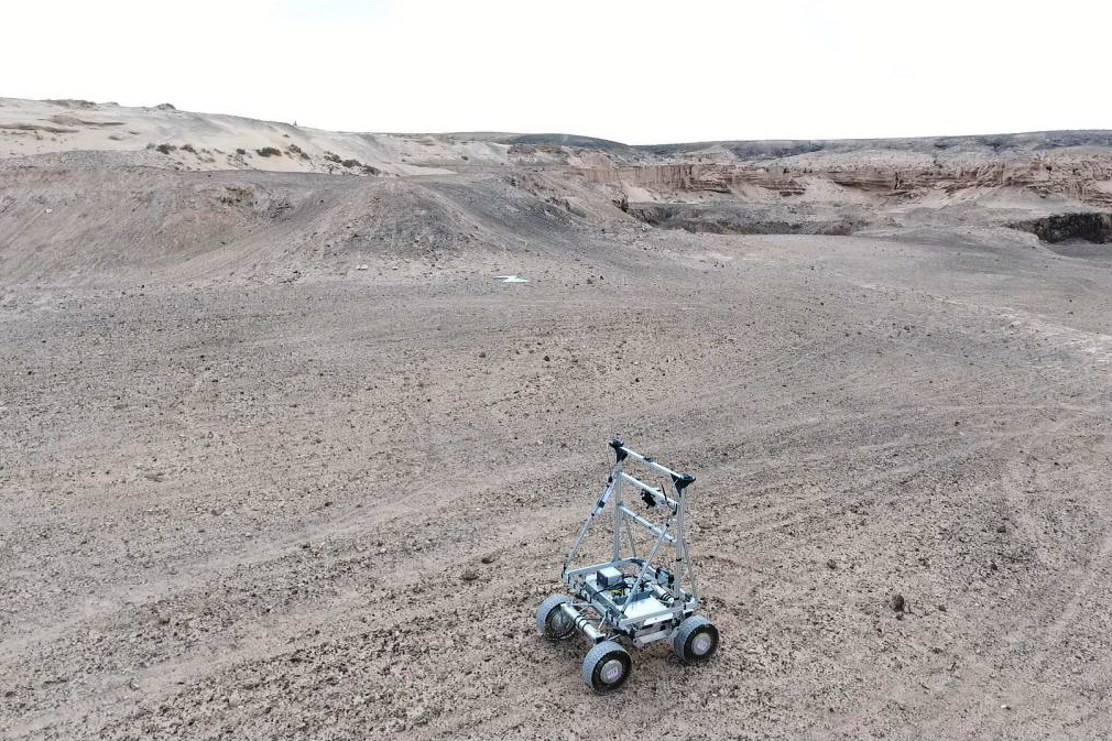
The European Space Agency (ESA) NAVISP-funded LUPIN project, ‘Enabling high performance PNT in the lunar environment’, has demonstrated hybrid navigation architecture intended to provide robust positioning for future lunar rovers.
Led by GMV UK, LUPIN addressed a fundamental limitation of conventional lunar navigation. Existing approaches have relied heavily on relative sensors such as inertial measurement units (IMUs) and visual odometry (VO), which provide continuous motion information but accumulate errors over time. Meanwhile, absolute fixes can depend on computationally intensive terrain matching or intermittent Earth-based tracking. Emerging lunar radio-navigation services such as the Moonlight lunar communication and navigation service (LCNS) offer the possibility of GNSS-like absolute positioning around the Moon.
LUPIN combined these capabilities in a tightly coupled multisensor architecture called ANIME. Its PNT engine uses an extended Kalman filter to fuse IMU measurements with RF-based absolute positioning, visual odometry, star-tracker attitude measurements and digital elevation model (DEM) aiding. The architecture can operate in an Earth configuration using real GNSS measurements or a Moon configuration using simulated LCNS/lunar GNSS data.
A giant leap in lunar navigation
To support realistic testing, the project developed LUSIM, a simulation environment that converts terrestrial rover trajectories into representative lunar scenarios. LUSIM generates synthetic LCNS/GNSS pseudorange, Doppler and carrier-to-noise measurements while modelling visibility, satellite geometry, signal errors and failures. This enabled the ANIME filter to be evaluated under lunar-specific RF conditions without requiring an actual lunar navigation infrastructure.
The system was tested on GMV’s RAPID rover platform. Following shakedown trials in Oxfordshire, final field testing took place in Fuerteventura, Canary Islands, including daytime and nighttime operations and different rover speeds.
The results, presented at a recent ESA-hosted event, indicate the potential of the hybrid approach. Across the test campaign, the best 95th-percentile, three-dimensional position error was below 6 meters in the Earth configuration and below 8 meters in the Moon configuration. Corresponding velocity errors were below 0.1 and 0.2 m/s, respectively, while attitude errors remained below 2 degrees.
Importantly, LUPIN found that RF geometry and signal availability remain the dominant determinants of performance. Relative sensors improved continuity and robustness but did not substantially improve absolute positioning. Three RF measurements together with DEM constraints were required for stable dynamic operation.
The results suggest LCNS could provide a direct link between a rover’s local map and a global lunar reference frame, enabling longer and faster traverses with reduced operational complexity. Future work will address multi-constellation availability, differential corrections to mitigate RF signal-in-space errors, tighter integration with rover guidance, navigation and control, and potential LunaNet-compatible receiver development.


![ICON testing at the Nottingham Geospatial Building; Image courtesy ESA[88]](https://insidegnss.com/wp-content/uploads/2024/07/ICON-testing-at-the-Nottingham-Geospatial-Building-Image-courtesy-ESA88-150x150.jpg "GMV Demonstrates Cloud Cooperative Navigation")