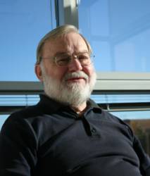
 Kai Borre
Download Easy Suite II (Adobe Acrobat PDF)
In 2009, Inside GNSS began a two-year occasional series by Danish geodesist Kai Borre called "GPS Easy Suite II: A Matlab Companion."
Download Easy Suite II (Adobe Acrobat PDF)
In 2009, Inside GNSS began a two-year occasional series by Danish geodesist Kai Borre called "GPS Easy Suite II: A Matlab Companion."
Many practitioners in the GNSS field are familiar with Matlab, a high-level technical computing language and interactive environment for algorithm development, data visualization, data analysis, and numeric computation. Borre used Matlab to illustrate and explain a variety of common GPS issues.
The Inside GNSS articles were follow-ups to a series of topics he covered in papers written in response to student questions in his classes at Aalborg University. "Students love this sort of support," Borre said, "But I also received positive reactions from professionals who used the code in research papers, which saved them a lot of coding efforts. "
Now Inside GNSS has packaged all six Easy Suite II articles in a downloadable PDF. It covers:
EASY11, stereographic sky plot of satellite orbits and plot of time when satellites are above a given local horizon
EASY12, details of the LAMBDA method, explained through a small numerical example
EASY13, receiver autonomous integrity monitoring (RAIM), horizontal protection level (HPL), and vertical protection level (VPL)
EASY14, sample of space-based augmentation system (SBAS) corrected positions and their presentation in Stanford plots
EASY15, accuracy comparison between pseudorange based stand-alone positions, baselines computed using pseudoranges alone, and pseudoranges and carrier phase observations
EASY16, error analysis of a selected one-way observation
EASY17, satellite orbits in inertial and Earth-centered, Earth-fixed (ECEF) systems, and curve defined by sub-satellite points
EASY18, computation of differential corrections at a base station.


