 City of the Future (Philip Hone Williams, eyewoo.com)
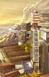
A 77-page report outlining UK’s Space Innovation and Growth Strategy 2010 to 2030 concludes with a vision of life 20 years from now, aided by advanced space technologies. This excerpt is reproduced verbatim from The Space IGS Main Report.
A 77-page report outlining UK’s Space Innovation and Growth Strategy 2010 to 2030 concludes with a vision of life 20 years from now, aided by advanced space technologies. This excerpt is reproduced verbatim from The Space IGS Main Report.
A Day Begins In 2030 . . .
Waking up to the radio is a thing of the past: The mobile phone has developed into a General Purpose Personalised Electronic Device. It has picked up all the news over the home UHF broadband network overnight from the Set Top Box (STB). It wakes you with an alarm at 7:05 and starts your favourite audio news and music programme from the beginning. It warns you that the heavy overnight rain has reduced your normal road to work to one lane due to flooding and that a departure slot has been booked 5 minutes earlier than usual with an alternative route.
Watching breakfast news: The STB is the hub of the home area network, using the frequencies released by the termination of the terrestrial TV and radio transmissions in 2018. The internet and TV have been integrated into an on-demand service and the STB receives its multimedia content by satellite. Whilst town dwellers have a fibre connected uplink you live in the leafy suburbs of Birmingham and use satellite for the uplink too, along with 8 million other households. The news announces that the overnight heavy rain has affected the entire Severn watershed but is predicted to be the first of this magnitude to be completely without damage to property.
Natural disasters are now mitigated by the availability of satellite imagery supplemented by a rainfall sensor network connected by low data rate satellite communications. The predictive model of water flow enables emergency organisations to concentrate on mitigation measures involving diverting water to huge emergency floodplains and reservoirs on agricultural land. Some road restrictions and closures are forecast but even here it is now possible to marshal relief efforts and resources more effectively. The satellite overlay ensures that during such emergencies, essential users are always connected by their usual handset even when the terrestrial infrastructure is down.
Checking the weather forecast: The meteorological satellite constellation provides continuous real-time weather data. These are fused with data collected by satellite from millions of terrestrial weather sensors. Together, they provide weather models of uncanny accuracy. Real-time personalised weather forecasts are sent to both the home and handset, allowing efficient management of the home through predictive heating and air conditioning, as well as accurate weather warnings direct to your handset using GNSS data.
Travelling to work: Your car has been charged overnight and has your new route logged through the home area network. By opting for the longer journey you have received 200 free car miles from your Traffic Service Provider. The last five minutes of your breakfast show has been downloaded so you do not miss the end of the video programme if you engage the autopilot. GNSS allows data to be gathered to generate real-time congestion statistics for road and rail. Satellite continues as the predominant means of digital radio transmission on the move and digital satellite radio sets are installed in all European cars. Road signs are being replaced by head up displays and verbal directions are provided if you choose to take over control of the vehicle. The Traffic Information System (TIS) enables accurate route finding and increased battery range. Trains are also controlled to reduce fuel consumption and increase safety despite decreased separations and increased speeds.
Always connected: The Satellite overlay provides a signal everywhere to every handset. There is no wilderness in Digital Britain and deaths on country roads have been reduced as responders are alerted of accidents and emergencies the moment they occur. Combined satellite services are socially connecting people through communications, location and timing. In the office, satellites provide high capacity, immersive environment communications allowing realistic virtual meetings and energy savings.
Using the Internet: Satellite provides an affordable and energy efficient high speed Next Generation Access service to businesses and households even in the most remote parts of the country. The rural economy has blossomed under its influence and more and more businesses are choosing to relocate to rural areas to retain staff by providing a better work/life balance. Mobile broadband is now a reality to hand held terminals that seamlessly switch between terrestrial and satellite networks for uninterrupted service.
Returning to a smart home: Smart domestic energy networks use satellite links to manage energy use and billing throughout the country. The national grid is managed to reduce peaks and troughs, improving efficiency, whilst GNSS timing is used to synchronise local power generation from solar and wind to the national grid. Whilst you were out your home environment was monitored and you are told on your return that no alerts were necessary.
Evening meal: Earth observation satellites provide the weather forecasting and environmental monitoring essential in agriculture. Even the most remote rural communities can be connected by satellite, allowing safe and efficient farming and food production. Precision agriculture enables satellite control of farm machinery and GPS-enabled harvesting for yield measurement. In getting the food to consumers, satellite GPS tracks the logistics chain to keep the supermarket shelves stocked.
Evening TV Entertainment: Satellites now broadcast Super High Vision TV to 100 inch screens. Pictures are stunning even for moving images as the programmes are played at 400 frames per second. Smart satellite STBs store all your favourite programs and anticipate the programmes you want to watch, offering them on demand through your own personalised interactive TV guide. Advances in satellite technology offer greater programme-carrying capacity for unprecedented picture quality and viewer choice.

 Asia Pacific Economic Cooperation GNSS Innovation Summit and GNSS Implementation Team (GIT) meeting")

