Global Navigation Satellite Systems Engineering, Policy, and Design
Global Navigation Satellite Systems Engineering, Policy, and Design
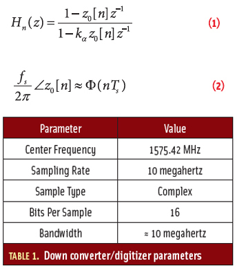 Article Equations
Working Papers explore the technical and scientific themes that underpin GNSS programs and applications. This regular column is coordinated by Prof. Dr.-Ing. Günter Hein, head of Europe’s Galileo Operations and Evolution.
By Inside GNSS
In this article, we will take a look at the various GNSS signals from the perspective of their cost-benefit tradeoffs. First, we’ll look at the evolution of consumer GPS architecture to date — where acquisition speed and sensitivity have been the main drivers of receiver architecture. That architecture has evolved rapidly to take full advantage of the characteristics of the GPS C/A code.
By Inside GNSS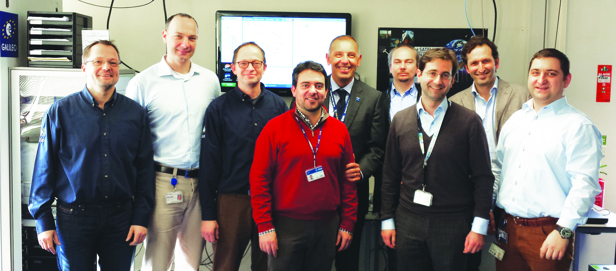 ESA Galileo IOV Test campaign authors, from left: Jörg Hahn, Stefano Binda, Edward Breeuwer, Roberto Prieto-Cerdeira, Marco Falcone, Alexander Mudrak, Gustavo Lopez- Risueño, Francisco Javier Gonzalez Martinez, and Daniel Blonski.
The objective of the IOV phase was to launch the first four operational Galileo satellites and to deploy the first version of a completely new ground segment. During this phase, the European Space Agency (ESA) needed to validate — in the operational environment — all space, ground, and user components and their interfaces, prior to full system deployment. With the assistance of industry partners, ESA had to analyze the performance of the Galileo system and its components with the objective to refine the full operational capability (FOC) system.
By Inside GNSS
Unmanned aerial vehicles or UAVs comprise a category of aircraft that fly without a human operator onboard. They are more popularly referred to by the misleading moniker “drones,” which masks the wide variety in their design and capability.
By Inside GNSS
 Amazon’s PrimeAir test UAV. Amazon photo
An enterprising Michigan florist beat Amazon to the skies with a delivery of flowers via an unmanned aerial vehicle (UAV).
But then the Federal Aviation Administration (FAA) shut them down before the industry’s second-biggest season of the year — Valentine’s Day.
Ahhhh, shucks!
By Inside GNSS
The prospects for LightSquared dimmed this month with both the Federal Communications Commission (FCC) and Congress making decisions likely to hamper the firm’s plans to exit bankruptcy.
By Inside GNSS
 One of 12 magnetograms recorded at Greenwich Observatory during the Great Geomagnetic Storm of 1859
 1996 soccer game in the Midwest, (Rick Dikeman image)
 Nouméa ground station after the flood
 A pencil and a coffee cup show the size of NASA’s teeny tiny PhoneSat
 Bonus Hotspot: Naro Tartaruga AUV
 Pacific lamprey spawning (photo by Jeremy Monroe, Fresh Waters Illustrated)
 “Return of the Bucentaurn to the Molo on Ascension Day”, by (Giovanni Antonio Canal) Canaletto
 The U.S. Naval Observatory Alternate Master Clock at 2nd Space Operations Squadron, Schriever AFB in Colorado. This photo was taken in January, 2006 during the addition of a leap second. The USNO master clocks control GPS timing. They are accurate to within one second every 20 million years (Satellites are so picky! Humans, on the other hand, just want to know if we’re too late for lunch) USAF photo by A1C Jason Ridder.
  Detail of Compass/ BeiDou2 system diagram
 Hotspot 6: Beluga A300 600ST

1. E-CROWDSHIPPING
Palo Alto, California USA

How many times, as some once-promising politician stumbles up against his pull date, have we heard that irreverent anthem of The Who invoked?
Thousands? Millions?
Yes, back in the wreckage of the second George Bush’s second term, Barack Obama looked pretty good by comparison. Even then, though, raising the banner of “Hope” before the eyes of a desperate nation was a risky thing to do.
By Inside GNSS Tim Springer, PosiTim UG
A common refrain in the world of GNSS is the desire for “interoperability,” the use of signals from multiple systems without a decline — and potentially even an improvement — in the quality of results.
Achieving this depends on large part in establishing comparable parameters — particularly the geodetic references and timing systems — among the GNSSs along with a dense network of ground reference stations that can provide continuous, precise monitoring of satellites’ orbital positions.
By Inside GNSS