What are the actual performances of GNSS positioning using smartphone technology?
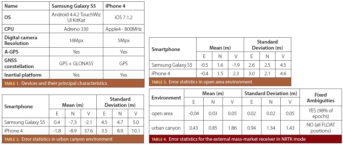
 Tables 1, 2, 3 & 4
Q: What are the actual performances of GNSS positioning using smartphone technology?
A: “Where I am?” is the typical question asked by a person when visiting a new city or unknown place. Knowing one’s own location is generally a basic necessity for people, both in indoors and outdoors.
By Inside GNSS