October 9, 2025
Poland Pushing Back: Initiatives Tackling GNSS Jamming and Spoofing
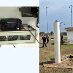
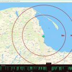
Poland has emerged as one of the most active European states confronting real-world GNSS (Global Navigation Satellite System) interference.
By Peter Gutierrez