legacy-application Archives - Page 6 of 14 - Inside GNSS - Global Navigation Satellite Systems Engineering, Policy, and Design

legacy-application

September 21, 2012

NextGen Equipage Fund Takes Off While FAA Works to Cut Program Delays, Cost Overruns

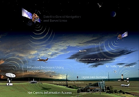
Future of air traffic control (FAA image)

A public-private partnership created to reduce the financial burden involved in implementing the nation’s GPS-based, next-generation (NextGen) air transportation system has raised its first rounds of financing and is now negotiating contracts with its charter customers.

“We have  . . . closed our first tranche of equity,” said Jim Hughey, senior vice-president of the NextGen Equipage Fund. The fund has secured a total of $100 million in commitments with some $40 million of that coming from leading aerospace companies.

Read More >

By Dee Ann Divis
September 12, 2012

2012 Trimble International User Conference

Trimble Dimensions, the 2012 International User Conference, will take place at the Mirage Hotel in Las Vegas, Nevada from November 5 to 7.

Early-bird pricing has been extended to September 14.

The annual event targets surveying, engineering, construction, mapping, GIS, geospatial, infrastructure, utilities and field service management professionals who use positioning products developed and sold by Trimble companies. The companies include: Accubid, Applanix, Meridian Systems, OmniStar, Pacific Crest, PeopleNet, Plancal, QuickPen and Tekla.

Read More >

By Inside GNSS
[uam_ad id="183541"]
July 5, 2012

Drones to the Rescue!

August 1994, early morning. Spain’s Central Pyrenees Mountains still in darkness.

At the outset of an ascent to a 3,000-meter peak along the international border, one of the co-authors encounters a group of tourist hikers who have begun searching for a colleague who had left the camp the previous evening. In the pre-sunrise gloom, helicopters cannot yet operate.

A week later, the body of the hiker is found. The rescue efforts came, unfortunately, too late.

Read More >

By Inside GNSS
May 31, 2012

GSA Issues Second GNSS Market Report: 1.1 Billion Units by 2020

The European GNSS Agency (GSA) has published its second GNSS market report, including a special focus on maritime and surveying application markets and refining its projections of unit and sales revenue volumes through 2020.

According to the new GSA report, the worldwide GNSS market is growing rapidly with total market size expected to increase at an average of 13 percent per year until 2016. At that point, increasing market saturation, price erosion, and platform convergence will reduce the growth rate.

Read More >

By Inside GNSS
[uam_ad id="183541"]
May 30, 2012

NovAtel, Interstate Electronics Team on SAASM RTK Receiver Board

NovAtel Inc. today (May 30, 2012) announced the development of their OEM625S Selective Availability/Anti-Spoofing Module (SAASM) GNSS receiver, the first product emerging from a collaborative effort with L-3 Interstate Electronics Corporation (IEC).

The OEM625S, which becomes available for purchase in the third quarter of this year, will combine a commercial dual-frequency NovAtel GNSS receiver with an L-3 IEC XFACTOR SAASM in a single card solution, reducing overall size and power requirements for end customer applications.

Read More >

By Inside GNSS
May 23, 2012

SpaceX ISS Mission Relies on GPS Technology

SpaceX Falcon 9/Dragon launch on May 22, 2012. NASA/Alan Ault

The unmanned SpaceX Dragon spacecraft currently attempting to visit to the International Space Station (ISS) is using on board GPS receivers to perform a series of maneuvers as part of NASA’s first collaboration with the commercial space operator.

On Tuesday (May 22, 2012) in its first day of flight after launching from Cape Canaveral on board SpaceX’s Falcon 9 rocket, Dragon successfully completed a test of its absolute GPS system, using GPS to determine its location and communicating this data via NASA tracking satellites.

Read More >

By Inside GNSS
April 26, 2012

NASA Backs Test of Real-time GPS Earthquake Mitigation Network

Location of real-time GPS monitoring stations in the western United States that make up part of the Real-Time Earthquake Analysis for Disaster Mitigation Network. The networks stations are overlain on a U.S. Geological Survey seismic hazard map showing areas forecast to have a 10-percent probability of exceeding a certain level of ground shaking within the next 50 years. (Areas in shades of red have the strongest shaking, while areas in green shades have the weakest shaking.) Image credit: USGS/UC Berkeley/Scripps Institution of Oceanography

Evolution of real-time GNSS reference networks and data processing has evolved to the point that NASA-backed researchers believe they can soon implement large-scale demonstration tests to provide earthquake and tsunami alerts to the general public and emergency responders.

Read More >

By Inside GNSS

Trimble to Acquire SketchUp — Google 3D Modeling Tool

Example of site logistic design by M.A. Mortenson Company using Google’s SketchUp 3D modeling tool

Trimble announced plans today (April 26, 2012) to acquire SketchUp, a popular 3D modeling tools, from its Silicon Valley neighbor, Google, Inc.

Sunnyvale, California–based Trimble signed a definitive agreement with Google, headquartered in Mountain View, with the transaction expected to close in the second quarter of 2012. Although the companies did not disclose financial terms of the deal, a Trimble news release said the transaction “is not expected to be material to 2012 earnings per share.”

Read More >

By Inside GNSS
1 4 5 6 7 8 14
IGM_e-news_subscribe