
September 29, 2014
Figure 14: Developing an Ionospheric Scintillation Monitoring Receiver
Return to main article: “Developing an Ionospheric Scintillation Monitoring Receiver”
By Inside GNSSGlobal Navigation Satellite Systems Engineering, Policy, and Design
Return to main article: “Developing an Ionospheric Scintillation Monitoring Receiver”
By Inside GNSS
My favorite bumper sticker this month: “Oh, no! Not another learning experience!”
After 20 years of putting together a European GNSS program, disappointment over the skewed launch of the first fully operational Galileo satellites is palpable and widely felt. For end users, it is uniformly bad news, and no system provider that sincerely wants to achieve interoperability and robustness in a system of GNSS systems can relish the European program’s current difficulties.
By Inside GNSS
Editor’s Note: An exclusive interview with Gen. Hyten is available here with more details.
Details are emerging about another restructuring of the contract for the new GPS ground system, a deal that pushes completion of the project back another two years and recasts the remaining work to fit within the Air Force’s strained financial profile.
By Dee Ann Divis Gerald Mader, National Geodetic Survey
In August, a group of scientists at the Scripps Institution of Oceanography reported that the severe drought gripping the western United States in recent years is causing a “uplift” in the western United States.
About the same time, governmental agencies were reporting widespread cases of land subsidence in California’s central San Joaquin Valley caused by overpumping of water from wells there.
By Inside GNSS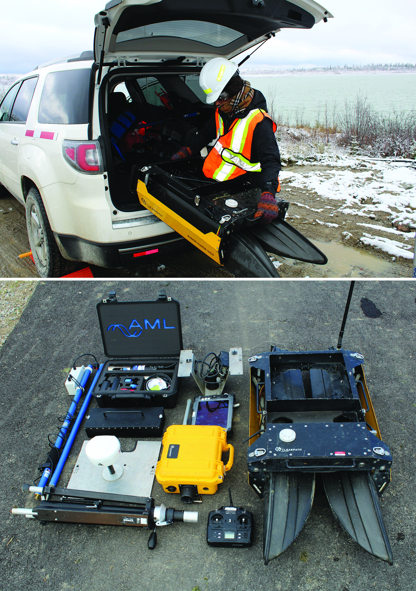 Eugenia Acosta, an intern with Clearpath Robotics, unloads a Kingfisher unmanned vessel in preparation for a mission (top photo), the Kingfisher components and controller (bottom photo).
“Our products are robotic research platforms,” says Clearpath’s Meghan Hennessey. “These can be configured and programmed so that our customers can explore their particular areas of interest without all the cost and troubleshooting involved in actually building robots themselves.”
Hennessey says Clearpath platforms — which include the all-terrain Husky, the larger, tractor-like Grizzly and the waterborne Kingfisher — can be thought of as project kits.
By Inside GNSS
Q: How do you trust centimeter level accuracy positioning?
By Inside GNSS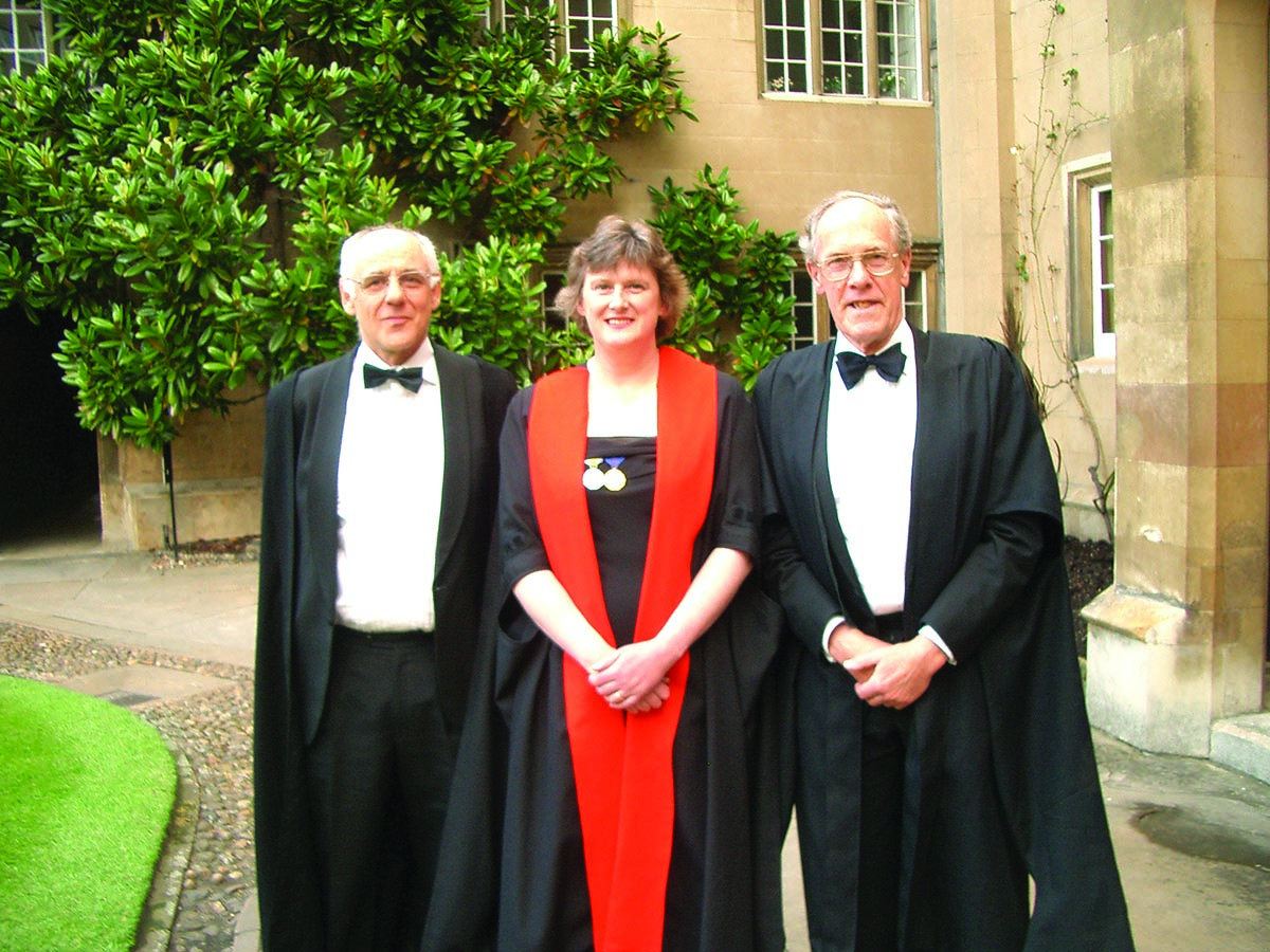 In 2005, Alison Brown was the first Sidney Sussex College woman alumna to be named as an honorary Fellow in recognition of her distinguished technical contributions. Pictured here with Keith Glover, now head of engineering at Cambridge University, who taught Brown control systems engineering, and Donald Green, her director of studies while she was an undergraduate.
SIDEBAR: Alison Brown’s Compass Points
On display in the Smithsonian’s “Time and Navigation” exhibit in Washington D.C. is the world’s first GPS-enabled cell phone. It was developed in 1995 by NAVSYS Corporation, a Colorado GNSS and inertial R& D company, as part of the push to build a national emergency notification system for mobile users, E911.
By Inside GNSS