May 18, 2014
 Michel Monnerat’s Favorite Equation
Michel Monnerat’s Compass Points
Michel Monnerat’s Favorite EquationMentors
By Inside GNSSGlobal Navigation Satellite Systems Engineering, Policy, and Design
Michel Monnerat’s Favorite EquationMentors
By Inside GNSS
Well, I could have taken up the subject of the deteriorating condition of U.S./Soviet, excuse me, U.S./Russian relations. But there are only so many windmills that I have time to tilt at.
So, rather than tracing the dissolution of bilateral GNSS cooperation in the wake of Russia’s reclaiming the Crimea and, who knows, perhaps eventually a large swath of eastern Ukraine, I thought I’d turn to an only slightly more remediable issue — GNSS carriage requirements.
By Inside GNSS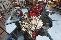
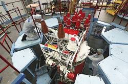 Working on a GLONASS-M satellite at Reshetnev ISS
The Russian GLONASS system, which had appeared to be recovering from a series of organizational and technical problems in recent years, suffered two major disruptions during April.
By Inside GNSS
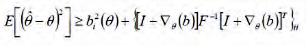
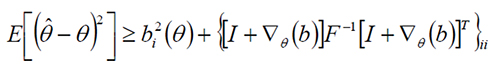
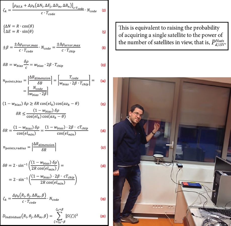 Clockwise from left: (a) article equations, (b) the probablility of acquiring a single satellite to the power of the nyumber of satellites in view, (c) Indoor scenario of signal collection at ISAE navigation lab, Toulouse
Working Papers explore the technical and scientific themes that underpin GNSS programs and applications. This regular column is coordinated by Prof. Dr.-Ing. Günter Hein, head of Europe’s Galileo Operations and Evolution.
By Inside GNSS

Q: How do you compute a relative position using GNSS?
A: In many applications the absolute position of an object is less important than the relative position to other objects in the vicinity. An obvious example is a collision avoidance system, wherein the proximity of nearly vehicles is much more important than whether the vehicles are located on street “X” or “Y.”
By Inside GNSS
SIDEBAR: Michel Monnerat’s Compass Points
“I was born in Arles, in the south of France,” says Michel Monnerat, “but I left France before my first birthday. We moved many times, from place to place.”
Monnerat’s father worked for a civil engineering company, specializing in maritime works — harbor construction, coastal protection, and such. His family lived in Ivory Coast, Cameroon, and Tunisia, but Monnerat spent most of my early life in Lomé, the capital city of Togo.
By Inside GNSS
Europe has been talking up its European Geostationary Navigation Overlay Service (EGNOS, for short) — and why shouldn’t it? Talking about Galileo doesn’t get satellites off the ground. EGNOS, on the other hand, is up and running, and has been since 2009. If the object is to build confidence in European savoir faire, why not talk about a real success like EGNOS?
By Peter Gutierrez
A shift in the Air Force’s acquisition plan should shave a year off the time needed to finish development of new M-code–equipped receivers and potentially inspire more commercially flavored innovation — and perhaps even the entry of new vendors.
The new approach enables the Pentagon to fulfill a congressional mandate to buy only M-code receivers after fiscal year 2017 and could help convince the user community, jaded by previous delays, to speed adoption of the more resilient devices.
By Dee Ann Divis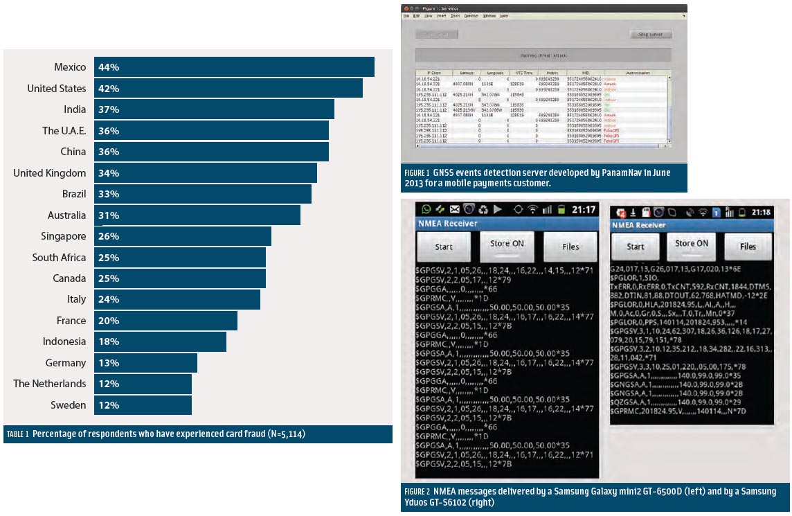 Table 1, Figures 2 & 3
Smartphone apps represent the most prominent market for GNSS. No other device or community of users has achieved a larger growth and market penetration in the period 2008–2013.
Apple introduced the first GPS capability on a smartphone in June 2008 with the iPhone3, and one year later Samsung introduced its Samsung Galaxy, incorporating the first GPS receiver for this brand.
By Inside GNSS
Don’t be misled by the title. This is not another round of speculation about who should be proclaimed the rightful “Father of GPS.”
By Inside GNSS
With the optimism of college-bound seniors touring the Ivy League, GPS managers have been weighing options to dramatically change the GPS constellation. Now, after studying the costs, considering the benefits, and assessing the funding climate, officials have made the starkly fiscal decision to stick close to home and take a few extra years to finish.
By Dee Ann Divis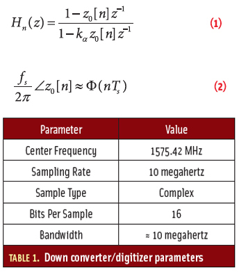 Article Equations
Working Papers explore the technical and scientific themes that underpin GNSS programs and applications. This regular column is coordinated by Prof. Dr.-Ing. Günter Hein, head of Europe’s Galileo Operations and Evolution.
By Inside GNSS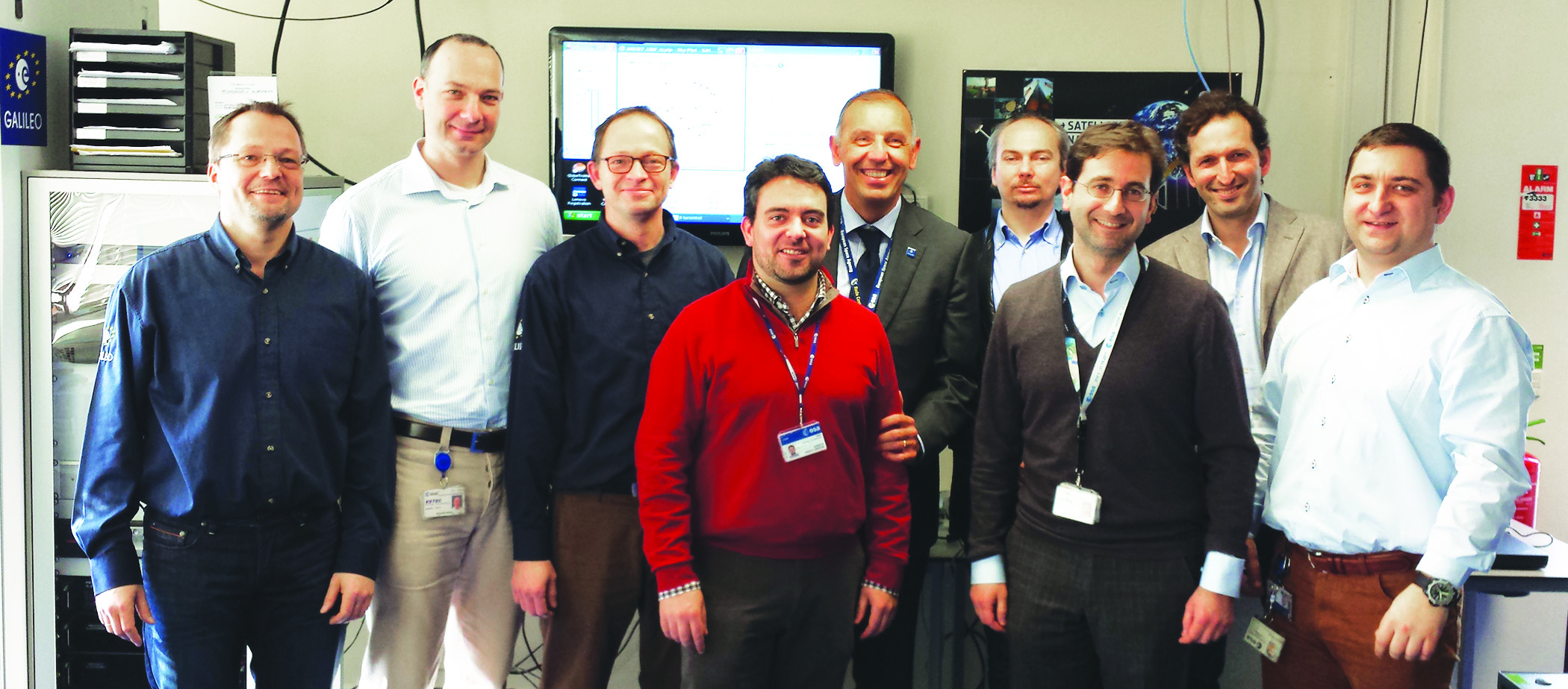 ESA Galileo IOV Test campaign authors, from left: Jörg Hahn, Stefano Binda, Edward Breeuwer, Roberto Prieto-Cerdeira, Marco Falcone, Alexander Mudrak, Gustavo Lopez- Risueño, Francisco Javier Gonzalez Martinez, and Daniel Blonski.
The objective of the IOV phase was to launch the first four operational Galileo satellites and to deploy the first version of a completely new ground segment. During this phase, the European Space Agency (ESA) needed to validate — in the operational environment — all space, ground, and user components and their interfaces, prior to full system deployment. With the assistance of industry partners, ESA had to analyze the performance of the Galileo system and its components with the objective to refine the full operational capability (FOC) system.
By Inside GNSS