May 8, 2018
San Jose, California-based DT Research, a leading designer and manufacturer of purpose-built computing solutions for vertical markets, recently announced the DT301T Rugged RTK Tablet (DT301T-RTK), a lightweight military-grade tablet that is purpose-built for GIS mapping applications with real-time kinematic (RTK) satellite navigation used to enhance the precision of position data derived from satellite-based positioning systems. This tablet enables 3D Point Cloud creation with centimeter-level accuracy — meeting the high standards required for scientific-grade evidence in court.
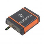
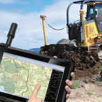
The DT301T-RTK is military-grade with an IP65 rating, yet lightweight — offering the versatility to be used in the field, office and vehicles. A dual frequency GNSS module is built into the tablet, which uses real-time reference points within 1- to 2-centimeter accuracy to position 3D point clouds created from aerial photogrammetry, using GPS, GLONASS and Galileo receivers. Users can measure with the RTK GNSS positioning directly using a foldable antenna or connect to an external antenna for more robust receiving and survey grade precision.
“We’ve seen a dramatic uptick in the need for rugged tablets to be purpose-built for a range of mapping uses across industries,” said Daw Tsai Sc.D., president of DT Research. “In designing the DT301T with RTK satellite navigation, we also took into consideration the other features and capabilities necessary within a rugged tablet to quickly and easily conduct forensic mapping, land surveying, e-construction, Building Information Modeling and other mapping scenarios.”
The DT301T-RTK tablet is compatible with existing GIS software for mapping applications and brings together the advanced workflow for GIS data capture, accurate positioning and data transmitting. The tablet can be used in a variety of scenarios, including:
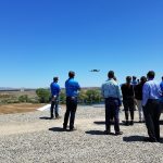
Forensic Mapping — Public safety teams, investigators and crash reconstructionists can use the DT301T-RTK Tablet to accurately collect measurements that are scientifically defensible by using the real-time centimeter reference points to position 3D point clouds created from aerial photogrammetry or take stand-alone measurements, according to the company.
“When reconstructing a crime scene, crash scene or natural disaster — forensic mapping needs to have scientific-grade precision in order to stand up as evidence in court,” said Andrew S. Klane, a former Massachusetts State Police Lieutenant who teaches Forensic Mapping and is now the Chief Operating Officer at Forensic Mapping Solutions Inc. “As more drones are being used for mapping, there is a growing need for ground control positioning devices. By using a DT301T-RTK Tablet in combination with a drone, users can more quickly and cost-effectively create a 3D model to deliver an accurate representation of the scene with scientific-grade tolerance that will hold up in a court of law.”
The DT301T-RTK Tablet has been purpose-built for precision mapping in a variety of environments and includes the following features and capabilities:
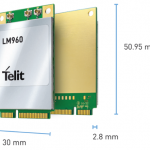
- Dual Frequency GNSS Module — GNSS L1 & L2 RTK that receives GPS, GLONASS and Galileo signals up to 372 channels with RMS 10 mm + 1ppm accuracy.
- High Performance CPU and Windows OS — Intel® 6th Generation Core i5 or i7 processor with Microsoft Windows 7 Professional or Windows® 10 IoT Enterprise. Units come with either 8 GB or 16 GB of RAM.
- Military Standards — For use in harsh environments, the tablet is fully ruggedized to meet the highest durability standards with an IP65 rating, MIL-STD-810G for vibration and shock resistance and MIL-STD-461F for EMI and EMC tolerance.
- Accessories — The DT301T Rugged RTK Tablet is complemented by a variety of accessories, including: external antennas, pole mount cradles, detachable keyboards, battery charging kits, and digital pens.
By Inside GNSS


