August 23, 2018
Septentrio Launches the AsteRx-i S GNSS/INS Solution
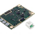
GNSS receiver manufacturer Septentrio announces today the addition of the AsteRx-i S to its GNSS/INS product portfolio.
By Inside GNSSGlobal Navigation Satellite Systems Engineering, Policy, and Design
GNSS receiver manufacturer Septentrio announces today the addition of the AsteRx-i S to its GNSS/INS product portfolio.
By Inside GNSS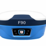
Featuring multi constellation with L-Band and satellite-based augmentation system (SBAS), theF90 GNSS/RTK receiver from Geneq Inc., tracks GPS, GLONASS, Galileo and BeiDou and can maximize the tracking to observe all visible GNSS satellite signals, thereby providing maximum performance for accuracy and real-time measurements. F90 also supports L-Band function and can get centimeter accuracy with just one receiver, according to the company.
By Inside GNSS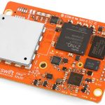
Swift Navigation, a San Francisco-based tech firm building centimeter-accurate GNSS technology and a Cloud-based Corrections Service designed to power a world of autonomous vehicles, today announced the latest firmware upgrade to its flagship product—the PiksiMulti GNSS Receiver.
By Inside GNSS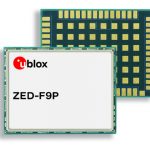
u-blox recently announced the ZED-F9P multi-band GNSS module with integrated multi-band real-time kinematics (RTK) technology for machine control, ground robotic vehicles, and high precision unmanned aerial vehicles (UAV) applications. The ZED‑F9P measures just 22 x 17 x 2.4 millimeters and uses technology from the recently announced u‑blox F9 platform to deliver robust high-precision positioning performance in seconds, according to the company.
By Inside GNSS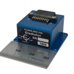
Gladiator Technologies has introduced a three-axis, inertial rate system, the G300D gyro. With small size, low power and high speed, the G300D gyro is particularly well-suited for image stabilization applications.
By Inside GNSS
NovAtel Inc. today launched its new TerraStar-C PRO correction service with multi-constellation support, including the GPS, GLONASS, Galileo and BeiDou constellations. Combined with NovAtel’s OEM7 positioning technology, TerraStar-C PRO cuts initial convergence times by nearly 60 percent and offers 40 percent better horizontal accuracy than the current TerraStar-C service.
By Inside GNSS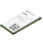
Quectel Wireless Solutions, a global supplier of Internet of Things (IoT) modules, announced on Monday the release of MC90, a quad-band GSM/GPRS/GNSS/Wi-Fi module. The new module supports hybrid positioning technologies including GNSS, Cell ID and Wi-Fi aided positioning, and enables position tracking in both indoor and outdoor environments.
By Inside GNSS
GNSS receiver manufacturer Septentrio recently launched the next generation AsteRx-i which combines the company’s latest compact, multi-frequency multi-constellation GNSS engine with an external industrial grade MEMS based IMU. It can deliver accurate and reliable GNSS/IMU integrated positioning to the cm-level as well as full 3D attitude at high update rates and low latency, according to Septentrio.
By Inside GNSS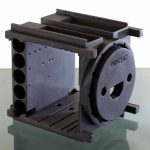
For the fourth year in a row CRP USA is attending the Small Satellite Conference and Exhibit at Utah State University, Logan, Utah, from August 4-9. The event is held at the Taggart Student Center, and CRP USA is displaying cutting edge solutions for the space industry manufactured in the Windform family of high performance materials.
By Inside GNSS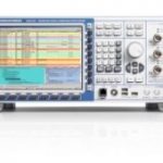
Test and measurement equipment supplier Rohde & Schwarz has further expanded the capabilities of its R&S CMW500 wideband radio communication tester and R&S SMBV100A GNSS simulator to support Global Certification Forum (GCF) protocol conformance tests for C-V2X (cellular vehicle-to-everything) device certification.
Using the Qualcomm(R) 9150 C-V2X chipset solution from Qualcomm Technologies, the R&S CMW500 acting as LTE network simulator now allows automakers to test C-V2X direct communications (PC5) according to GCF Work Item 281.
3GPP Release 14 specifies the direct communications specifications for C-V2X PC5, which enables vehicle-to-vehicle (V2V), vehicle-to-pedestrian (V2P) and vehicle-to-infrastructure (V2I) safety applications, and does so without a mobile cellular subscription or network assistance and operates in ITS bands 46D (5.8 GHz) and 47 (5.9 GHz).
The new R&S CMW-KK550 test package includes the 3GPP protocol conformance tests from LTE-V2V GCF Work Item 281 and LTE-V2X GCF Work Item 282. As recently announced, the R&S CMW-KU514 C-V2X software package on the R&S CMW500 is used to verify data transmission and reception over the PC5 interface in ideal, faded and congested channel conditions. Together, both packages enable Rohde & Schwarz to support C-V2X device testing through all protocol layers.
C-V2X device testing is a significant step towards achieving the goal of having fully connected and autonomous vehicles to improve public safety and increase traffic efficiency. C-V2X, including direct communications for safety applications, complements network-based communications that deliver telematics services and various use cases for connected infotainment and over-the-air software updates.
“C-V2X PC5 radio technology has quickly advanced to a pre-commercial stage, and Rohde & Schwarz is pleased to be the first test equipment vendor to offer a comprehensive C-V2X test suite. The automobile industry can now verify functionality and performance of C-V2X devices, as well as start device testing as per 3GPP protocol conformance tests,” said Anton Messmer, vice-president, mobile radio testers at Rohde & Schwarz. “This expanded capability complements our support for European eCall and shows our long-standing support for automotive applications.”
By Inside GNSS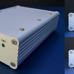
Lighthouse Technology and Consulting Co., completed the development of a series of front-end processors, “Hibiki”, for software receivers, processing up to four frequency GNSS signals simultaneously. Japanese Quasi-Zenith Satellite System (QZSS) broadcast GNSS signals in 4 frequency bands — L1, L2, L5 and L6.
Similarly, GPS and Russian GLONASS broadcast in three bands, Europe’s Galileo and China’s BeiDou broadcast in four bands. However, many conventional front-ends process only two bands at the same time, and could not be used for highly specialized applications such as processing multiple signals with different frequencies at the same time.
By Inside GNSS
GMV, Tecnobit and Skydel announced last week that they are working to adapt Skydel’s Global Navigation Satellite System (GNSS) simulation solution to support the latest developments of the Galileo GNSS, synchronizing with the European efforts to bring a modern, highly-accurate and secure positioning system to the market. GMV, Tecnobit, and Skydel aim to provide corporations, universities, and research labs with a reliable, advanced simulation system that closely follows the latest Galileo capabilities.
By Inside GNSS
Global Invacom, a global provider of satellite communications equipment, is pleased to announce the launch of an innovative solution enabling aircraft ground engineers to undertake 24/7 avionics testing of Inmarsat, Iridium and GPS satellite signals indoors.
By Inside GNSS