B: Applications

November 5, 2010

LMCO Ships GPS III Simulator to Aerospace Corporation, Maintains Program Schedule Lead

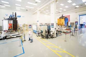
The Aerospace Corporation has completed acceptance testing on the GPS III Bus Real Time Simulator (BRTS) from the Lockheed Martin–led team developing the next-generation satellite program, keeping the initiative ahead of schedule.

The BRTS is a specialized piece of test equipment designed to reduce risk and ensure overall mission success for the lifecycle of the GPS III program. The simulator will enable Aerospace Corporation to independently validate GPS III bus flight software for the U.S. Air Force.

Read More >

By Inside GNSS
October 30, 2010

Asia Multi-GNSS Demonstration Project Schedules Second Workshop in November

Organizers of an ambitious project in the Asia/Oceania region demonstrating the benefits and opportunities for using multiple GNSS systems are moving ahead in their effort to design and implement a five-year campaign.

The 2nd Asia Oceania Regional Workshop on GNSS will be held in Melbourne, Australia, on November  21–22, in the two days before the Asia-Pacific Regional Space Agency Form (APRSAF) annual meeting in the city.

Read More >

By Inside GNSS
October 25, 2010

Military PNT — The Way Ahead

With thanks to Yogi Berra, it’s “déjà vu all over again” for the Global Positioning System, but this time with a twist.

Twenty-five years ago, the question asked by U.S. military commanders and combat personnel in the field was, “Why should I go to the trouble to use this space-based system called GPS?” Today, the question being asked is, “GPS is vital to the success of my mission; so, why are you asking me to consider using something else?”

Read More >

By Inside GNSS
[uam_ad id="183541"]
October 18, 2010

Topcon Adds Mapping System

Topcon Positioning Systems (TPS), Livermore, California, has announced the addition of the IP-S2 HD Mapping System to its line of mobile mapping solutions.

The IP-S2 HD is a vehicle-mounted surveying and mapping system featuring a high-definition LiDAR scanner from Velodyne Lidar, Inc. The system incorporates high-precision GNSS receivers, an inertial measurement unit, vehicle wheel encoder, 360-degree digital cameras and Velodyne’s HDL-64E S2.2 LiDAR scanner.

Read More >

By Inside GNSS
[uam_ad id="183541"]
October 1, 2010

Launch Fever

It is not all about the satellites, of course.

And, despite the thrill of launches — the Fourth of July and every other national holiday celebration all grown up — it’s not about the rockets.

When evaluating the progress of GNSS programs, however, satellites and launches are a way to keep count — in fact, it is the way most of us do keep count.

By that measure, then, the numbers are adding up quickly.

Read More >

By Inside GNSS
September 16, 2010

ION 2011 International Technical Meeting

The Institute of Navigation International Technical Meeting (ITM) will take place January 24-26 at the Catamaran Hotel on Mission Bay in San Diego California.

Paul Kline of Honeywell Aerospace is the general chair. Jade Morton of Miami University, Ohio, is the program chair.

"Robotics Navigation" is the plenary session topic. Invited speakers will discuss current trends and future technologies that support navigation for surveillance, search and rescue, undergound and underwater robotics and unmanned air vehicles.

Read More >

By Inside GNSS
IGM_e-news_subscribe