
B: Applications

Polynesian Exploration Launches Integrated Navigation System

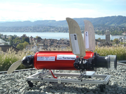
The POLYNAV 2000 is one of the company’s integrated navigation systems. Photo: Polynesian Exploration Inc.

Polynesian Exploration Inc., a San Jose, California navigation startup, has launched its high-accuracy navigation solution for demanding applications such as autonomous driving and UAVs.

The POLYNAV 2000 is designed to deliver high accuracy position, velocity and attitude whether the platform is static or moving. The solution features multiple satellite constellations (GPS/GLONASS/BeiDou/Galileo), multiple frequencies real time kinematic (RTK) L1 & L2, multi-antenna signal processing, tactical grade sensors, and high dynamic tolerance.

Read More >

By Inside GNSS
[uam_ad id="183541"]
[uam_ad id="183541"]

Answering the Call for a GNSS Back-up

A government report commissioned by Innovate UK, along with the UK Space Agency and the Royal Institute of Navigation, entitled “Economic impact to the UK of a disruption to GNSS”, comes in the wake of troubling incidents for GNSS operators, both the United States and Europe.

Last year a problem with the GPS satellite timing signal triggered alarms and caused an unknown number of outages, and in Europe earlier this year the fledgling Galileo signal crashed due to unspecified ground facility issues.

Read More >

By Peter Gutierrez
July 24, 2017

Reports of Mass GPS Spoofing Attack in the Black Sea Strengthen Calls for PNT Backup

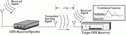
After reports of an apparent mass and blatant GPS spoofing attack involving more than 20 vessels in the Black Sea last month, navigation experts and maritime executives are scratching their heads and the president of the Resilient Navigation and Timing (RNT) Foundation is hoping this latest incident will help spur more action toward building an eLoran complement and backup for GPS.

Read More >

By Inside GNSS
July 21, 2017

Orolia’s McMurdo Wins U.S. Search and Rescue Technology Awards

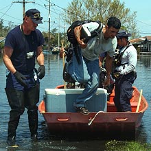
Government Security News has named McMurdo, an Orolia brand, the winner of two national search and rescue technology awards in its annual Airport, Seaport, Border Security Awards Program. McMurdo won Best Search and Rescue and Best Man Overboard Tracking in the Maritime/Port Security/Underwater Vehicles and Communication Systems categories, respectively.

Read More >

By Inside GNSS

Data Collecting Program for Mobile GNSS Field Data Set taking Place in Japan

Mobile GNSS Field Data Set being tested in the winter. Photo: Lighthouse Technology and Consulting

Lighthouse Technology and Consulting Co., Ltd is proceeding with a program to collect precise GNSS data on major highways in Japan. The data is an inevitable “must use” tool for high precision positioning systems used in automated driving vehicles.

While the major part of autonomous driving systems consists of sensors and image recognition technologies, satellite positioning is also a key element used for complementing the precise current position.

Read More >

By Inside GNSS
IGM_e-news_subscribe