
Table 1, Figure 2: GNSS Evolutions for Maritime
Return to main article: “GNSS Evolutions for Maritime”
By Inside GNSSGlobal Navigation Satellite Systems Engineering, Policy, and Design
Return to main article: “GNSS Evolutions for Maritime”
By Inside GNSS
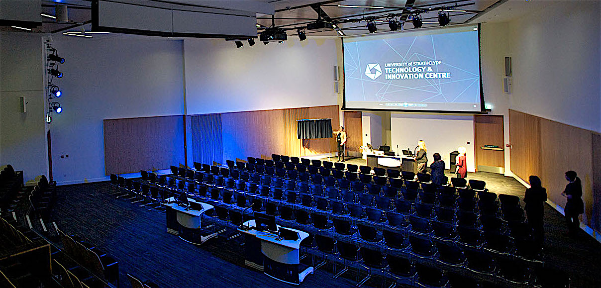 Main auditorium, Strathclyde Conference Centre
The Royal Institute of Navigation’s International Navigation Conference 2016 will be held at the University of Strathclyde Conference Centre in Glasgow, Scotland from November 8 – 10, 2016.
A number of keynote speakers will discuss topics from Virgin Galactic’s voyage to space to quantum sensors for inertial navigation to autonomous cars, android phones, train control and even "Three dimensional thinking: from rats to humans, via Klingons."
Poster and demonstration abstracts are due by May 30. Full paper submission is due on June 15.
By Inside GNSS
Alessandra Fiumara is the liaison officer on GNSS Evolution Program for the European Space Agency.
She has been working in the space sector for 25 years, both in public and private contexts, and has acquired a deep knowledge of the related political, strategic and financial aspects. As an electronic engineer, she started with technical and scientific activities in the radar application domain, then moved to strategic planning and financial control responsibilities as well as international relations.
By Inside GNSS Carlo des Dorides, GSA Executive Director
Last October, the European GNSS Agency (GSA) Administrative Board reelected Carlo des Dorides as executive director of the GSA, giving him a second — and final — four-year term in charge of this key agency responsible for supporting the effective operation, maintenance, and security of Europe’s satellite navigation systems. We met with him recently at the GSA office in Prague to learn how he plans to see out his mandate.
By Peter Gutierrez Belabbas with his children, Laila and Lunis.
Boubeker Belabbas’ Compass Points
Boubeker Belabbas, an expert in aerospace mechanics and safety-critical GNSS applications, grew up in Bordeaux, a city of wine, and works in Munich, a city of beer. But he started out in the land of mint tea: a small village in the north of Algeria in the region called Kabylia.
By Inside GNSS
Trends for marine accidents show rising numbers and costs that are mainly associated with collisions and groundings. Research indicates that about 60 percent of these accidents are caused by human error. The majority of them could have been avoided by providing suitable input to the navigation decision-making process, according to a 2008 report by the International Maritime Organization (IMO) Marine Safety Committee. (See IMO 2008 in Additional Resources section near the end of this article.).
By Günter W. Hein Southampton’s Town Walls
The Royal Institute of Navigation will host a one-day event on The Future of GNSS with speaker Prof. Terry Moore on April 21, 2016 at the Warsash Maritime Academy in Southampton, England.
The speaker will outline the future of GNNS and its systems, anticipated changes and the impact of these developments.
This meeting which is joint with the NI and UK Hydro Society will be followed by the RIN Solent branch AGM.
This event is free. Prior booking not required, guests are welcome.
By Inside GNSS
Federal testing is about to begin to determine how much interference GPS receivers can tolerate from their spectrum neighbors.
By Inside GNSSNEO-M8P.jpg)
u-blox continues to roll out variations on its new generation of GNSS technology, launching the NEO-M8P receiver modules targeted at such applications as unmanned vehicles and robotic guidance systems
By Inside GNSS The Saint Louis Cathedral, New Orleans, Louisiana
AUVSI’s Unmanned Systems conference and trade show is now XPONENTIAL.
XPONENTIAL 2016 will take place at the Ernest N. Morial Convention Center in New Orleans, Louisiana, U.S.A. from May 2 – 5, 2016.
By Inside GNSS
Europe’s space community rang in the New Year with two of its brightest annual fixtures: the European Union (EU) Space Policy conference in Brussels and the European Space Agency (ESA) media briefing in Paris.
The events brought out all of the relevant voices and served to illustrate not only the disposition of materiel and troops but also their intent and even the level of morale.
By Peter Gutierrez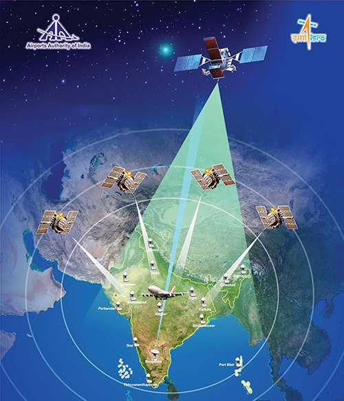
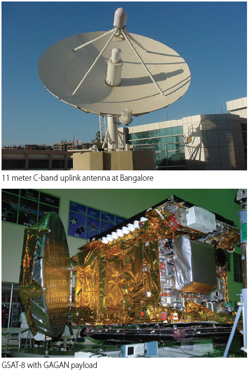
The GPS Aided Geo Augmented Navigation (GAGAN) system was developed by the Indian Space Research Organization (ISRO), together with Airports Authority of India (AAI), to deploy and certify an operational satellite-based augmentation system (SBAS). The system’s service area covers the Indian Flight Information Region (FIR), with the capability of expanding to neighboring FIRs.
By Inside GNSS
Small GPS jammers, particularly the “personal privacy devices” readily available on the Internet, pose one of the greatest risks to the nation’s critical infrastructure, according to a now-public Homeland Security assessment.
By Dee Ann Divis