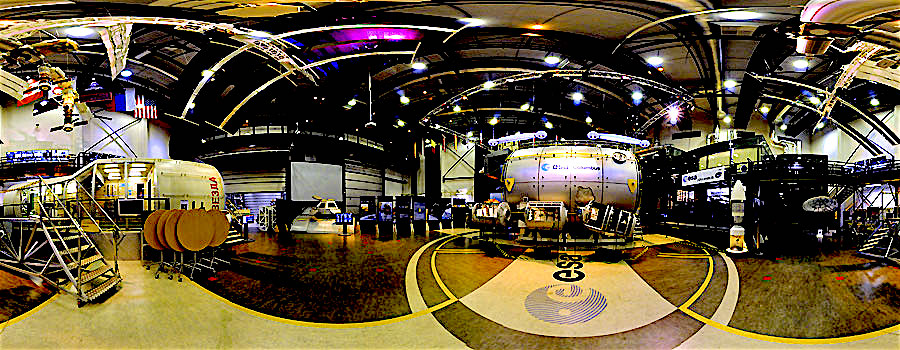
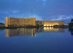
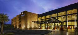
SBAS and RNSS Archives - Page 12 of 40 - Inside GNSS - Global Navigation Satellite Systems Engineering, Policy, and Design

SBAS and RNSS

January 19, 2016

SBAS

ISRO’s GSAT-15 satellite before launch, with GAGAN navigation payload

GAGAN — India’s SBAS
Redefining Navigation over the Indian Region
Recognizing the potential benefits of satellite-based augmentation systems, India took the early initiative to create its own SBAS called GAGAN — GPS Aided Geo Augmented Navigation.

Read More >

By Inside GNSS
January 18, 2016

GNSS Satellite-Based Augmentation Systems

Working Papers explore the technical and scientific themes that underpin GNSS programs and applications. This regular column is coordinated by Prof. Dr.-Ing. Günter Hein, head of Europe’s Galileo Operations and Evolution.

With the support of the European Space Agency (ESA), a European team designed a frequency- and time-transfer process and validated its performance in a complex navigation test bed. This two-way time-transfer technology took advantage of the following:

Read More >

By Günter W. Hein

What is Doppler collision and is it a problem in GNSS?

Figure 1, 3, 4 & 5

Q: What is Doppler collision and is it a problem in GNSS?

A: Doppler collision is a physical effect in code-division multiple access (CDMA) systems where code measurement errors are observed due to cross-correlation effects. Doppler collision may occur when the Doppler frequency between signals from two different transmitters is smaller than the code lock loop bandwidth.

Read More >

By Inside GNSS
[uam_ad id="183541"]

GAGAN — India’s SBAS

The GPS Aided Geo Augmented Navigation (GAGAN) system was developed by the Indian Space Research Organization (ISRO), together with Airports Authority of India (AAI), to deploy and certify an operational satellite-based augmentation system (SBAS). The system’s service area covers the Indian Flight Information Region (FIR), with the capability of expanding to neighboring FIRs. 

Read More >

By Inside GNSS

Measuring Navigation Payload Absolute Delay

Figures and Tables

In satellite navigation, the user receiver finds its position by measuring its distance to satellites and knowledge of the satellite position. The distance is measured by ranging, i.e., finding the delay of the signal from the transmitter to the receiver. The delay will comprise of payload hardware delay and the geometric range delay. Hence, the payload delay of the signal from generation to radiation is very important and needs to be transmitted in navigation data. 

Read More >

By Inside GNSS
January 14, 2016

ICG-11: International Committee on GNSS

Russia will host the eleventh meeting of the International Committee on GNSS (ICG) from November 6 to 11, 2016 in Sochi, on the Black Sea near Georgia. This meeting is organized by Roscosmos, the State Space Corporation. It will take place at the Pullman Sochi Center Hotel and Conference Center.

The ICG is a voluntary United Nations–backed association that brings together GNSS and augmentation providers, including the United States, Russia, European Union, China, India, and Japan.

Read More >

By Inside GNSS
[uam_ad id="183541"]

CSNC 2016: China Satellite Navigation Conference

Preparing for a May 2016 event at the Hunan International Conference and Exhibition Center, Changsha.

The 7th China Satellite Navigation Conference and exhibition will take place at the Hunan International Conference & Exhibition Center in Changsha (長沙), the 3,000 year old capital city of Hunan Province on May 18, 19 and 20, 2016.

Several thousand scientists, GNSS businesses and researchers from all over the world are expected to attend this high-level annual event. The conference language will be Mandarin, with simultaneous English translation.

Topics include:

Read More >

By Inside GNSS

2016 Geospatial World Forum

The Geospatial World Forum 2016 and industry exhibition will be held at the Beurs-World Trade Center in Rotterdam in Rotterdam, The Netherlands on May 23 – 26, 2015.

This year’s theme is "Where’s the Money? Disruptive Business Models." The annual event features plenary and technical sessions and workshops on policy, technology and user practices of the GIS  industry. Plenary themes this year are:

Read More >

By Inside GNSS
January 13, 2016

ICL-GNSS 2016: Localization and GNSS

The sixth international conference on localization and GNSS will take place at the Universitat Autònoma de Barcelona (UAB) – Casa Convalescència, a UNESCO site, on June 28, 29 and 30 in Barcelona, Spain.

ICL-GNSS covers recent research on terrestrial and satellite-based positioning techniques to provide reliable, accurate and low latency position information with the goal of inspiring new design, implementation, test and evaluation methodologies for positioning platforms.

Read More >

By Inside GNSS
December 28, 2015

Baška GNSS Conference 2015

The 10th Baška GNSS Conference will take place May 8–10, 2016, in Baška, Krk Island, Croatia, organized jointly by The Royal Institute of Navigation (London, UK), Faculty of Maritime Studies (University of Rijeka, Croatia), and the Faculty of Transport and Traffic Sciences (University of Zagreb, Croatia),  with technical co-sponsorship from Beihang University of Aeronautics and Astronautics (Beijing, China)

The conference focuses on GNSS resilience and GNSS applications development. The deadline for submitting an abstract (300 – 500 words) of a proposed paper is February 22, 2016. Please contact Renato Filjar.

Please contact Ms Sally-Anne Cooke (e-mail <conference@rin.org.uk>) or Mrs. Marija Šimić-Hlača (e-mail: <marija@pfri.hr>) for further information.

By Inside GNSS

InterGEO 2016

The 2016 InterGEO Trade Fair and Conference for Geodesy, Geoinformation and Land Management will take place at the fairgrounds —Hamburg Messe und Congress (HMC)—in Hamburg, Germany on October 11, 12 and 13.

Now 22 years old, the fair attracts 16,000 visitors from 92 countries who process, use or analyze geodata online or in the field.

The conference will cover the latest developments in surveying, geoinformation, remote sensing and photogrammetry and allied technologies. Proceedings are conducted in German and English.

Read More >

By Inside GNSS

ENC 2016: European Navigation Conference

Finlandia Hall conference center

The 2016 ENC will take place at Finlandia Hall in downtown Helsinki on May 30 and 31 and June 1 and 2. The event will focus on innovations in positioning, navigation and timing technologies and applications at land, sea and air. Topic areas include GNSS positioning,indoor and urban navigation and position based applications.

The opening keynote speaker will be Matthias Petschke, director for European Satellite Navigation Programs, European Commission. The conference endnote will be presented by John Raquet, U.S. Air Force Institute of Technology.

Read More >

By Inside GNSS
1 10 11 12 13 14 40
IGM_e-news_subscribe