June 19, 2020
U.S. Military Procures New GPS Simulator Systems
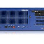
The U.S. Department of Defense awarded a $1.7 million contract to Orolia Defense and Security for multiple BroadSim advanced GPS simulator systems for testing facilities and field test assets.
By Inside GNSS