Vehicle Positioning with GNSS — at the Speed of Sound
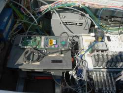
A Topcon Euro 160T mobile control board connected to a laptop computer collects satellite positioning signals used to calculate the North American Eagle’s speed. Photo: Don TalendA team led by led by Seattle, Washington–area aerospace and computer experts is attempting to break the sound barrier to surpass the world land speed record of 763 miles per hour — and they’re using GNSS technology to help them do it.
By Inside GNSS