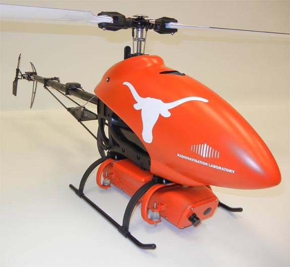
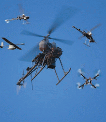
GPS Archives - Page 121 of 134 - Inside GNSS - Global Navigation Satellite Systems Engineering, Policy, and Design

GPS

June 16, 2009

Air Force May Be Able to Fix Problem with Latest GPS Satellite

Members of the 45th Launch Support Squadron, along with the 45th Range Management Squadron’s GPS team, pause in front of the GPS IIR-20 satellite atop its Detla II booster prior to its launch March 24. (Lockheed Martin photo/Bruce Johnson)

U.S. Air Force officials have confirmed that signal anomalies on the latest GPS satellite — IIR-20(M), also identified as SVN49/PRN01 — are related to the interface to the new L5 payload also on board.

But the problem appears fixable.

The spacecraft has remained is still in early orbit checkout since its launch on March 24 and has not been introduced into the operational constellation.  

A dedicated response team of Air Force and contractor experts are wrapping up their investigation of the cause of the L1 signal anomalies, which were detected on April 9. The signal distortion was initially observed as an elevation-dependent bias in ranging measurements from GPS monitor stations.

Read More >

By Inside GNSS
June 15, 2009

eLoran: The Never-Ending Story?

Loran tower – Starkey Loran research photos 2001

To say that enhanced Loran (eLoran) has been an on-again off-again program would give short shrift to multiple generations of official ambivalence about the proposed backup for GPS.

The latest chapter began on June 4 when Senator Maria Cantwell (D-Washington) introduced S. 1194, the Coast Guard Authorization Act for Fiscal Years 2010 and 2011 (FY2010/11).

Among other details, the measure directs the Secretary of Transportation to continue the Loran system until a plan has been drawn up and implemented to transition the program to eLoran.

Read More >

By Inside GNSS
June 4, 2009

Applanix Introduces New Aerial Digital Photogrammetric System

Applanix
has introduced the POSTrack 410 flight management and direct
georeferencing system designed for use with the latest generation of
medium-format airborne digital photogrammetric camera.

The POSTrack 410 incorporates Applanix’s POS AV GNSS-inertial navigation
system (INS) and POSPac Mobile Mapping Suite (MMS) office software,
featuring the IN-Fusion technology and SmartBase module. This system
can process both GPS and GLONASS signals as well as those from
satellite-based augmentation systems.

Read More >

By Inside GNSS
[uam_ad id="183541"]

Changes in Store for U.S. Military GPS Equipment Development and Acquisition

DAGR 2008. Rockwell Collins image

Development and acquisition of military GPS user equipment (MGUE) are taking on new dimensions across the board — institutionally, procedurally, and technologically.

Along the way, the changes could redefine relationships within the Department of Defense (DoD) and between the agency and industry.

At the agency level, a proposal is forthcoming to “stand up” a positioning, navigation, and timing (PNT) user equipment joint program office (JPO) that would incorporate UE responsibilities (and budgets) now exercised by the GPS Wing (GPSW).

Read More >

By Inside GNSS
May 25, 2009

GAO Report on GPS Satellite Constellation Status: The Pushback

Two weeks after a Government Accountability Office (GAO) report warned of potential gaps in the GPS satellite constellation, reassurances from Department of Defense (DoD), U.S. Air Force, GPS program officials, and industry are slowly restoring calm to an anxious public.

Coupled with a May 7 congressional hearing (and subsequent media coverage) that fanned the flames, the report described scenarios — for instance a two-year setback in launching the first GPS III spacecraft — that could lead to deterioration in the quality of GPS service due to delays in building new generations of satellites and past program management problems. The news coverage drew primarily on the GAO report and prepared statements presented at the hearing and not on the much more interesting dialog with subcommittee members captured on video or on the assumptions and methodology underlying the constellation analysis.

Read More >

By Inside GNSS
May 22, 2009

First Look: Initial Observations of the GPS L5 Broadcast and L1 Signal Anomaly

(Updated May 22, 2009) Leading researchers from Ohio University, Stanford, and the University of Colorado have released their initial observations of the GPS L5 signal broadcast, including an anomaly in SVN49’s L1 signal reported by the GPS Wing’s chief engineer on May 4.

The U.S. Air Force switched on the eagerly awaited, modernized L5 signal on April 10 after the successful launch of the newest GPS Block IIR-M satellite – SVN49 – in March. This was the first broadcast of a GPS signal in a frequency band dedicated solely for civilian use.

Read More >

By Inside GNSS
May 21, 2009

New Leaders to Gather for First Obama-Era PNT ExCom Meeting

Mike Shaw, NCO Executive Director

A June 18 meeting of the National Space-Based Positioning, Navigation, and Timing (PNT) Executive Committee (ExCom) will bring together leaders of the Obama administration in the key interagency setting for GPS issues.

Established under a 2004 National Presidential Security Directive, the ExCom advises and coordinates federal departments and agencies on matters concerning the Global Positioning System and related systems. The deputy secretaries of defense and transportation and co-chair the committee, which includes equivalent-level members from seven other federal agencies.

Read More >

By Inside GNSS
[uam_ad id="183541"]

GPS III Passes Preliminary Design Review

GPS IIIA. Lockheed Martin graphic

The Lockheed Martin team developing the next-generation GPS III satellites has successfully completed a major program milestone, the preliminary design review (PDR) conducted by the U.S. Air Force’s GPS Wing.

Underlining the importance placed on meeting a 2014 first-launch schedule, nearly 150 representatives from the GPS Wing and user communities, including representatives from the Department of Defense, the Joint Chiefs of Staff, Air Force Space Command, the Department of Transportation, and the Federal Aviation Agency participated in the four-day Space Vehicle PDR at Lockheed Martin Space Systems facilities in Newtown, Pennsylvania.

Read More >

By Inside GNSS
May 16, 2009

Telematics Detroit 2009

The Telematics Detroit 2009 Conference & Exhibition covers the digital in-car and mobile industries. It will take place on June 2-3 at The Rock Financial Showplace in Novi, Michigan.

The event features senior-level speakers from Ford, Toyota, TomTom, Yahoo!, Garmin, Panasonic, Garmin, U.S. Department of Transportation, Visteon, Google and others.

Read More >

By Inside GNSS
IGM_e-news_subscribe